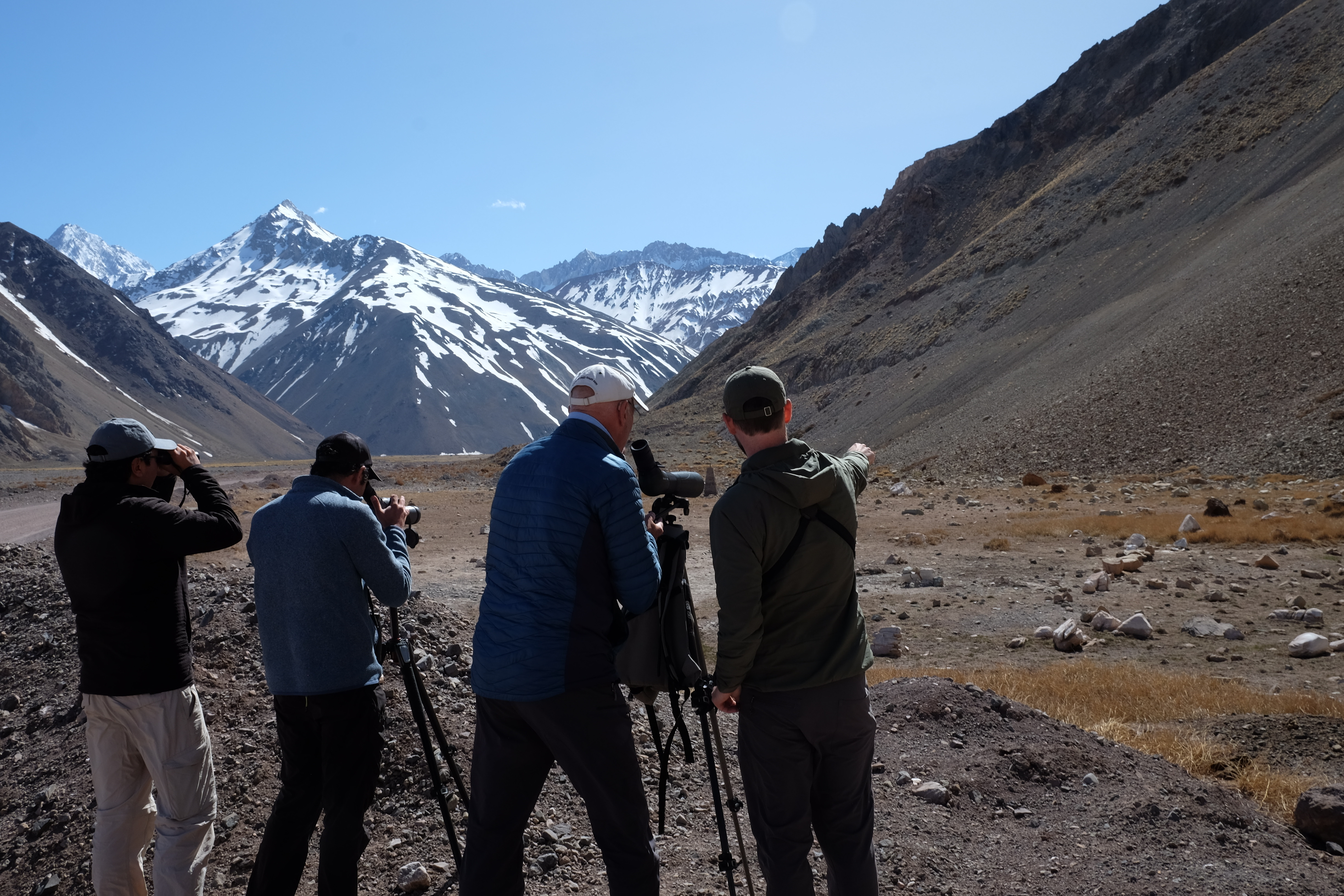
Before we left home we had tried to book a couple of tours with local bird guides to help us understand habitats and find birds that we might otherwise have missed. One such guided trip was to El Yeso, a national park some hours drive from Santiago. The purpose was to set eyes on a Diademed Sandpiper-plover, a near threatened species, restricted to the Andes, in bogs between the frost line and snow line between 4 and 5000m of elevation.
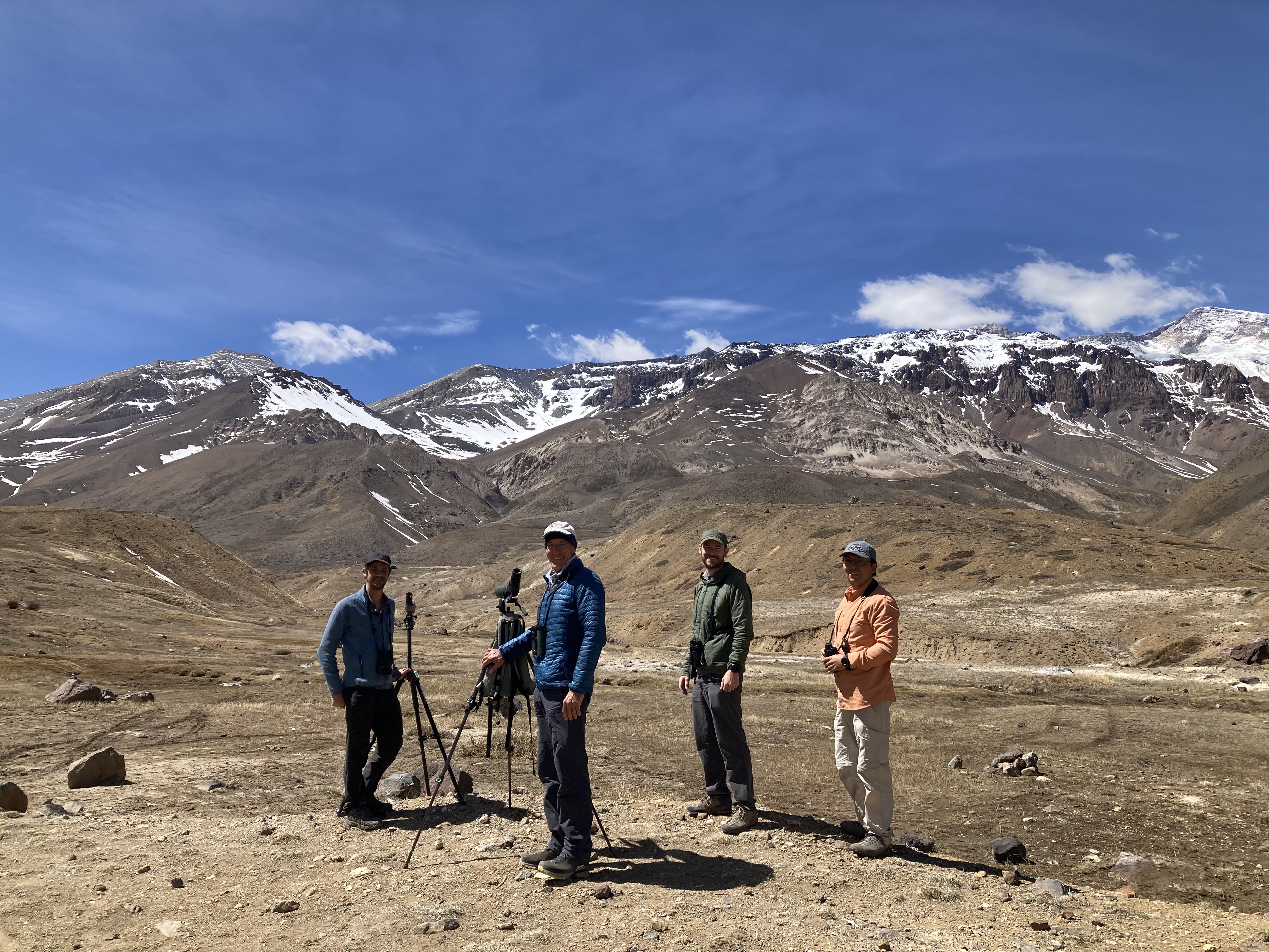
Andy sent out a series of emails to Chilean bird tour companies and we heard back from a couple but the cost, 300USD each for a one day excursion, was prohibitive. However, the word was out. Not so long after, Andy had a message from Ivo Tejeda, executive director of Red de Observadores de Aves y Vida Silvestre de Chile—the Chilean Bird and Wildlife Observer Network, ROC. Chile’s top birders and wild life conservationists all wear multiple hats and work as freelance guides for all the bird touring companies. If Andy (former director of the British Trust for Ornithology) would commit some time to meet with Ivo and his team, they would be very glad to take us out for a day of birding at El Yeso free of charge. How could we possibly decline?!
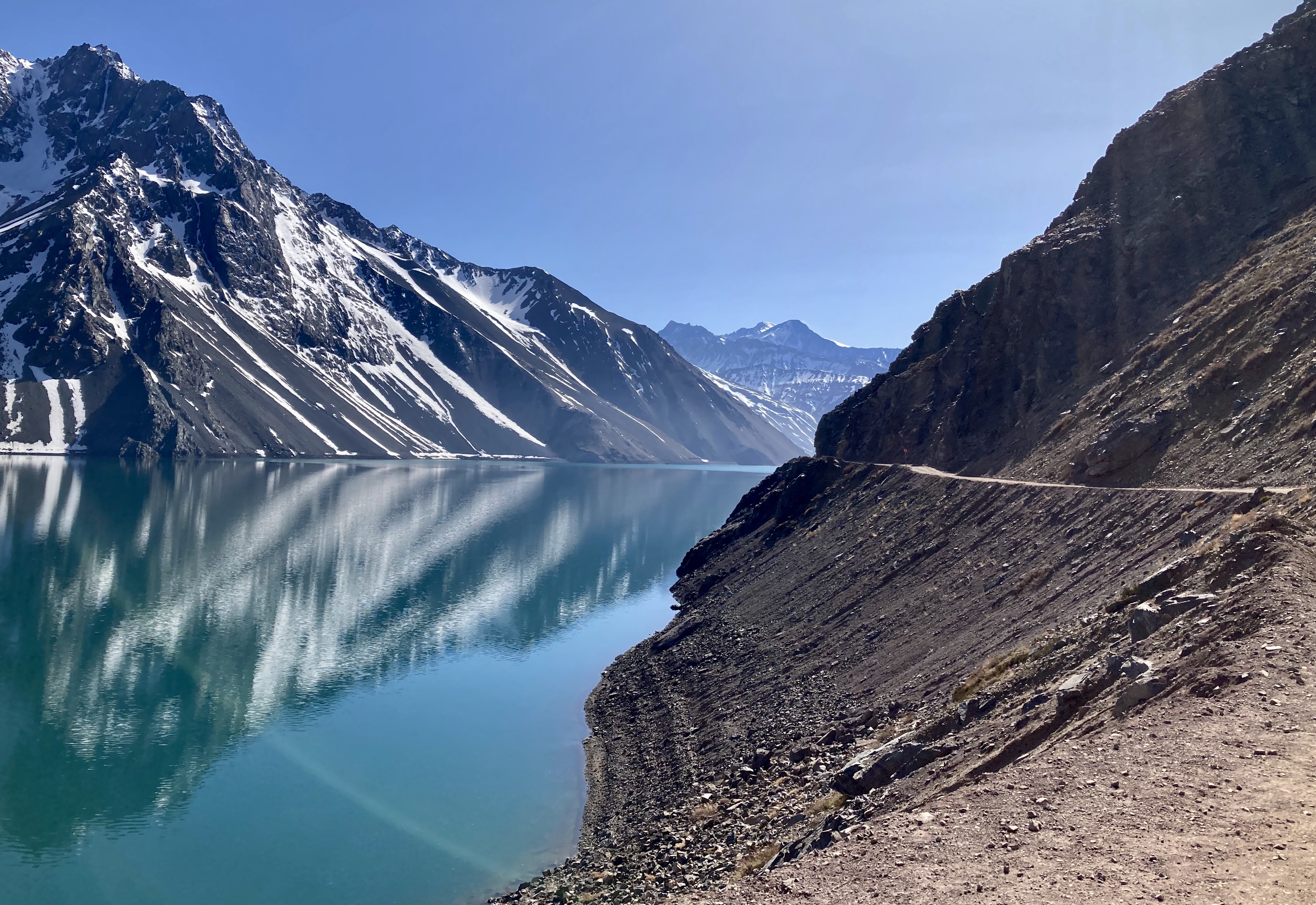
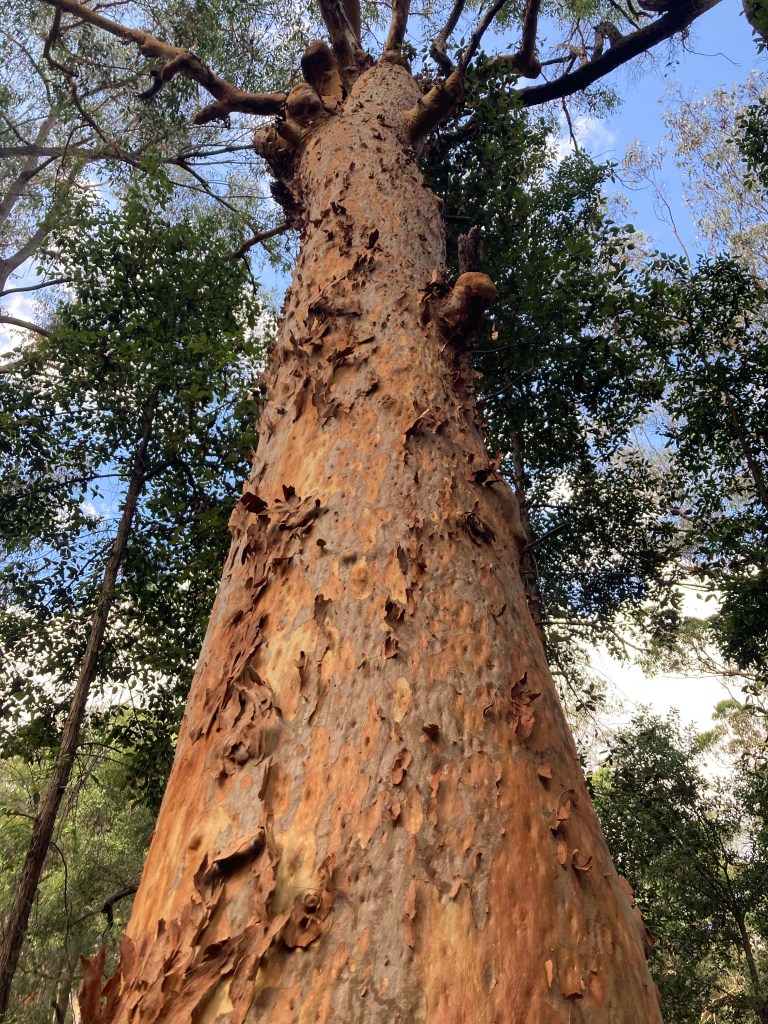
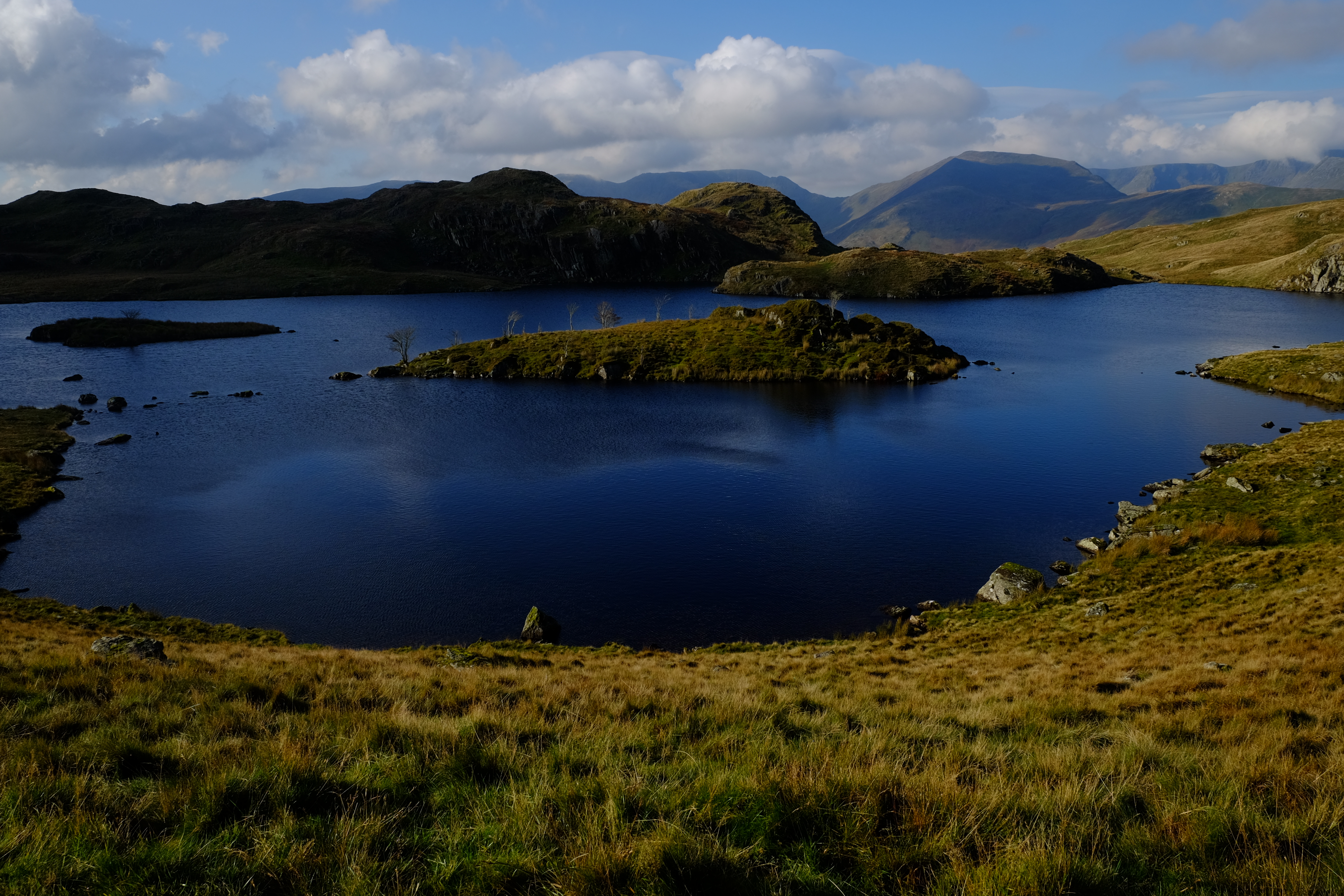
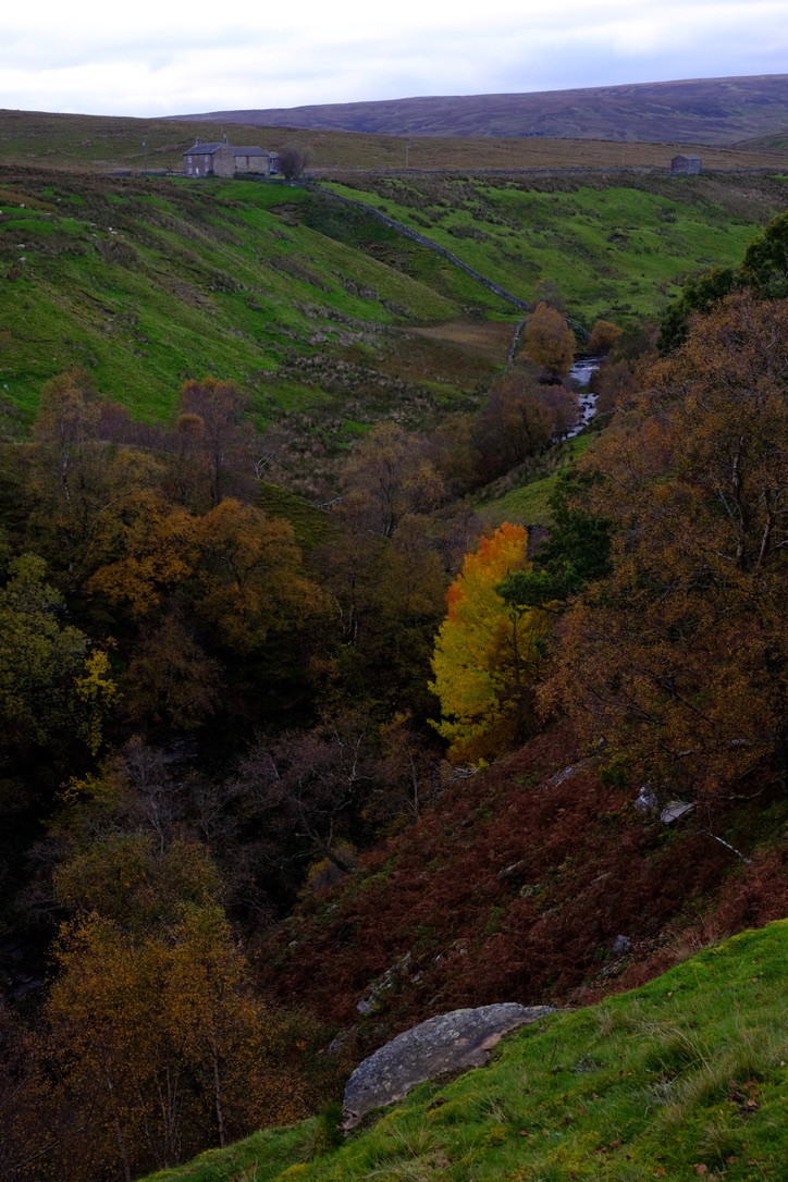
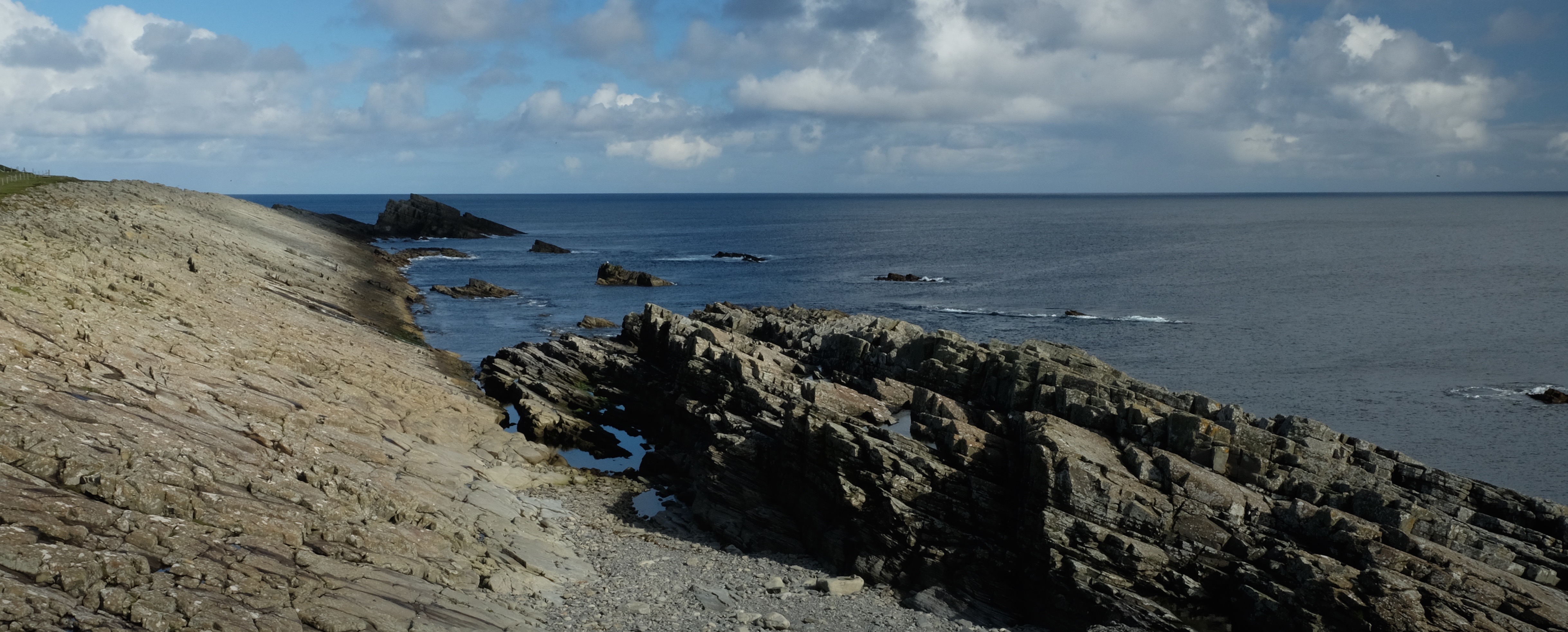
El Yeso
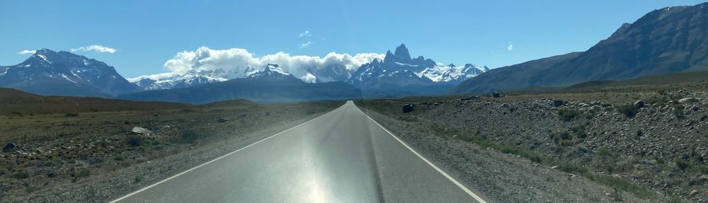
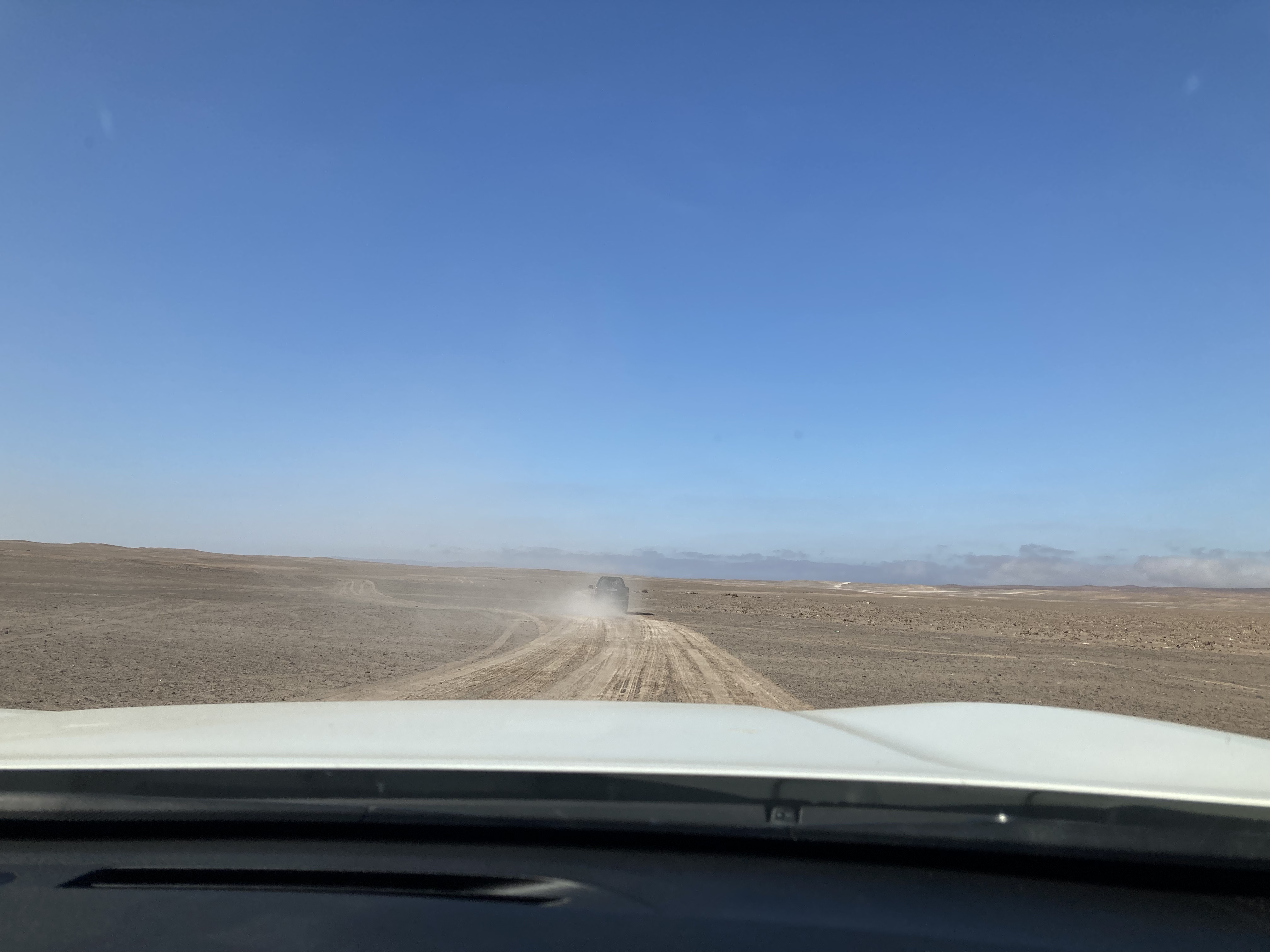
The road to El Yeso
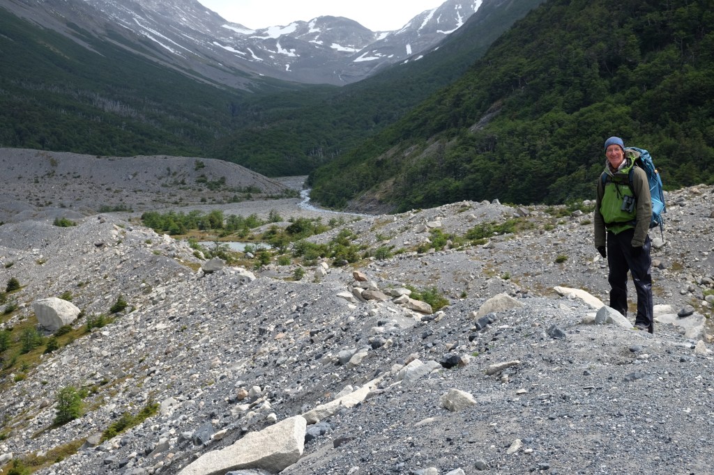
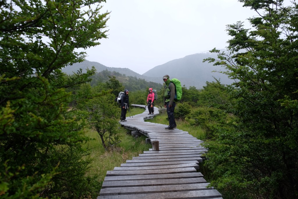
We left Santiago in the dark, bagged a siting of a Torrent duck en route, and eventually piled out of the cramped car deep inside the national park.
Every bird we saw was a first for me, some iconic others that ought to be. Condor, Fire-eyed Diucon, Seed Snipe, Grey-hooded Sierra Finch, Andean Goose, to mention just a few.
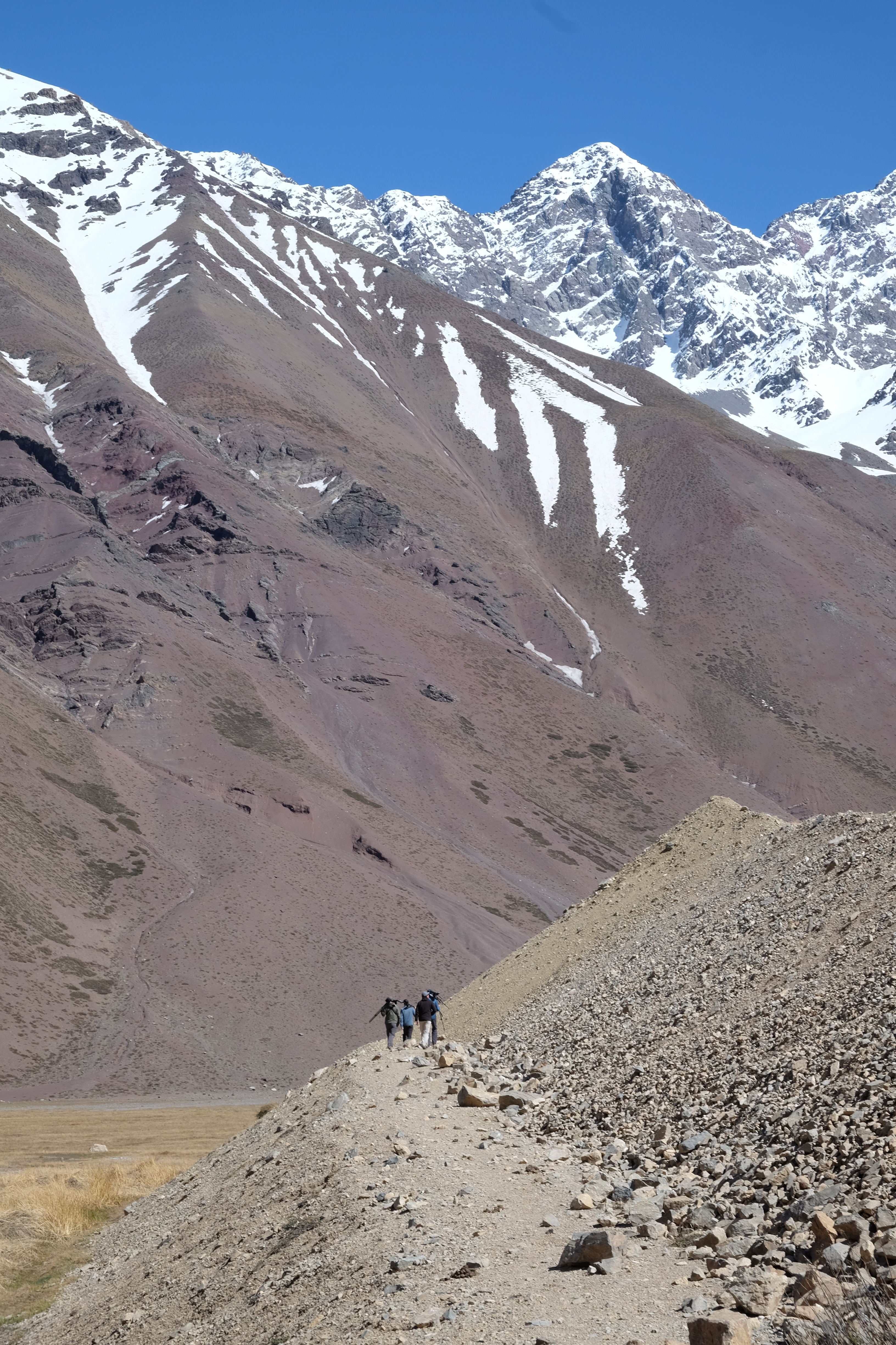
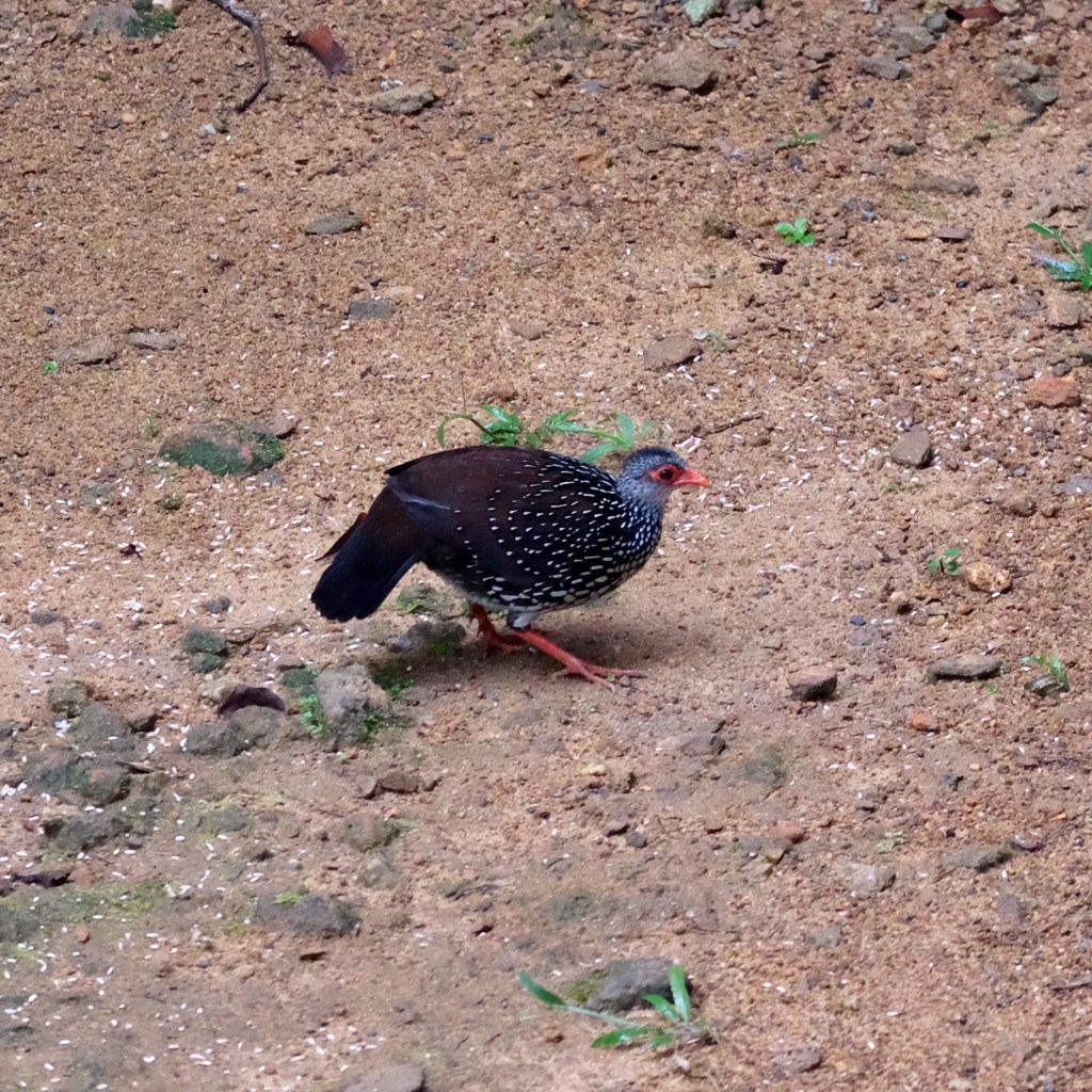
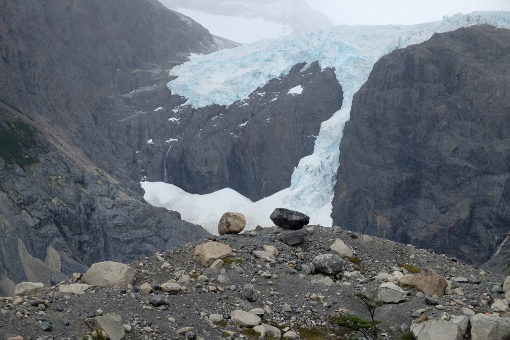
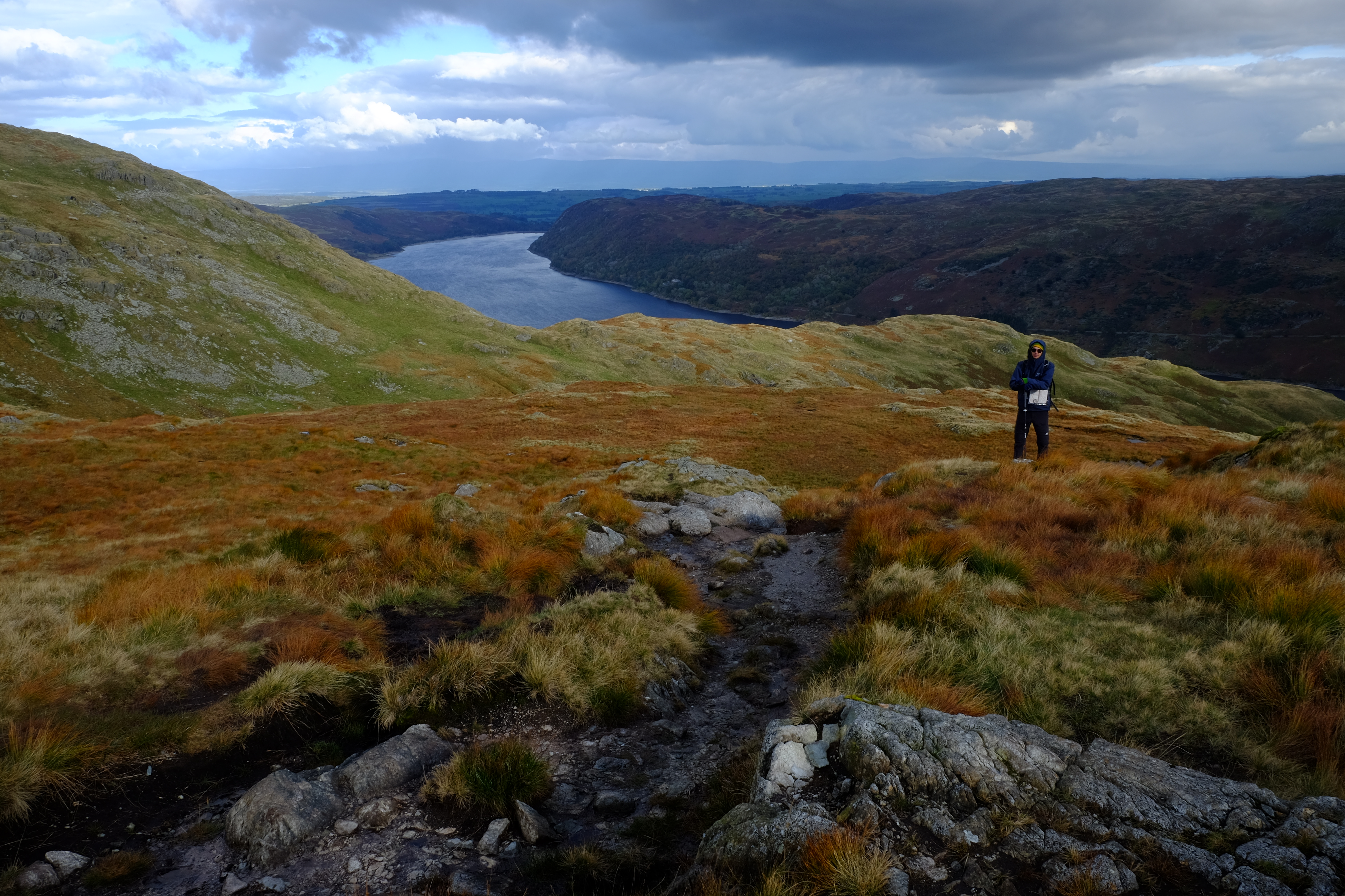
We spent some time trudging along boggy ground but much of it was too dry and places where the Diademed Sandpiper-plover had been seen previously were void of the bird. We drove further up the valley where the road became submerged in snow and were dismayed that motor bikers were skidding around destroying hope of finding any birds let alone the prize for the day.
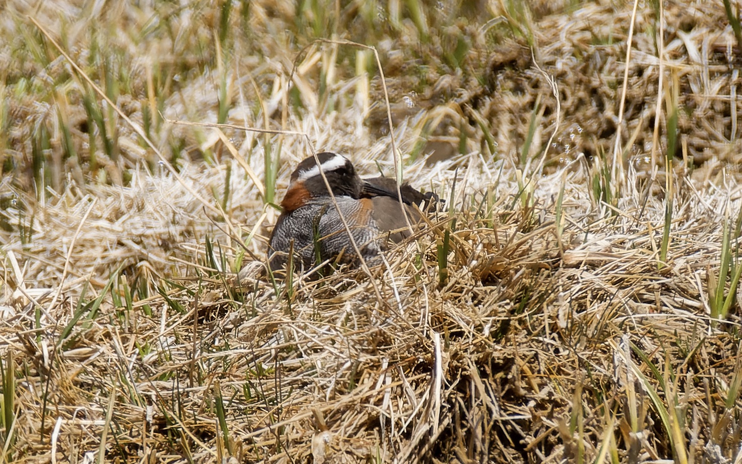
We retreated down the valley having all but given up until someone in the car (it might have been me) caught a movement on the side of the road. The habitat was completely right. Out we clambered and scanned the surrounds. Not far away we spotted first a bird on the nest and then its partner. Beauties!
Diademed Sandpiper Plover. Photo credits: Peter Kennerley
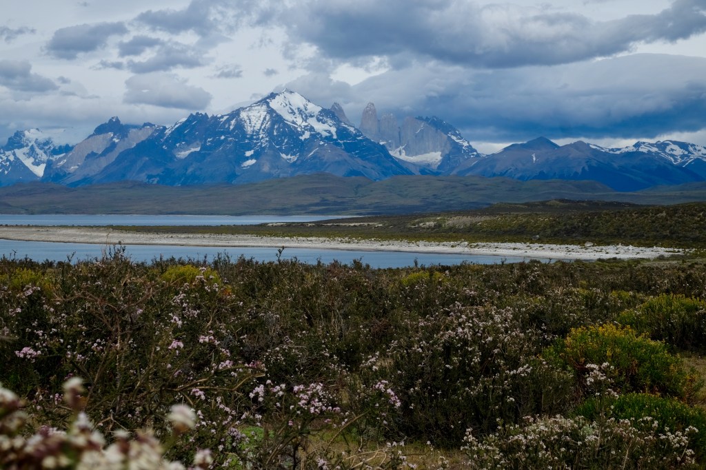
The Atacama
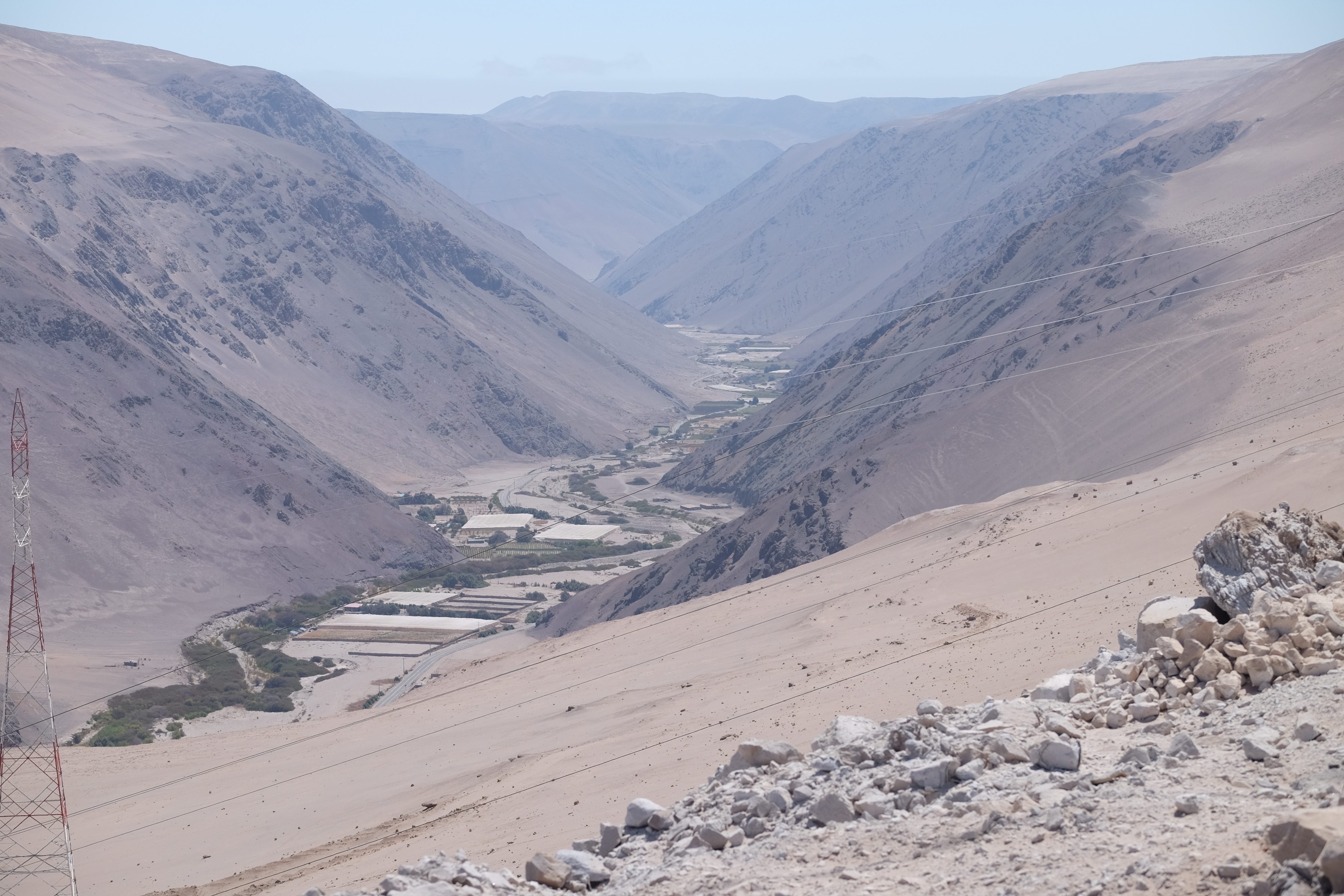
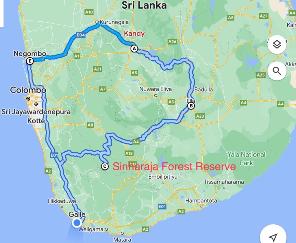
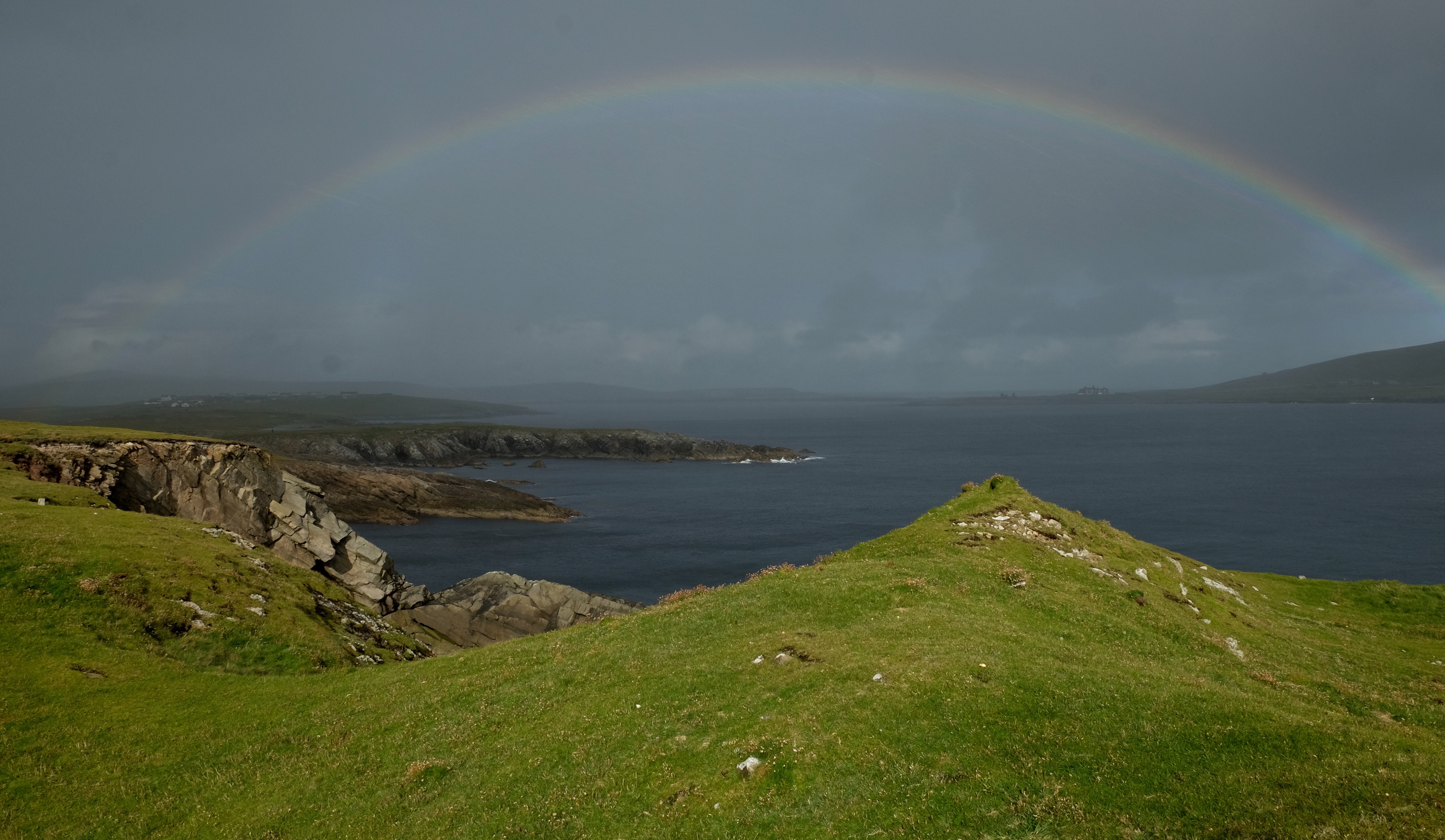
But this is not where our wonderful relationship with ROC ended. From Santiago we travelled north first visiting the northern most Chilean town of Arica, just a few kms from the boarder with Peru. From there we travelled up onto the Altiplano and Lauca National Park, bordering Bolivia. While there, Ivo Tejeda messaged to say that ROC had a team monitoring the nest site of Markham’s Storm Petrel in the Atacama desert and would we have time to go and meet with them. We changed our plans to divert south, to the Atacama, of course we did!
leaving the Altiplanofarming the desert
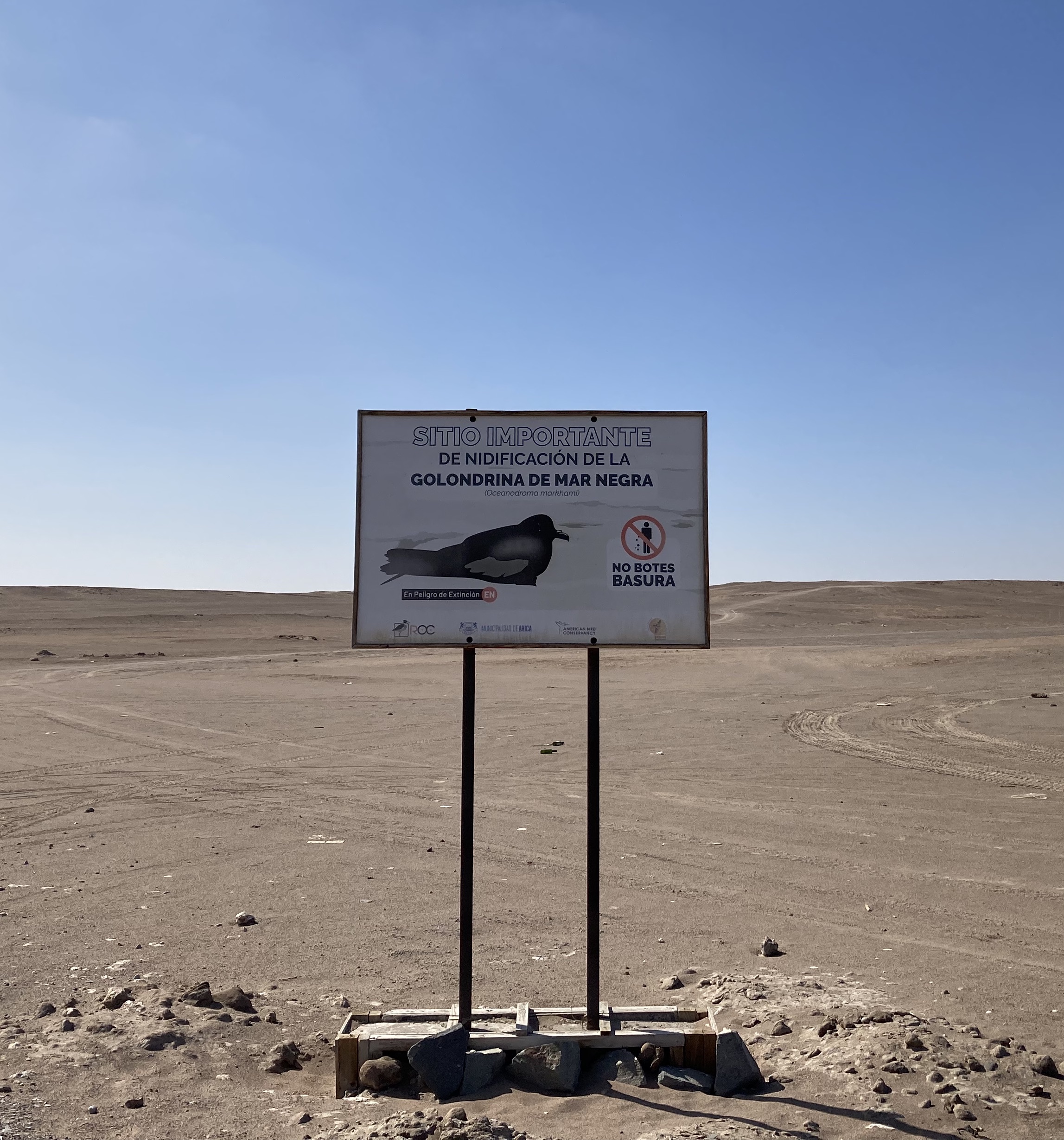
For centuries it was unknown where Markham’s Storm Petrel, sea fairing birds, nested. 10 years ago this changed. How the search unfolded is told in an article by Sarah Gilman. ROC were centre stage to this wonderful story.
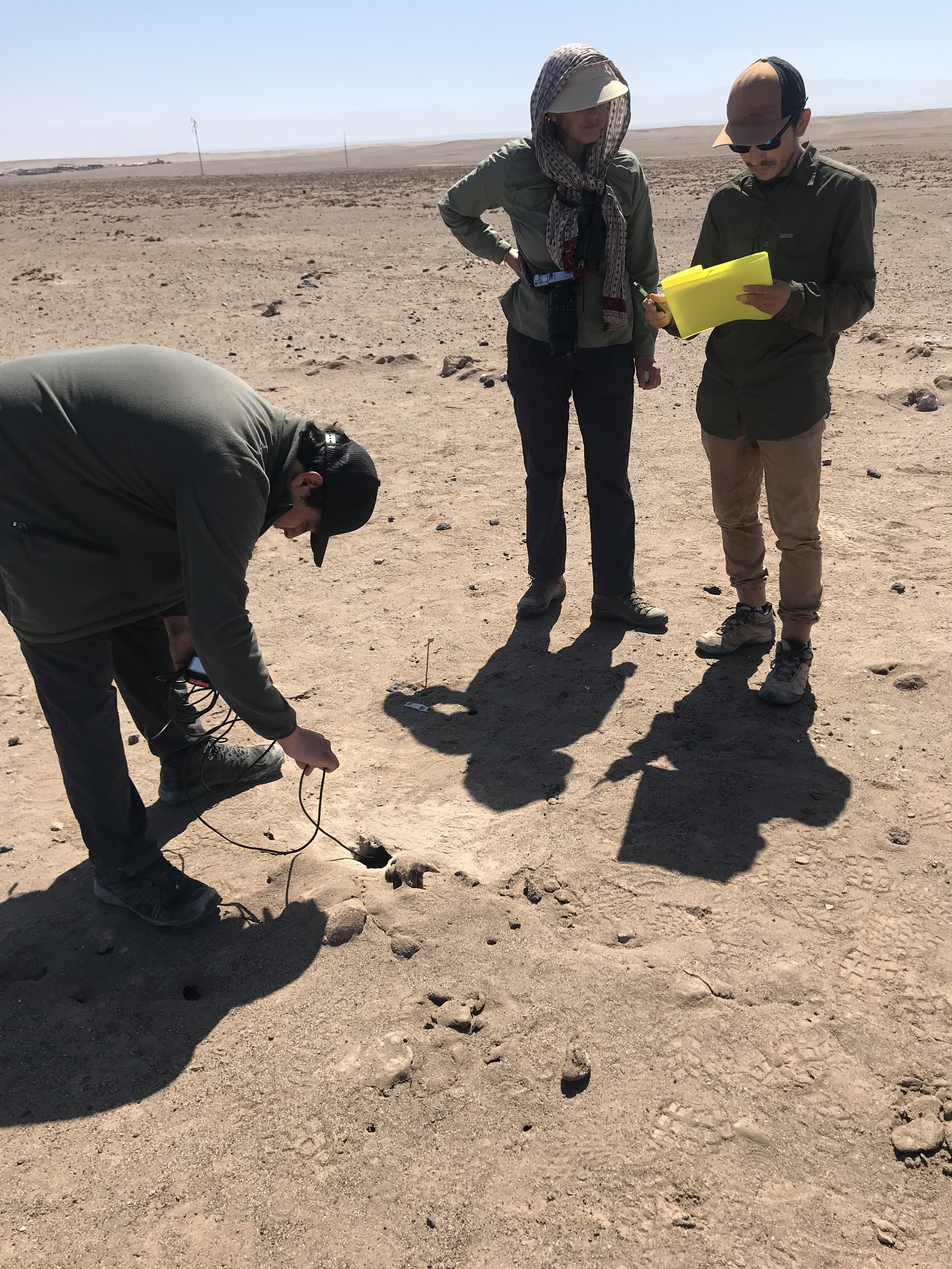
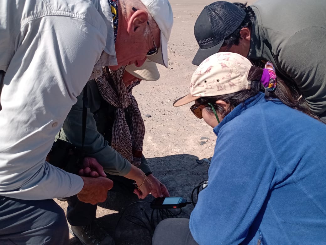
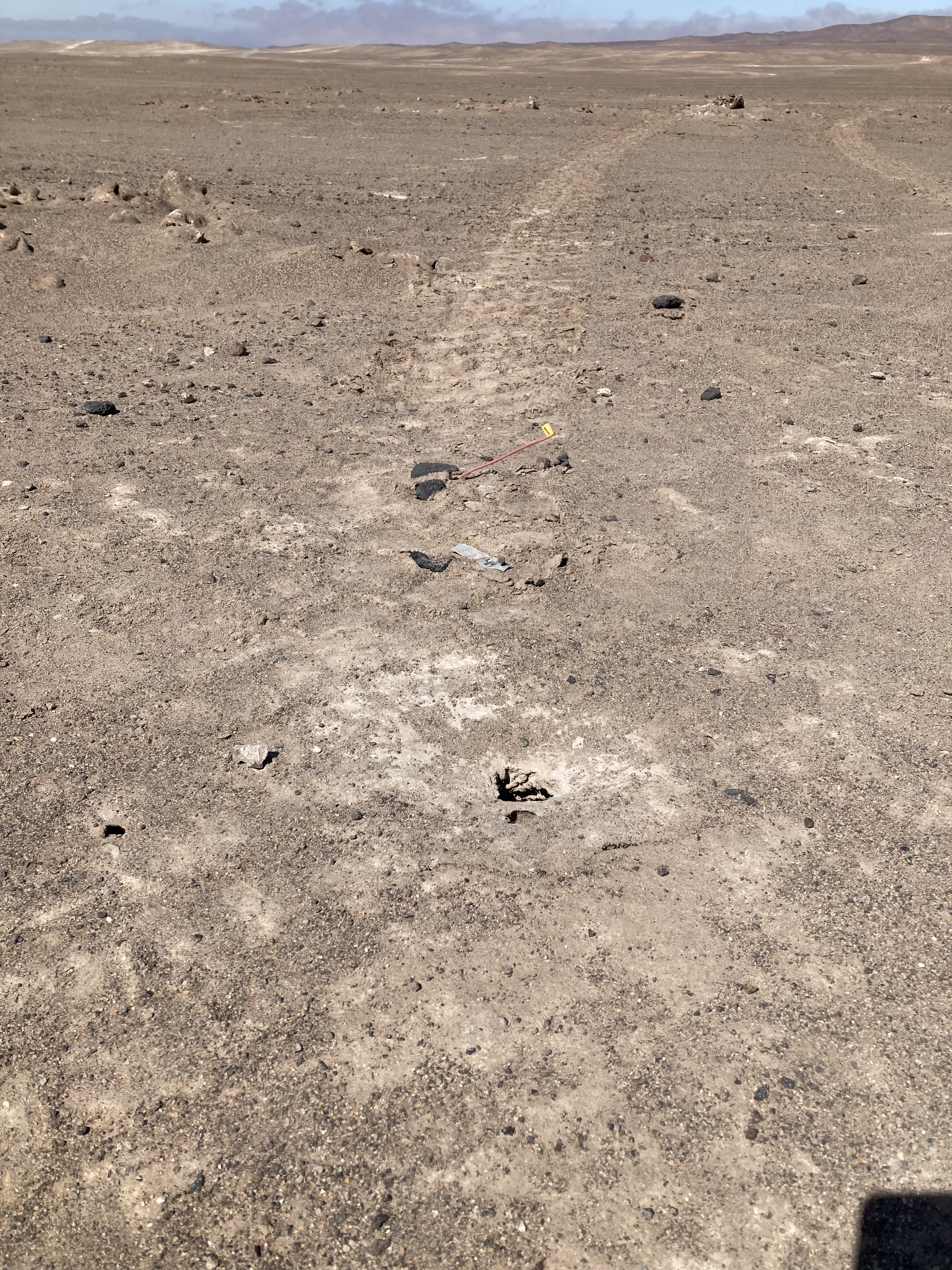
The birds lay their eggs in hollows under the thick salt crust of ancient lakes, 50km inland in the Atacama desert. Using a fibre optic camera and microphone we were able to see and hear inside dozens of nests. Now the nesting whereabouts has been discovered, ROC has set up a local campaign to protect their habitat and breeding success. Street lights attract the newly fledged birds, causing them to congregate in urban areas rather than heading out to sea. Education programmes on how to recognise and rescue the birds from roads, as well as changes to street lighting are beginning to have beneficial effects. Much of the nesting area is owned by the military. ROC has been working with them to raise awareness and ring fence the nest sites so that fewer tanks now plough through. Funding for the continued protection of these birds has now been provided by the power company who’s pylons and cables stretch through the landscape.
Good things do happen!
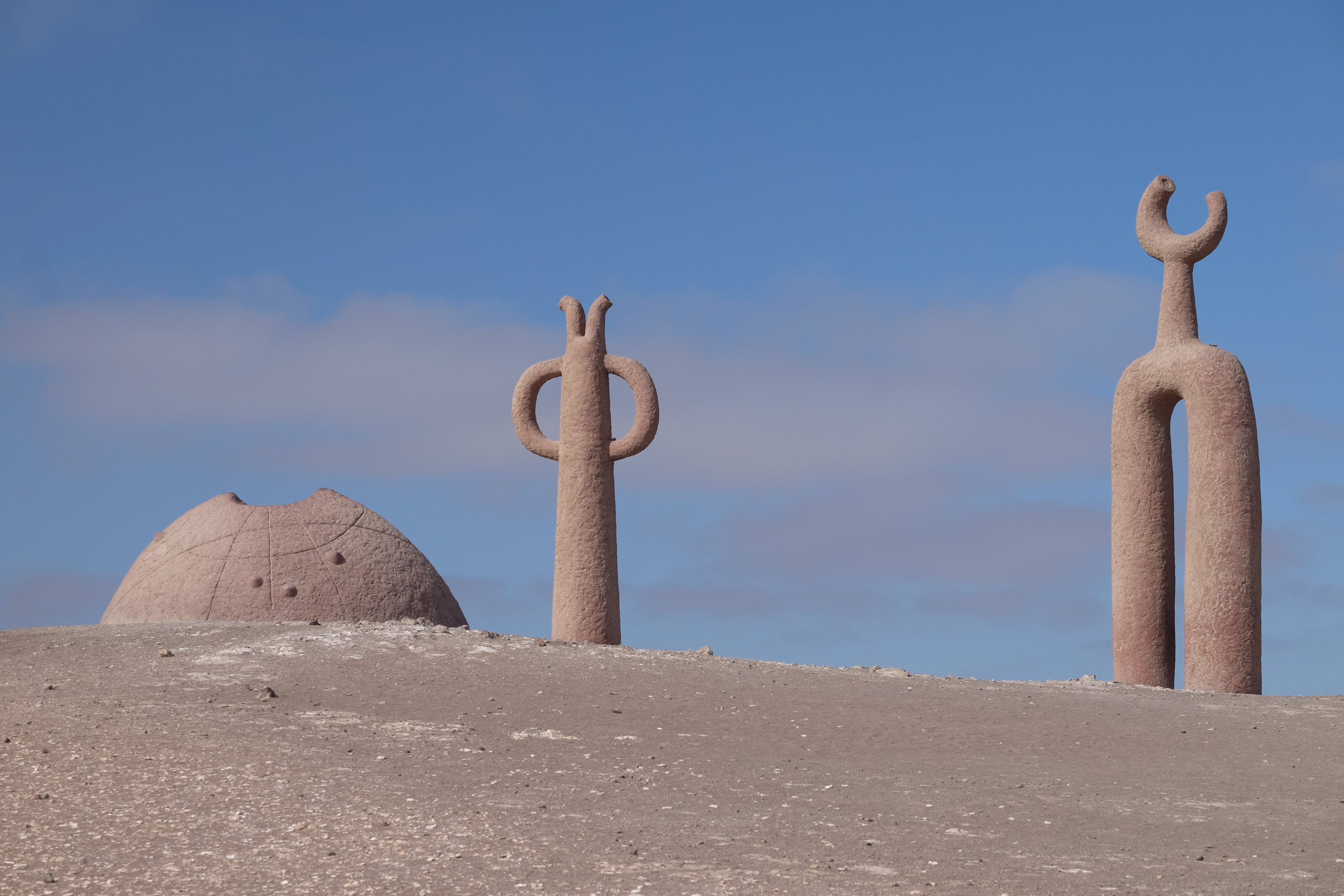
Important site- nesting of the black swallow of the sea, aka Markham’s Storm PetrelPresencias Tutelares, public sculpture close to where we left the roadFollowing the team from ROC into the desertFibre optic camera being used to see inside the nest and monitor the size and number of chicks L to R: Pablo Gutierrez Maier Miranda, Benjamen GallardoPhoto credit: Benjamen GallardoTank tracks across the nesting site, the flag marking an occupied nest. Markham’s Petrel in the hand! Photo credit: Pablo Gutiérrez Maier
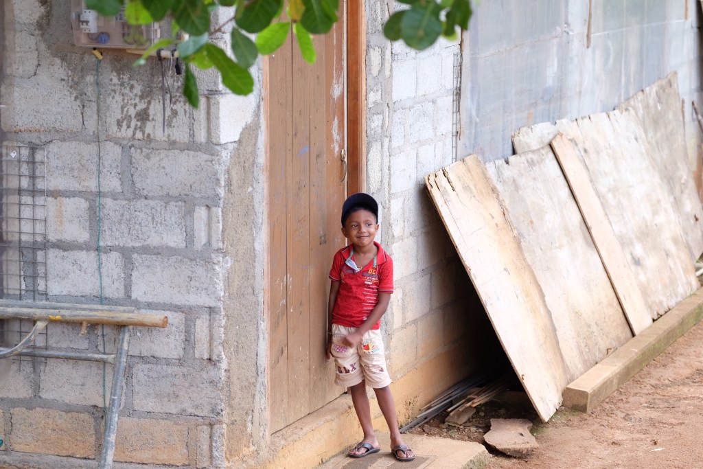
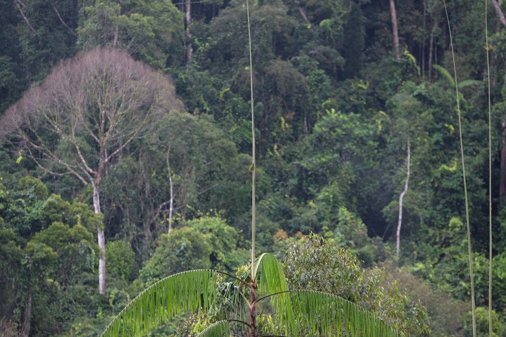
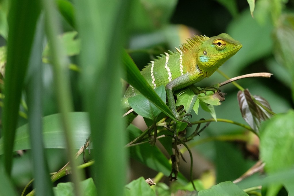
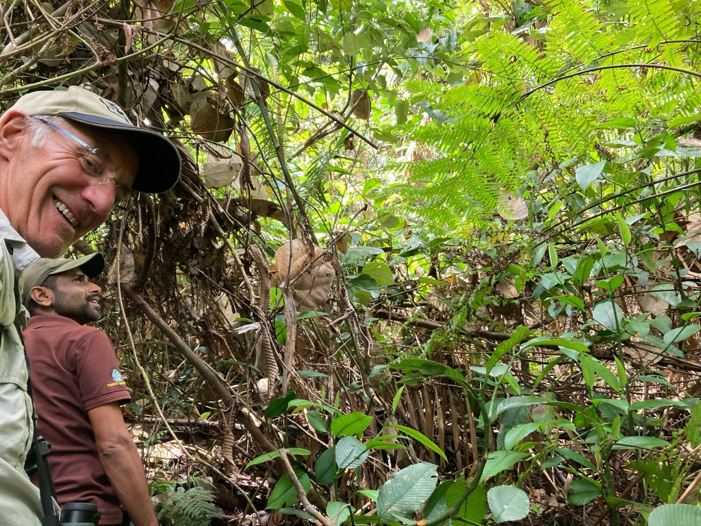
This place, a predominantly primary tropical rain forest, designated a UNESCO World Heritage Site in 1988, came with a recommendation from serious birders which meant it eclipsed the other reserves, Yalle and Udawellewe, where big mammals could be seen easily, with the naked eye, no binoculars or super ocular skill required. Visiting Sinharaja Forest raised eyebrows from those we met on the tourist route, ‘be ready for leeches’ they said. They were not wrong!
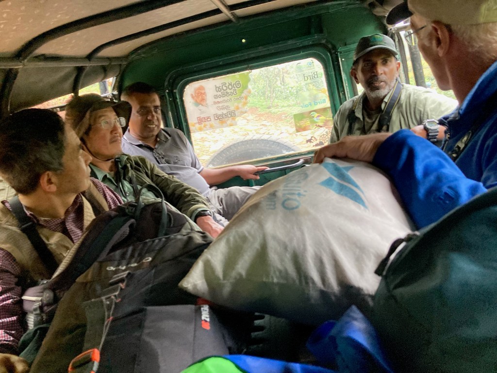
We arrived at the small village of Waddagala, Kalawana in the early afternoon by air conditioned Toyota hybrid car from Ella, a journey that took us on a tour of petrol stations amongst much more. There are big fuel shortages here in Sri Lanka. Our driver pitched us out of his relatively smart car saying he would go no further. The road ahead looked reasonable to me but he was adamant, this was the end of the road for him. We paid and agreed to write him a review on Trip Advisor despite his taking constant phone calls on numerous phones en route. ‘It’s really no problem here he laughed, I can pay the police and keep my licence’.
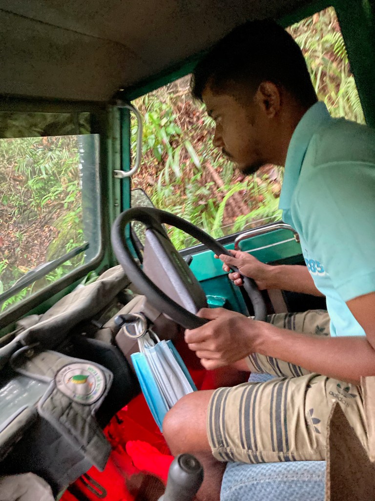
We waited an hour or so, Andy busied himself birding and I wondered up the road, squatted down, bared my bum and peed for England. Eventually we were picked up in a battered old Landrover. It must have been at least 50 years old. The driver was a young man, Anoushka, grandson of Martin, the famous bird enthusiast and conservation guru. Anoushka’s wife and their young son occupied the front and we perched with our packs in the back. Soon it became apparent that this was going to be a painful drive, bumping and crashing and sweeping past thick vegetation. The switch backs were too tight, so each bend required a three point turn, large boulders had to be negotiated and at times quite sheer drops, of the kind where you close your eyes and wait for safer ground. I don’t know why I worried myself in our truck in Chile. This was many times worse! Occasionally Anoushka would answer his phone, other times he would stick his head out of the window and point out a bird, invariably flown before we had time to get eyes on it.
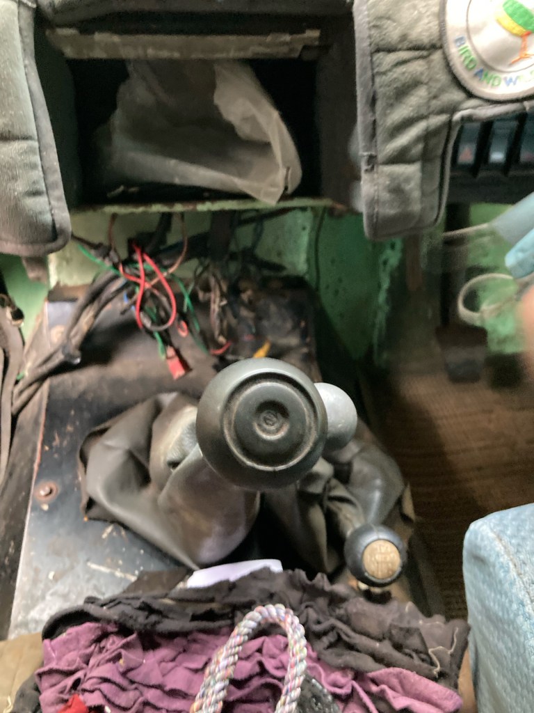
Anoushka, Martin’s grandsonHigh and low ratio gear sticks and wiring for I’m not sure what Martin’s great grandon
It had taken 4.5 hours to drive from Ella to Waddagala, a distance of 152km. The final 2.7km took us best part of an hour. It would have been faster and more comfortable to walk! We arrived and were greeted by Martin’s 4 daughters and his wife. And now we came face to face with the great man himself, in a photograph. He looked a cross between Nelson Mandela and David Attenborough. Sadly, he died in 2021, aged 82, of a stroke. This man had won all kinds of National and international awards which were displayed around the simple room. He is celebrated for establishing forest, bird and education programmes, training generations of guides and forest specialists.
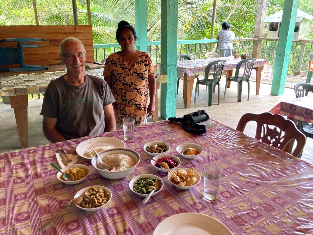
Martin’s Lodge, full board, $50 per head per day, simple very beautifully prepared and delivered meals. Two Japanese visitors, their private guide, Upul Wickremasinghe, and Andy on the veranda
Later that evening, I noticed a leech on the floor of our bathroom. ‘What should I do with it’ I asked Andy. He came in to inspect the little thing and picked it up with some loo roll. It squished as he did so, bright red blood oozing out of it onto the paper. MY blood as it transpired, the critter had made a meal of me and I had not even noticed. The lesson? Never pee in a tropical rain forest!
Spot the bird
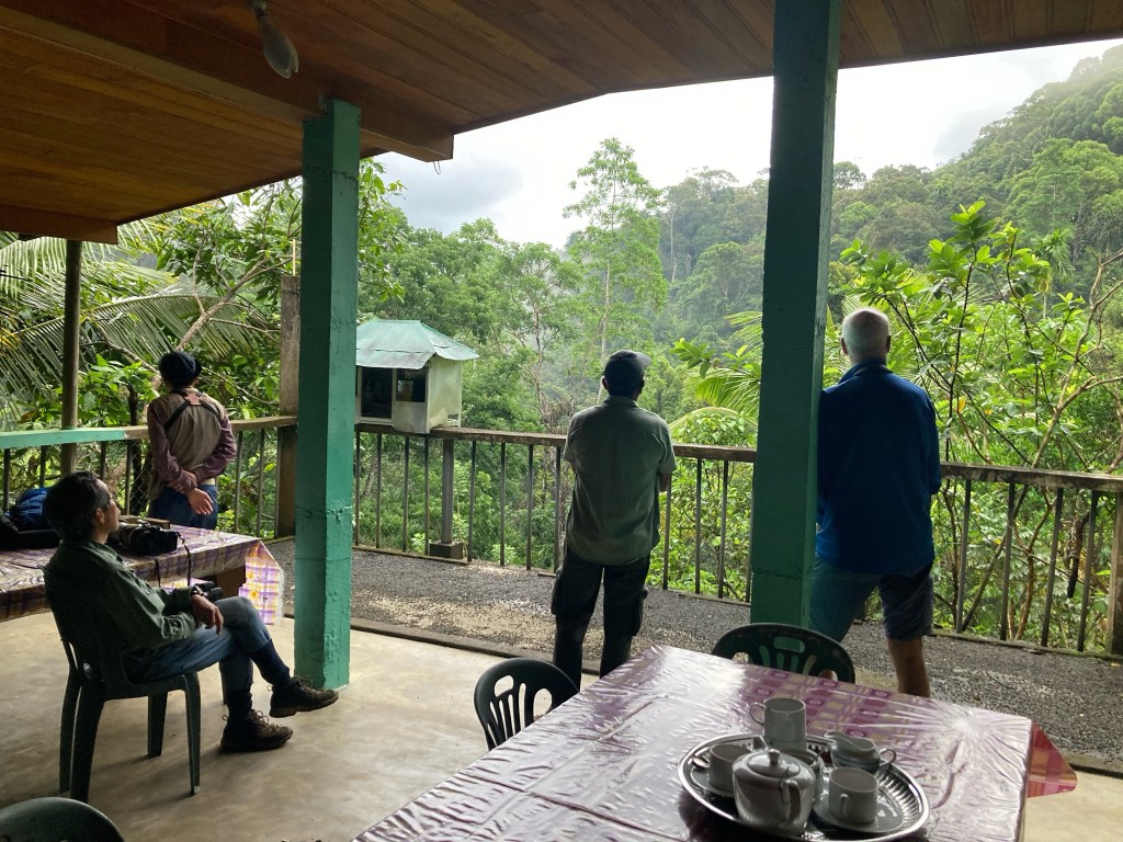
Birding from the veranda gave us a great introduction to the treasures of the forest and also a sense of how difficult it was going to be. Sinharaja is home to 24 of the 27 endemic birds of Sri Lanka, before arriving we had seen just 4. With only one day to play with, we had no time to lose.
Centre of image, tiny dot on top of bare branch, a Legge’s Flower PeckerCentre image, a Hanging Parrot, green body, red head, facing down on the very tall and thin trunk of a palm
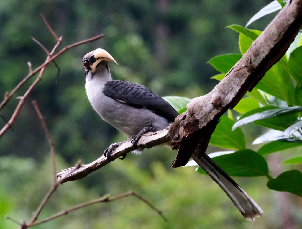
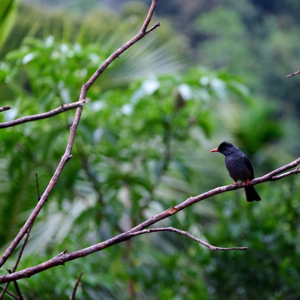
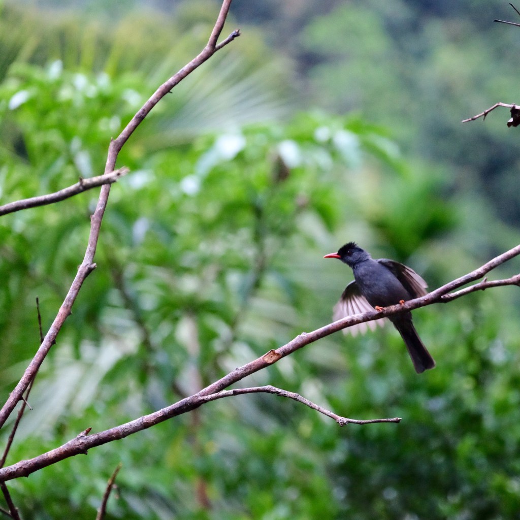
Martin’s family feed the birds from the veranda making sightings of other birds much easier. Sri Lankan Blue Magpie, Sri Lankan Grey Hornbill (both endems), Black Bulbul and Yellow Browed Bulbul all appeared to enjoy banana and cooked red rice.
Sri Lankan Blue Magpie, rear endSri Lankan HornbillBlack BulbulBlack Bulbuls have white under their wings, nothing is straightforward when it comes to birdingYellow-browed Bulbul
On the other hand Sri Lankan Spur Fowl, a severely endangered endemic, won’t come to the veranda, but can be persuaded into the open a little further away especially if uncooked red rice grain is on the menu!
Sri Lankan Spur Fowl
Before heading into the national park we were given a pair of leech socks. These look like Christmas stockings except you put them on over your socks before pulling on your walking boots. The idea is that leeches cannot get under your trouser leg and crawl up your body to find the most juicy and tender places to feast on. I’m not sure they’ll ever hit the cat walk, but for sure they are essential kit in the rain forest, especially during and after rain, which of course is most of the time. You have to remember it is hot and humid in this part of the world, so being buttoned to the neck, hatted, double socked and trouser legged, meant you dripped with sweat. It was a very thirsty endeavour.
Introducing The Leech Sock
Sinharaja is the country’s last viable area of primary tropical rain forest. More than 60% of the trees at are endemic. In addition to the birds, the reserve is also home to 50% of Sri Lanka’s endemic mammals and butterfly’s, insects, reptiles and rare amphibians. Through the seriously dense thicket, light occasionally filtering down. Under the canopy it was cooler than in the open. We moved very slowly, listening to the sound of the forest, treading softly, watching our foot steps. I almost trod on a Green Pit Viper, a massive thing, that slithered off into the undergrowth leaving me quivering. We soon learned that birds come screaming through the forest in mixed feeding flocks. The number of flocks you see is the measure of the success of your birding expedition because it takes a number of fly by’s to get good views of all the species in the flock. You have to be ready, quick on the binoculars, they don’t hang around for long. The flocks tend to be led by Drongos and include Orange-billed Babbler, Yellow-fronted Barbet, Dark-fronted Barbet, Blacked-capped Bulbul, Sri Lanka Scimitar Babbler, Malabar Trogon and Red-faced Malkoha. Great names and some great lookers. Note to self: add links to images when I get home.
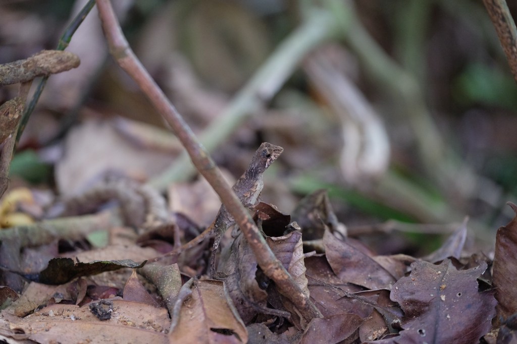
Unlike the birds, foliage was easier to capture. And as my eyes adjusted to the dappled light, other critters came into focus.
A carnivorous Pitcher Plant
I was wilting so we sat down for a drink and a rest and Wasantha, our fabulous Government funded guide took off to scout. A couple, so obviously from the UK, approached us on their way out of the park. ‘Have you seen anything?’ he asked. ‘Loads’ I replied. ‘Oh’, said she, ‘we must have been on the wrong path then’. More likely looking in wrong direction, I thought! She had a pair of tiny binoculars around her neck. Not good for much in this forest. ‘We are not naturists’, she continued, not realising her malapropism. We wanted to visit a National Park and this was the nearest’. They were on a day trip from Galle, a torturous 150km away! They went on their way, clearly disappointed.
My camera battery died. Just as I was phaffing around trying to find another, a young lad came along the path carrying a tripod and filming kit. Give us a minute, he said with no introduction, I might have a spare you can have. His name is Don Weersirie, half Sri Lankan, brought up in Bedford. In lock down he made a film called Wild Bedfordshire and he was currently gathering footage on snakes, for a new film, Wild Sri Lanka, ‘to give something back’ he said. Having not met any Brits since the train to Ella (a story still to be told), it was quite a coincidence to encounter two sets especially since Sinharaja barely features on the tourist map.
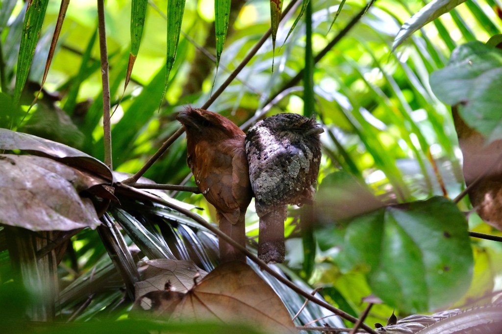
Wasantha returned, a little out of breath. He beckoned us to follow. By now all I wanted was to get home. ‘How far?’ I asked, ‘2-300m’ came the reply, ‘and then we will stop’. What he failed to mention was that this 2-300m was off piste, a dive into the undergrowth, over roots, pushing through branches taking care not to hold on to the barbed ones to steady your step, twisting and weaving, crossing a stream, almost over the boot, dripping with sweat. Eventually Wasantha instructed us to move slowly and quietly down a steep, slithery incline. He pointed. Initially, it was not apparent what he was showing us. But as our breath slowed, it became clear. There in front of us, huddled together were a pair of sleepy Sri Lankan Frogmouths. They look part Owl and part Nightjar. He is Grey and white and she, a deep cinnamon colour. She watched us. He kipped. What a pair! With some difficulty and with Wasantha’s help, I got some passable shots.
Look hard, centre image, high magnification below! Sri Lankan Frog Mouth, she’s on the right.Our guide, Wasantha, did not possess binoculars, he occasionally asked Andy to borrow his. He has the most acute eye sight and hearing. As Don had wrily commented, the guides of Sinharaja must eat their carrots!
Forty hours on and we were on the road again. We joined the Japanese birders their guide Upul and their translator, Sunat, in the ancient jeep to get down to the village. Sunat was on his second only birding tour having been a cultural guide for more than 10 years. We had enjoyed their company. Now we would start the final episode of our journey. In the short time we visited Sinharaja Forest Reserve we clocked 20 out of 27 of Sri Lanka’s endemic birds.
I’ve just watched Don’s film Wild Bedfordshire (https://youtu.be/LCgGRmPbNso). A very nice reminder of the country we are returning to after 4 months of travel, tomorrow, Feb 6 2023.
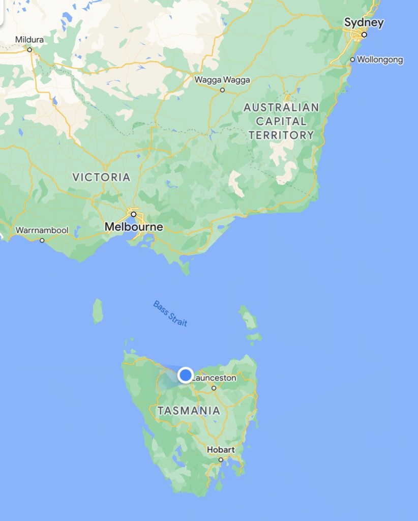
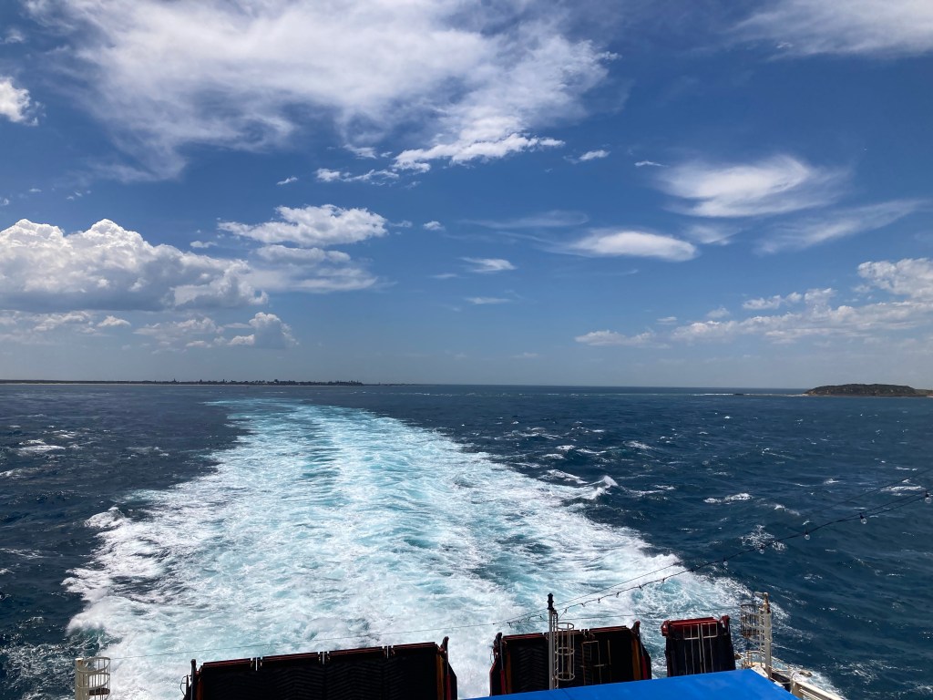
Today we managed to get onto the Tasmania Ferry by the skin of our teeth. We were the last passengers to board. The doors were held, we carried all our clobber, by passed scanning, hasty security questions – no, we don’t have any fresh food nor weapons nor scuba diving equipment.
This next phase of our journey started yesterday. A lazy morning, a bit of stretching with Paula, who comes from these parts (@yoginimelbourne), a dip in the pool, laundry followed by lunch.
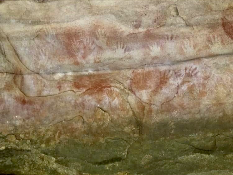
Then a fabulous bush walk in the Blue Mountains to Red Hands Cave which is buried deep in a wonderful narrow valley, along a near dried up creek in thick eucalyptus forest. Towards the top of the gully was a massive rock, hollowed by water over millennia and at some stage in the distant past, decorated with painted and stencilled hand prints, ancient Indigenous Australian art. These prints have been created in a similar way to those at Cueva de los Manos, in Argentina. These were described by Mary Beard in the recent BBC art history documentary, Civilisations. What a shame we did see them too! In the TV programme, Mary suggests that the hands could represent a greeting. A wave, from earlier inhabitants of this land, to Nicky, a recent settler, and to Andy and I, travellers, circling the world.
We got back to the car, hot and dripping, we had a few minutes to down a cold drink before we bade farewell and Nicky returned to her new Winmalee home for a zoom meeting on media strategy for the new Urban Transformations Research Centre she has set up at the Western Sydney University.
We caught the train back to Sydney where we had a generous hour before the night train to Melbourne. We walked all the way down platform 1 to car A, 1st class. I’ve never been in 1st class before. I’m not sure it quite met my expectations. We had a small cabin, which felt submarine-like, old, with heavy grey metal fittings, worn blue upholstery, pleated curtains, and strip lighting. However, between each grim little pod was a tiny cubicle containing an antiquated yet cleverly designed, drop down loo and basin, and, god bless Australia, A SHOWER! Shampoo, tooth brush/paste and fluffy white towels all provided! It was so good to pull off our boots and get washed after the wonderful but fearsomely hot walk earlier in the day.
Jessie, our host on the train, came to pull down the bunks and make up beds. Heavy-duty, crisp white sheets, slightly dubious duvet, pillows made of rocks and a plastic mattress. A mainly comfortable night was had, clean, if a bit sweaty!
The following morning we learned of the delay, first 30 min, then 45 and finally 50 minutes. We were going to miss the carefully planned connecting train but there was a later one so we were not overly concerned. We gazed out at the unfamiliar landscape. In his special and after 10 years together, all too familiar way, Andy commented that this was perfect habitat for Kangaroos. Seconds later, there they were, a family of three Eastern Greys, mum, pa and a little joey, bouncing by!
On the next train we tried to book a cab to take us from the station to the ferry terminal. With that sorted, we relaxed. The trouble started when we arrived at North Geelong station. There were car parks on either side of the train tracks. Which side would the cab come to? It took us some time to realise that the cab had failed to materialise. Andy got back on the phone, and another car was dispatched, but by now we were right up against time.
As we arrived at the port it was clear that cars and freight were still being loaded. However, when I walked into the foot passenger entrance, the person at the front desk told me that check in had closed. ‘But but but’…I stuttered in disbelief, ‘we have come all the way from England (via Chile, Argentina, New Zealand) and we booked this ferry months ago, cars are still being loaded, surely there is something you can do?’ The security man behind the counter ominously rose to his feet as Andy came to my side, having paid the cab driver. ‘I’m sorry you are too late’ said the receptionist, ‘I can book you onto the night sailing if you like? Your ticket has been cancelled.’
I could see our names on the no show list in front of her. ‘No no, we need to get on THIS ferry. Please can you see if something can be done to help us’. Reluctantly, she lifted her phone, ‘I’ve got a couple at the desk, their train from Sydney was delayed, they had trouble finding a cab, I’ve told them check in is closed and our policy on late arrivals, but they are pleading with me. You are the manager, it is your call’.
A few anxious minutes later, the manager came to the desk. He agreed to let us on and also waived the fee to reinstate our tickets. Just at that moment, there was commotion at the sliding door behind us, a women was distraught that the gate to the car departure area was shut, she too was late. We kept our heads down. Boarding passes were thrust into my hand, we clambered aboard.
Chatting to a man on board, I mentioned how lucky we felt to have made it to the ferry. ‘Oh’ he said, ‘so you are the reason we were delayed! I’ve used this service over 30 times in the past couple of years and never has it been late’. Had the boat been on time, we probably would not have been on it.
Red Hands CaveNicky on the Red Hand Caves bush walkFirst class ‘twinette’ on the Sydney to Melbourne night train Out there be Kangaroos!Entering the Bass Strait
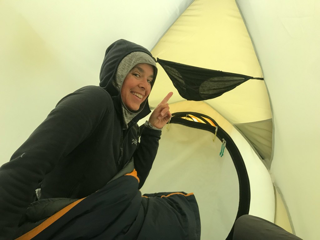
How wonderful it was to wake up in a warm dry bunk bed and be able to fall out of it, rather than having to hunt for yesterday’s underwear stuffed into a makeshift pillow, push damp clothes into a sleeping bag to warm for a few minutes before dressing horizontally, pulling on boots, then finally, crashing out on all fours through a dripping tent door, getting sodden in the process, before arriving at a fully upright position in whatever wind and weather the morning had brought!
It was also wonderful to have been able to shower inside, in a room with radiators, and space, and hooks to hang things on, not worrying about dropping precious dry clothes onto an icy cold muddy floor.
Before taking off we dropped our packs in a locker room and walked back up the way to grab some photos in the relatively better weather. On returning to the refugio, we discovered that we were not the only ones to have dropped bags that morning. We spent best part of the next hour excavating our 4 packs and then carefully returning the hundreds of others to the very small room. Shortly after we had finished a very angry woman started hurling the bags out again. We watched her for a while, and then took off.
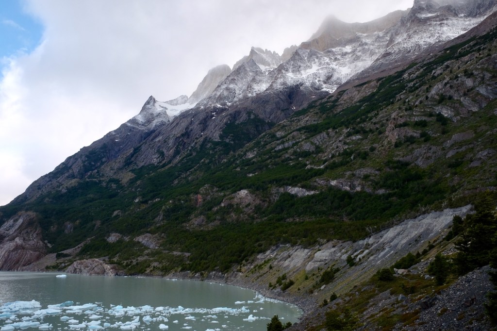
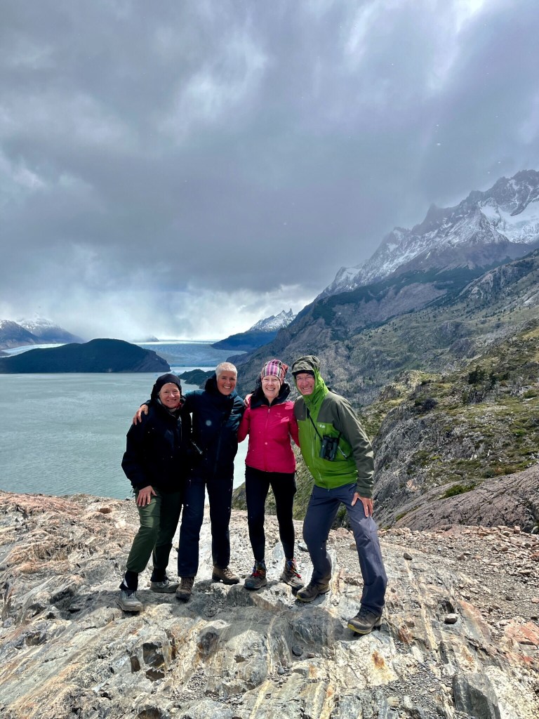
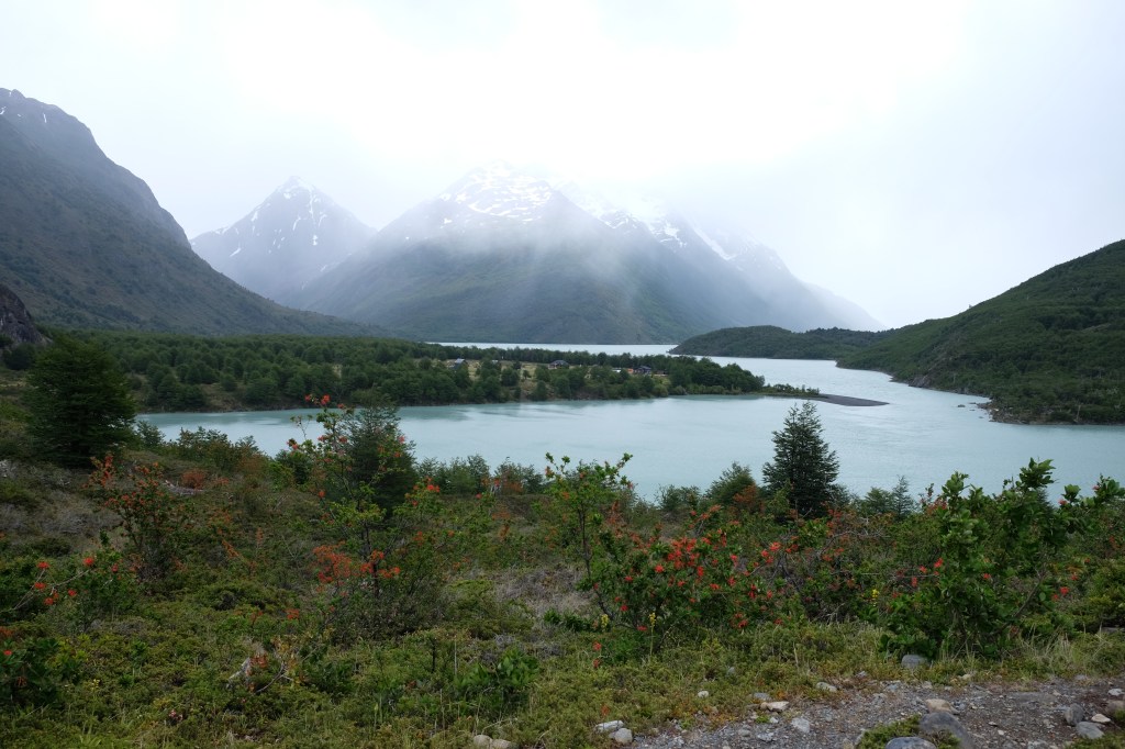
The path followed the valley down, rising and falling to cross streams, eventually climbing to a fantastic mirador where a number of people had stopped on a rocky promontory. A massive gust of wind, set them flying for hats, gloves, hiking poles. A pack cover filled like a balloon, ripped off a backpack and disappeared over the glacial lake. Our plan to stop here for lunch was soon revised. We finally escaped the wind when we came down into a deep, tree-lined ravine. Lunch was cheese and tortillas, not my favourite, but I was beginning to feel unwell.
At every refuge there is an elaborate check-in procedure. Not only must you produce your booking information and National Park Pass, you must also hand over your passport and PDI, a flimsy piece of paper which you receive when you enter the country. These latter two items are then copied, who knows what for. After this, if you are dining in, you are asked if you have any dietary requirements. We got quite good at saying ‘Andy y Ona son vegetarianos, Kris come de todo, Miranda come de todo pero no puede comer nada con huevos’. The previous evening I asked a member of staff three times to confirm the meal was egg free. Three times I was told it was. It wasn’t. For the next two days I suffered the consequences, although I did very much enjoy the offending vanilla desert at the time.
Even though it was me with the cramps, it was Andy who took the fall and came crashing down backpack and all, on a fair weather dry day. He just put one foot wrong. Fortunately, he was soon upright again and little damage was done. But good it happened on this day and not the previous
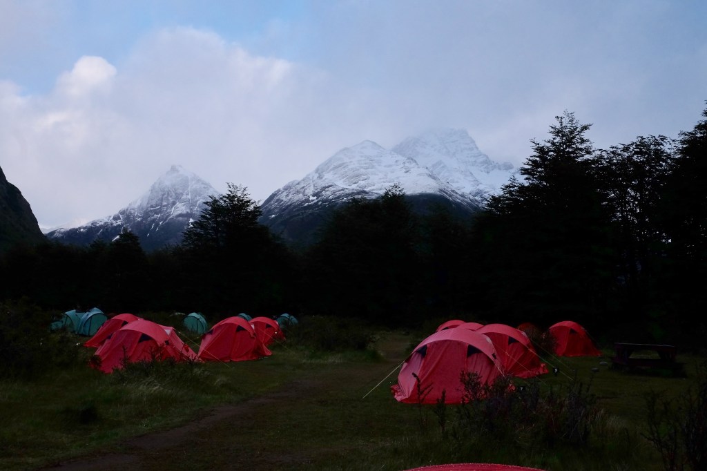
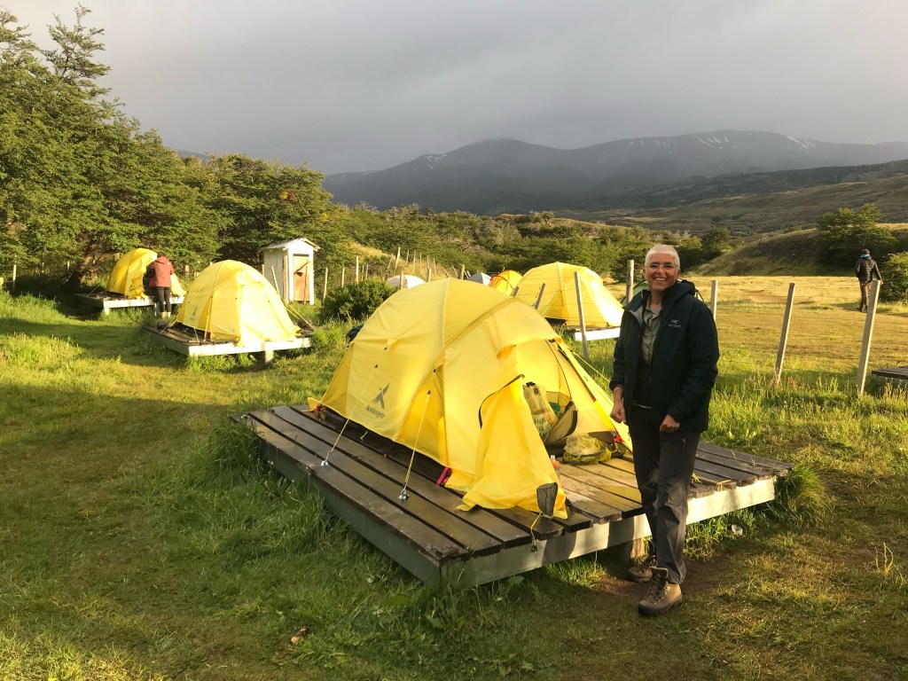
Paine Grande is the largest of the camps. It sits between Lago Grey and lago Pehoe and has a boat connection to Refugio Pudeto, where there is a road. As a result it gets many visitors. The best bit about it, is the view, but otherwise it was the least favoured of all our stopping places. That evening soon after we moved in, a mass of kids arrived. They kept us up most of the night. I don’t think anyone realises that you can hear everything through a tent wall. That’s everything! I was envious that these kids from Santiago, were able to have such an exciting school trip. I remember a day trip to Boulogne when I was at school, most of it spent on a coach. That’s about as exotic as it got!
Bag locker at Refugio GreyOur path is in there, somewhere A valley full of dead trees. They burnt in a fire some years back. Recovery is slow but sureA quick pic before we had to retreat from the Patagonian wind!Paine GrandeThe campsite with a view
The weather was variable but the the temperature was on a downward spiral. Los Perros, is the highest and most remote campsite on the ‘O’ circuit. We had been told that a pit toilet and cold shower would be provide but no meals. A tent would be available, but we would need to put it up and collapse it before we left. We had been led to believe that this camp was very basic with not even a shelter to cook in.
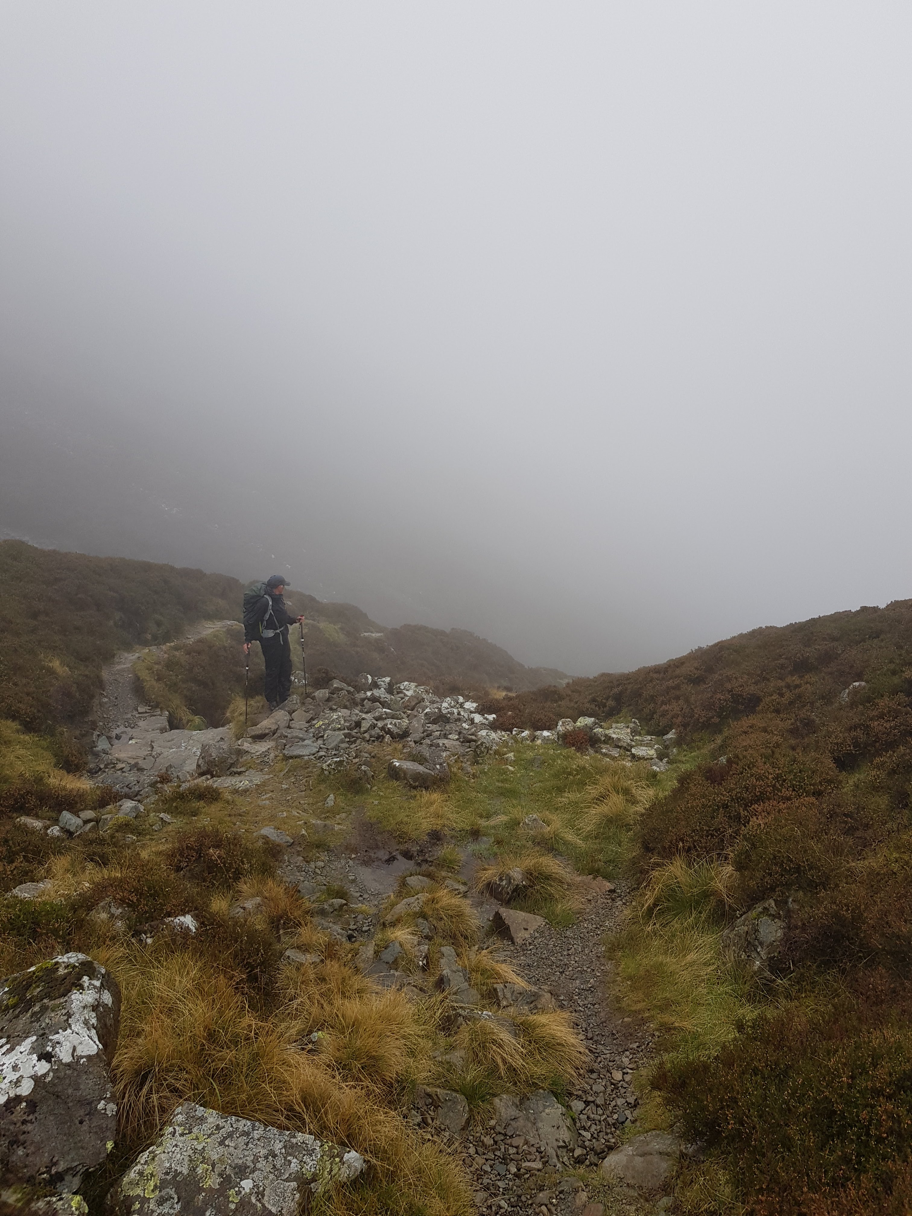
After Los Perros comes the John Gardiner Pass, famous for its extreme wind blowing straight off Chile’s vast southern ice sheet. An early departure from the camp is essential as the wind gets even more fierce later in the day.
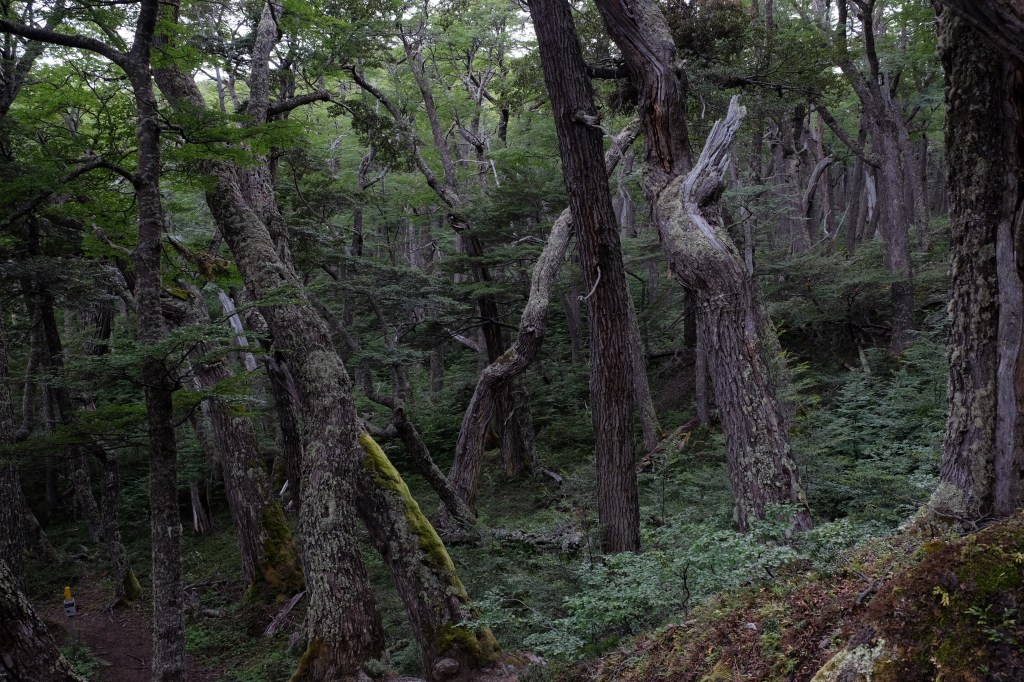
With all this in mind we set off, braced for a cold damp night and a pre dawn departure the following morning. It was not a huge distance from Dickson to Los Perros and we did not want to arrive too early, only to sit out in the cold, so we set off late and took our time. It was a lovely path through thick forest.
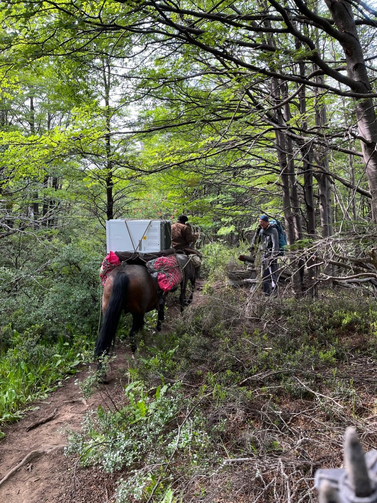
Soon after we left the camp two horses came up the path behind us. On one was a Gaucho, a beret on his head, on the other, you guessed, a freezer! Why on earth would anyone transport a freezer up this path unless they were taking it to the Los Perros Camp? And if this were the case, surely there had to be power up there, and potentially a shelter with lights! Perhaps the camp would be more hospitable than we anticipated.
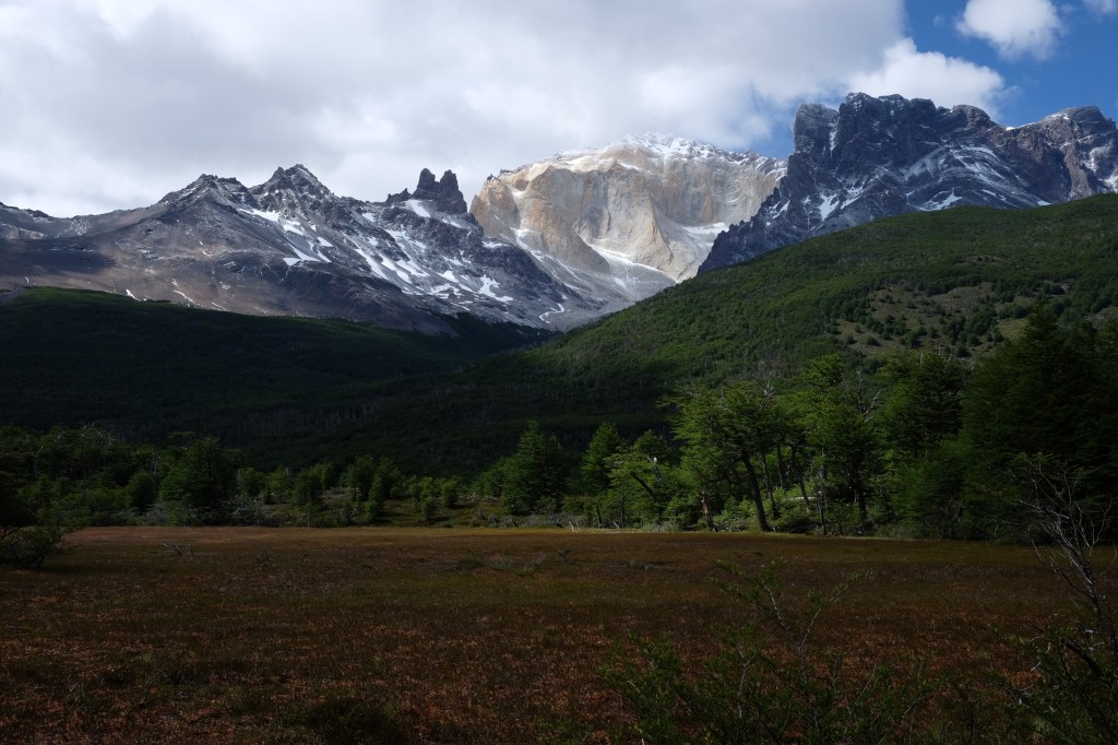
We had odd moments of sunshine and great views of the Catedral and Cota peaks. A fabulous bog, but too small for a seed snipe according to Andy. There were a number of bridges in varying states of disrepair and we stopped by one for lunch. Soon after, we heard the characteristic tok tok noise of a Magellanic Carpentario, a large woodpecker, the males are dressed up with a bright red head and yellow eye, the females with black head topped with a tuft of feathers, red around the beak and also, an intense yellow eye. Andy picked up a couple of sticks and started to beat out the double rhythm on a tree trunk. Soon, not one, but three birds were in the trees around us, inquisitive things that they are.
We continued up, into a section of dead forest, the trunks silver and smooth. We scrambled beside a stream and then onto the ridge of a terminal moraine. In front of us, the Los Perros Glacier, literally pouring down the mountainside. In the distance, off to our right, we The got our first site of the John Gardiner Pass, which at that moment looked rather innocuous. Not long after we arrived at the camp. Yes it was cold and damp, snowing in fact, a gentle but constant fall. But, the tents were pitched, walkers were congregating in the large communal kitchen, camp cookers were ablaze on the benches, warming everyone through and weary walkers were spinning yarns of their days exploits!
Seedsnipeless bogGlacier Los Perros Yay the sun came out for our selfie!
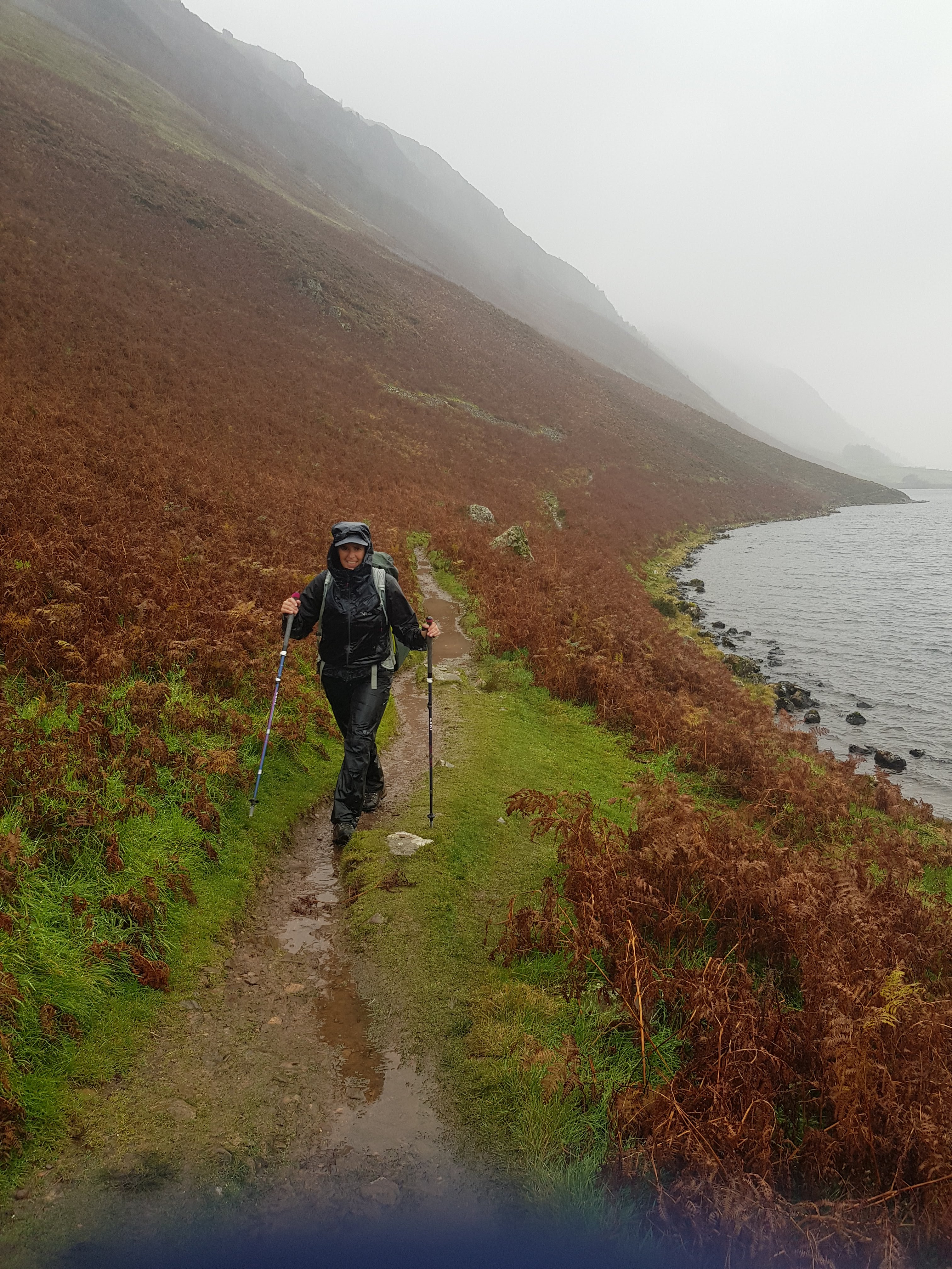
A damp start to the day, clouds low with drizzle. We packed up, breakfasted in the refuge, collected lunch bags, and set off in waterproofs. The walkers soon spread out along the narrow path following the silent river. Rising up a steep rock outcrop where we experienced two or three massive gusts of wind, we cross into the valley of the Rio Paine, with views of the lago by the same name. Ahead the weather looked bleak. Leaving the lago behind, the valley broadened out, with lovely reed beds and pools. We passed three British lads, Sam, Thomas, and Kyle from Birmingham bringing up the rear. Sam was lying across the path with his head in a small stream. We stopped for lunch and they leapfrogged ahead of us again. The path entered beech forest and we climbed to a mirador overlooking largo Dickson and the camp immediately below.
That evening we found ourselves sitting with Connie and Melissa, mother and daughter. They were German but living and working on a sheep farm, close to La Junta just off the Careterra Austral. They had inherited the farm from a great uncle and decided to make a go of it. Melissa, the youngest child was at University in Europe but was back for the Christmas holiday.
A note for walkers
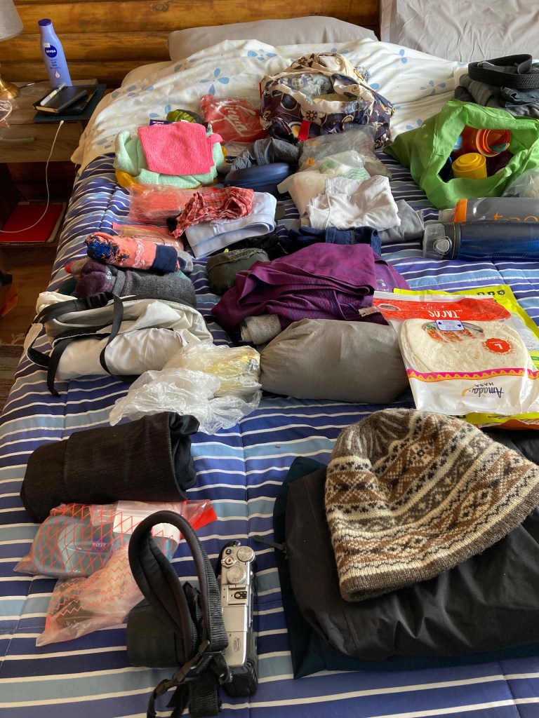
It turns out that the refuges bake their own bread, sell burgers and pizzas, all manner of snacks, provide shampoo in the showers, and for the most part loo roll! Some even had sun cream freely available. It would have been good to have known all this up front and saved us carrying additional weight on our backs. We carried kilos of nuts and dried fruit, chocolate, snacks for the route, essential when the going gets tough. We had opted to eat evening meals and breakfasts in all refuges where possible (7 out of 8, no meals are available at Camp Peros) and buy 4 packed lunches (sold for an eye watering 30USD, and carry 5 of our own (tortillas and cheese, tomatoes, avocado, apple while they lasted, supplemented with reconstituted freeze dried ‘salads’. However, we could have easily prepared a sandwich or two from the very generous refuge breakfasts or even have bought pizza which at 10 USD were much better value, and carried that for lunch.
Leaving camp Seron along the upper Valley EncantadoPonds along the Rio PaineAn American Kestrel hovering over a reed bed, black necked swans, upland geese other and usual suspects in the valley.A lovely winding board walk to cross bog at the the head of the Paine valleyLooking down on Camp Dickson in the peninsula at the centre of the picture, Embothrium Coccineum, long petalled red flowers in the foreground and new snow on the mountains behind. The following morning, a little patch of blue sky but more snowfall visible above the campKris on lago Dickson
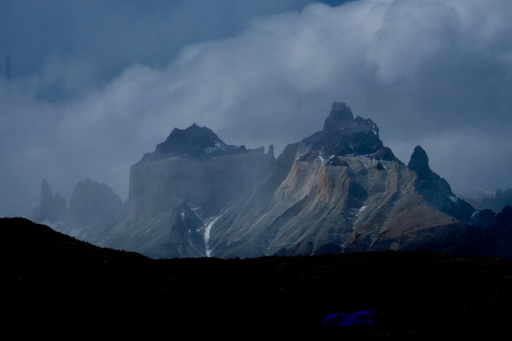
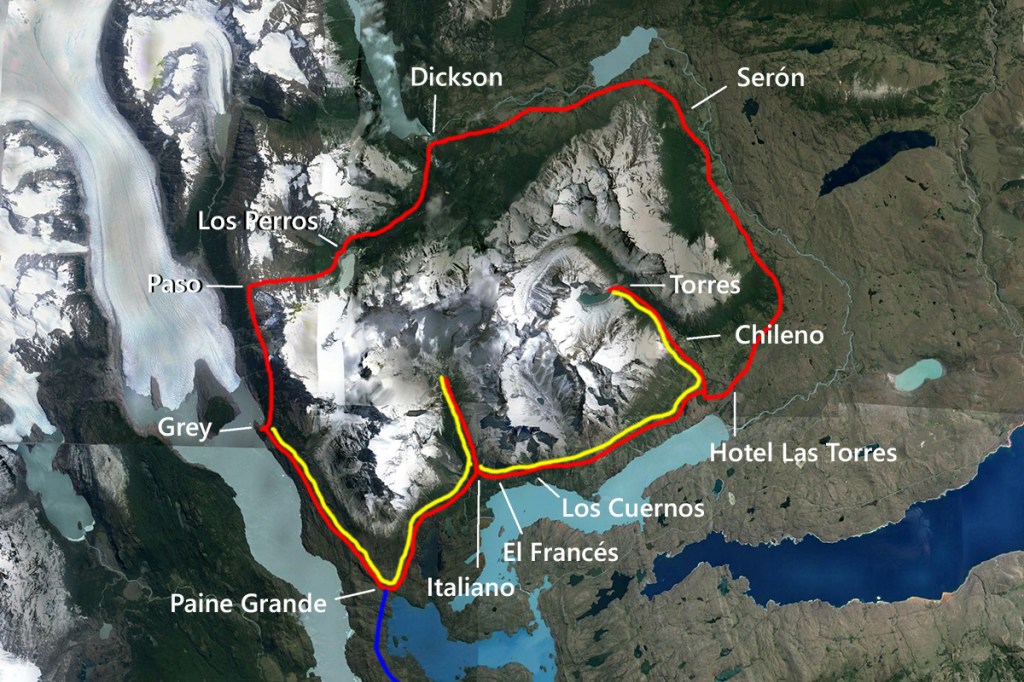
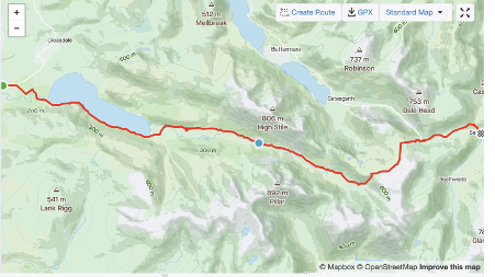
Torres del Paine National Park hiking trails, refuges and campsites. The ‘O’ circuit is labelled in red, the ‘W’ in yellow
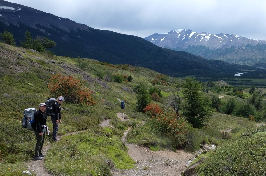
It arrived, the much anticipated date, the day we were starting the epic ‘O’ circuit of the Torres del Paine. The name says it all, (learning to pronounce it was another matter). In the months leading to our departure from home, we upped our exercise, he rowing and me running, and we added a weekly ‘personal training’ session to be sure to be able to complete this mountain circumnavigation injury free. Never have I been so glad to have given so much time to lifting, squatting, lunging, pushing and pulling. But the preparation fully paid off.
There was chaos at the entry to the Torres del Paine National Park. Hikers and day trippers poured off coaches from Puerto Natales. For all the complexity in the booking system, there was little information on what to do, where to go, how much to pay, what to expect.
At the Welcome centre, whilst Andy left a message for Gerado, who was due to deliver our repaired camper, left behind at El Calafate, (Argentina) I went in search of the water bottle that had got lost in the scramble for the bus. Fortunately, I found it on a counter along with someone else’s box of small pink pills. I asked around the groups gathered outside if anyone might have dropped their medication. “Probably birth control’ said a young women with dreads and piercings. ‘ Ah yes’ I responded, ‘not critical then’. ‘No’, she agreed, ‘but this sure is a cool place to conceive’!
We set off, not quite sure of the route but soon found the way. After a few steps Andy informed us, in true tour leader style, that the ‘zonas de recouperaciones’ were for habitat recovery, not ours.
The route to camp Seron was gentle, a lovely path through forest, along the bank of the aptly named Rio Ecantado. We were warmly greeted at the camp. There were only 12 walkers dining in that evening, the others were cooking in a shelter outside. On our table were two women, in front of them a bottle of wine which they immediately offered to share with us. They were Russians, living in America, with no desire to return. Thirty somethings, mothers, married to Russians met in the US. They were fresh, beautifully poised and turned out. One was in clothes that coordinated head to toe, pinks purples, mauves. They were on their 5th day of the circuit, having started at Paine Grande. That day they had walked two stages, starting from camp Chileno at 3:00 in the morning, hiking up to the Torres for sunrise, then all the way down to the Central Sector and on to Camp Seron. A mammoth hike. You must be totally exhausted’ I exclaimed. Think Villanelle, from Killing Eve, ‘ I feel totally rested’ the coordinated one replied. She took a long slow breath, her eyes closed for a second or two. ‘I have no worries. Children (three, under 7) are with father.’
The evening meal was excellent, each plate carefully constructed – a tower of gratin potato, roasted veg, crowned with a fillet of chicken finished with a crispy ‘leaf’ of Parmesan.
Working out what not to take!The Torres from the busValley Encantado with two mujeres encantadores!A bright yellow tent at camp Seron to have some fun in!A cold night, I slept in all my warm clothes but look, clean knickers!
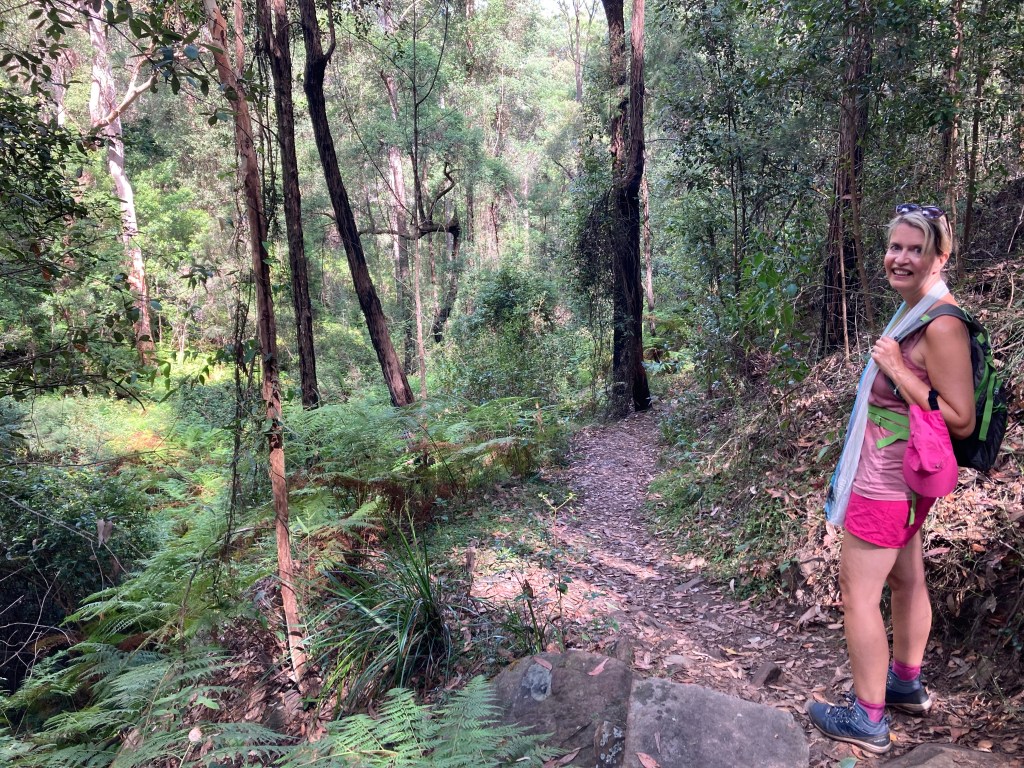
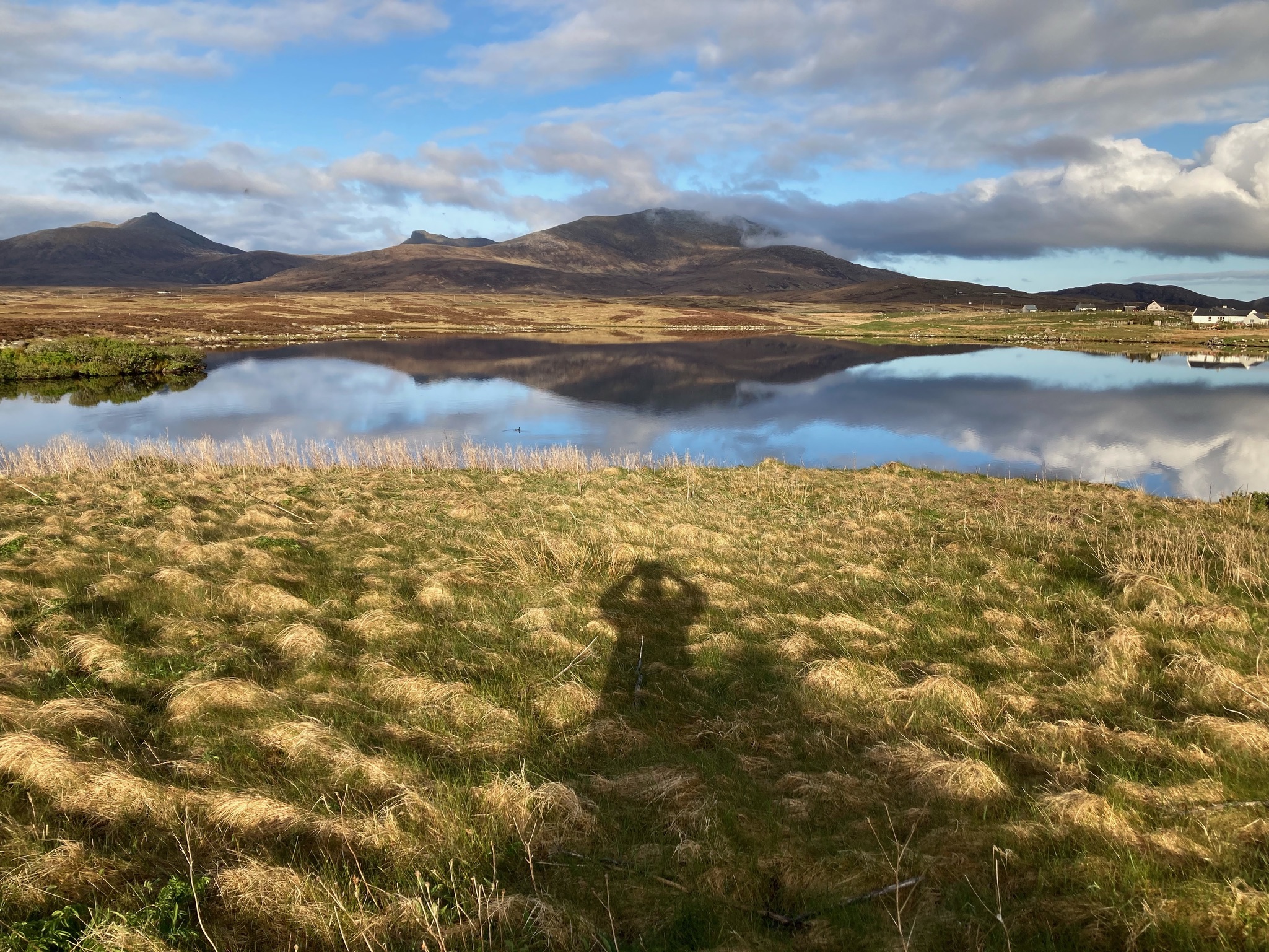
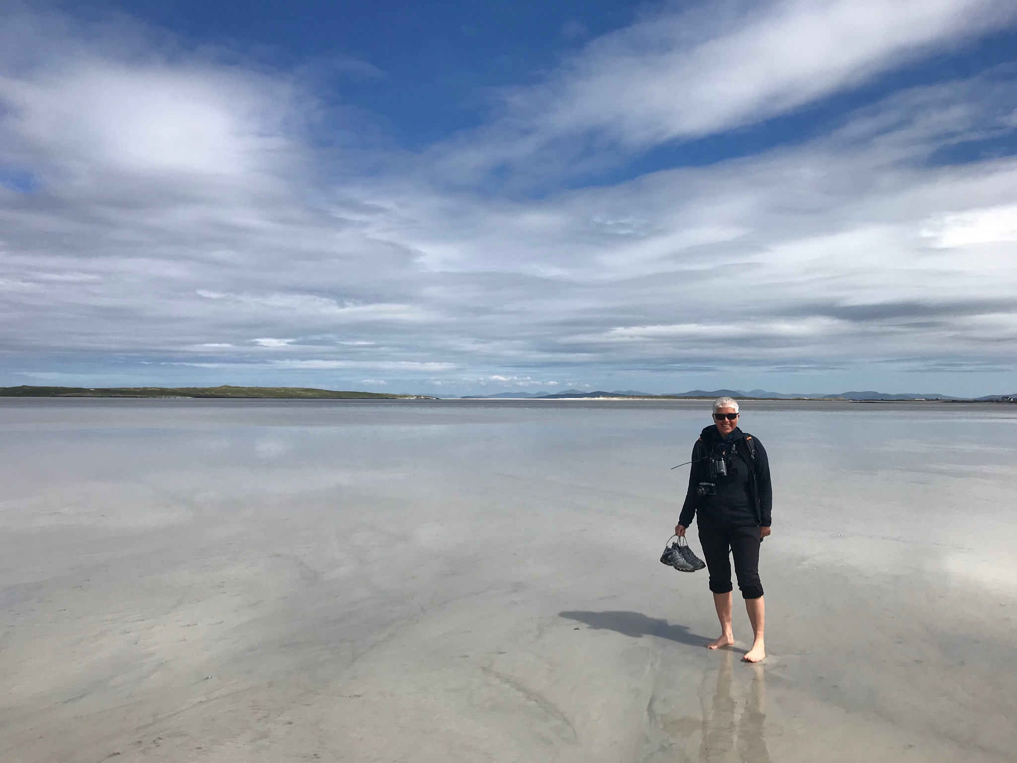
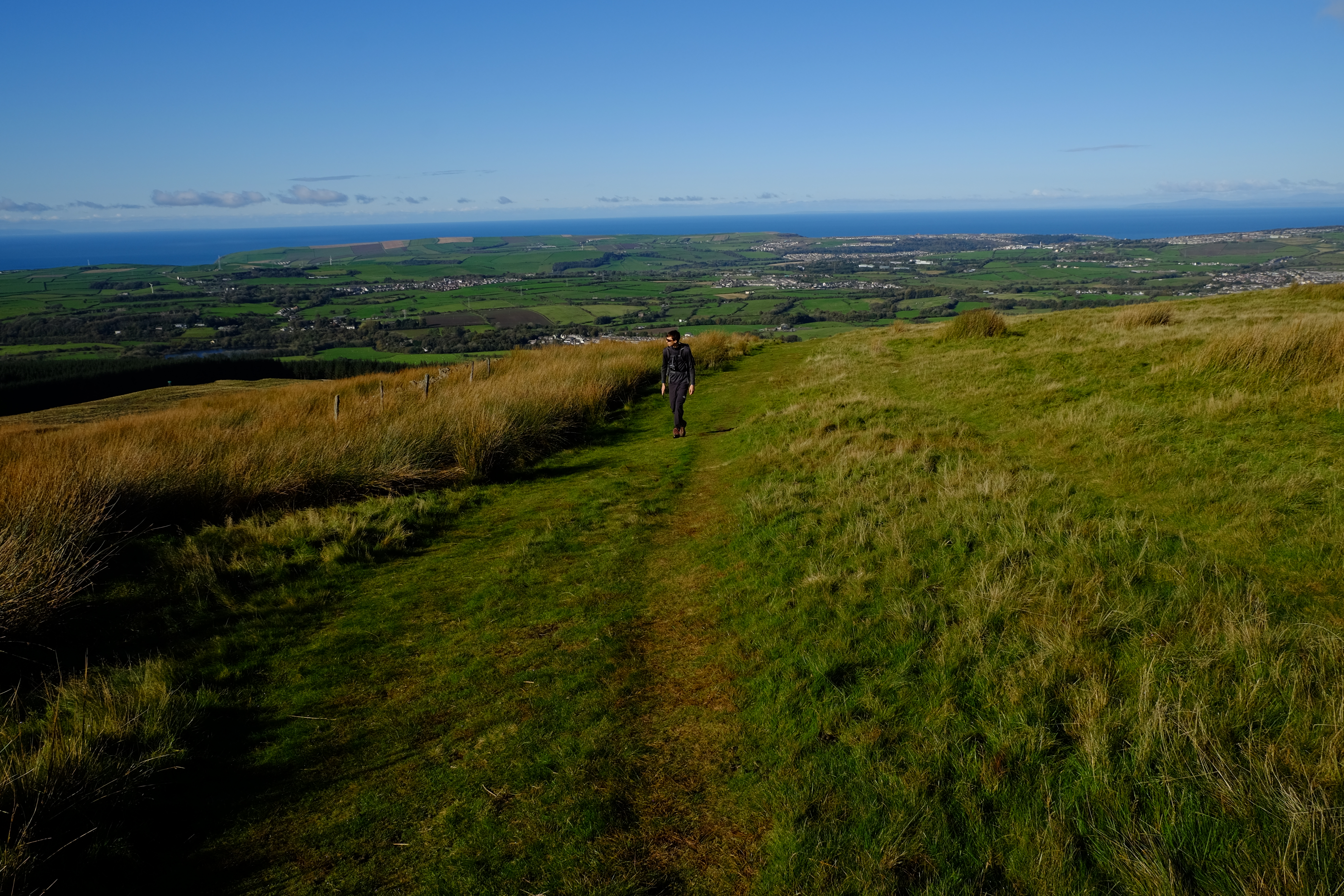
With restrictions easing and in need of a change of scene, we looked at destinations where both our interests could be satisfied – birds for him and hills for me. Of course over the years these interests have melded and while I am far from an accomplished birder and he sometimes prefers to sit (in a northerly gale sea-watching), it is not generally hard for us reach agreement. The Uists became our favoured choice, we found a place to stay and booked the ferry crossing. Neither were trouble free. We travelled North stopping for lunch at Low Newton-by-sea and then overnight with friends in Edinburgh. The next leg of our journey took us to a hill side off the river Dee and from there, because of a change in the CalMac time table (a regular feature of their service) we left a day early for Oban and the spectacular 7 hour sea crossing to Lochboisdale. Our return was similarly stepwise, stopping for a lovely lunch with friends in Doune and then overnight with other friends in Edinburgh. We had not realised quite how much we had missed the proximity of others. Being able to scan someone else’s bookshelf, stand at another’s kitchen counter, sit and chat in a different living room or garden, is transformational!
Staoinebrig
The view of Beinn Mhòr from our rented house at Staoinebrig, S. Uist. The garden went all the way to the water and included a rusty old beat up car complete with what looked like bullet holes!
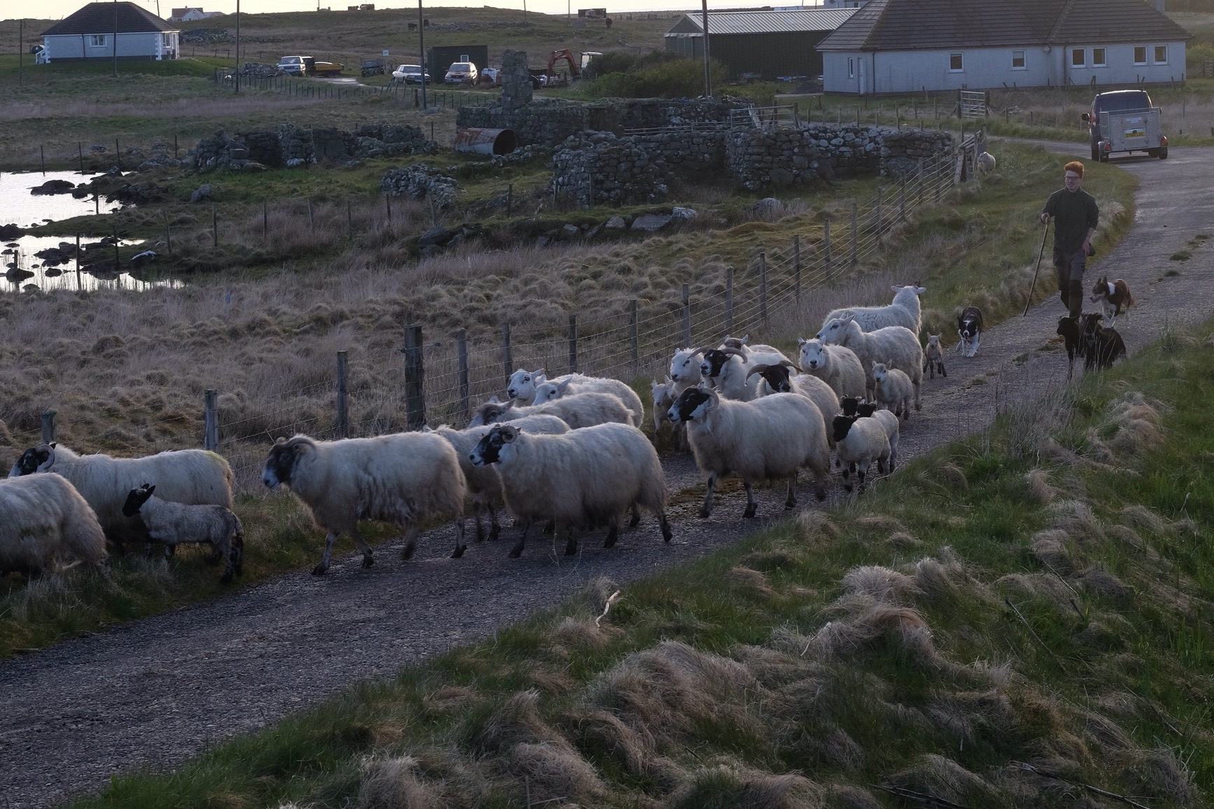
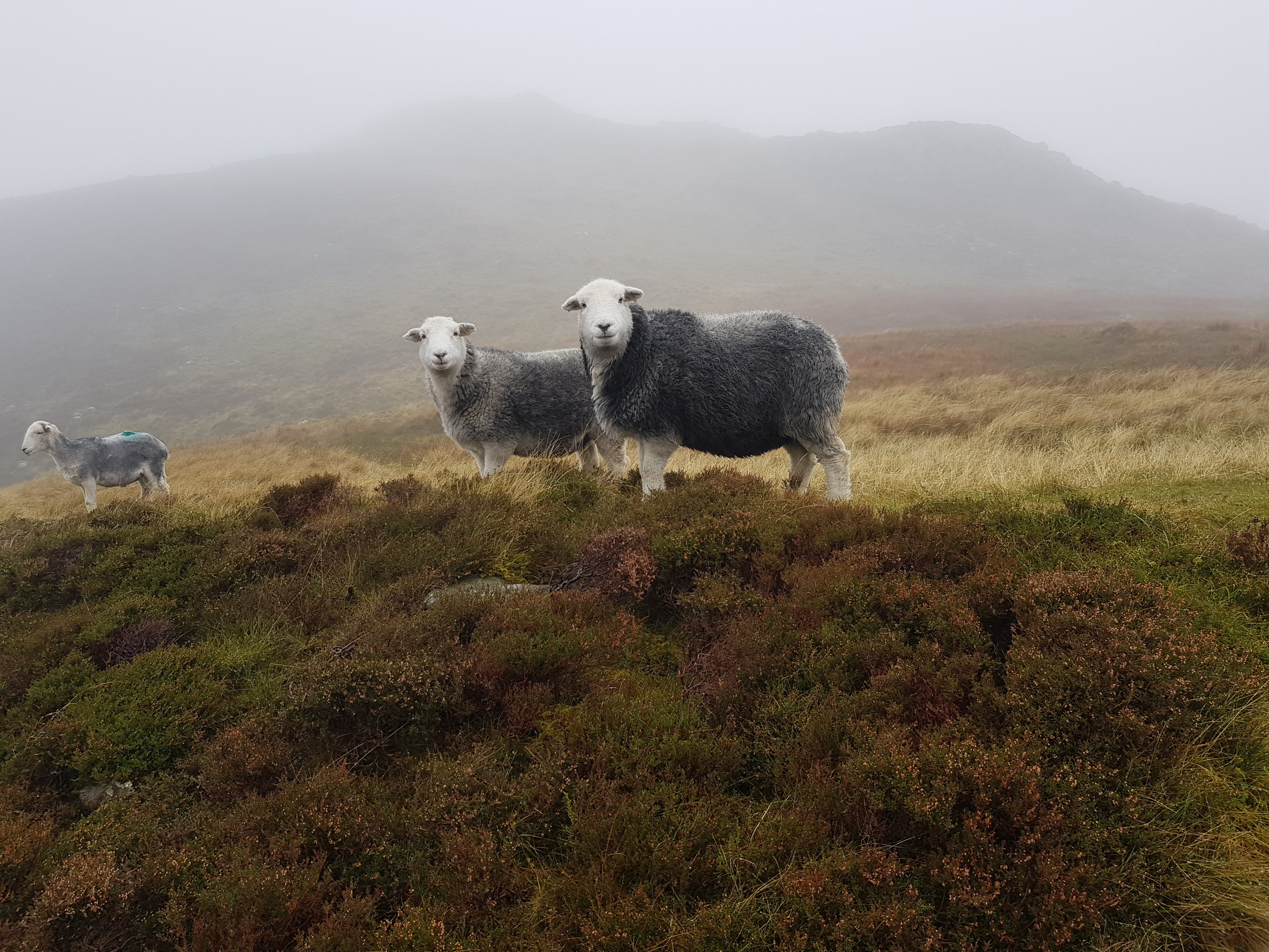
An evening stroll from the house, to the accompaniment of at least two Corncrakes! They make a distinctive noise, like drawing a stick over a hard comb, twice in succession. We made way for a ginger haired shepherd, his flock and sheep dogs. The crofts, cars and other debris in the back ground are typical of the island.
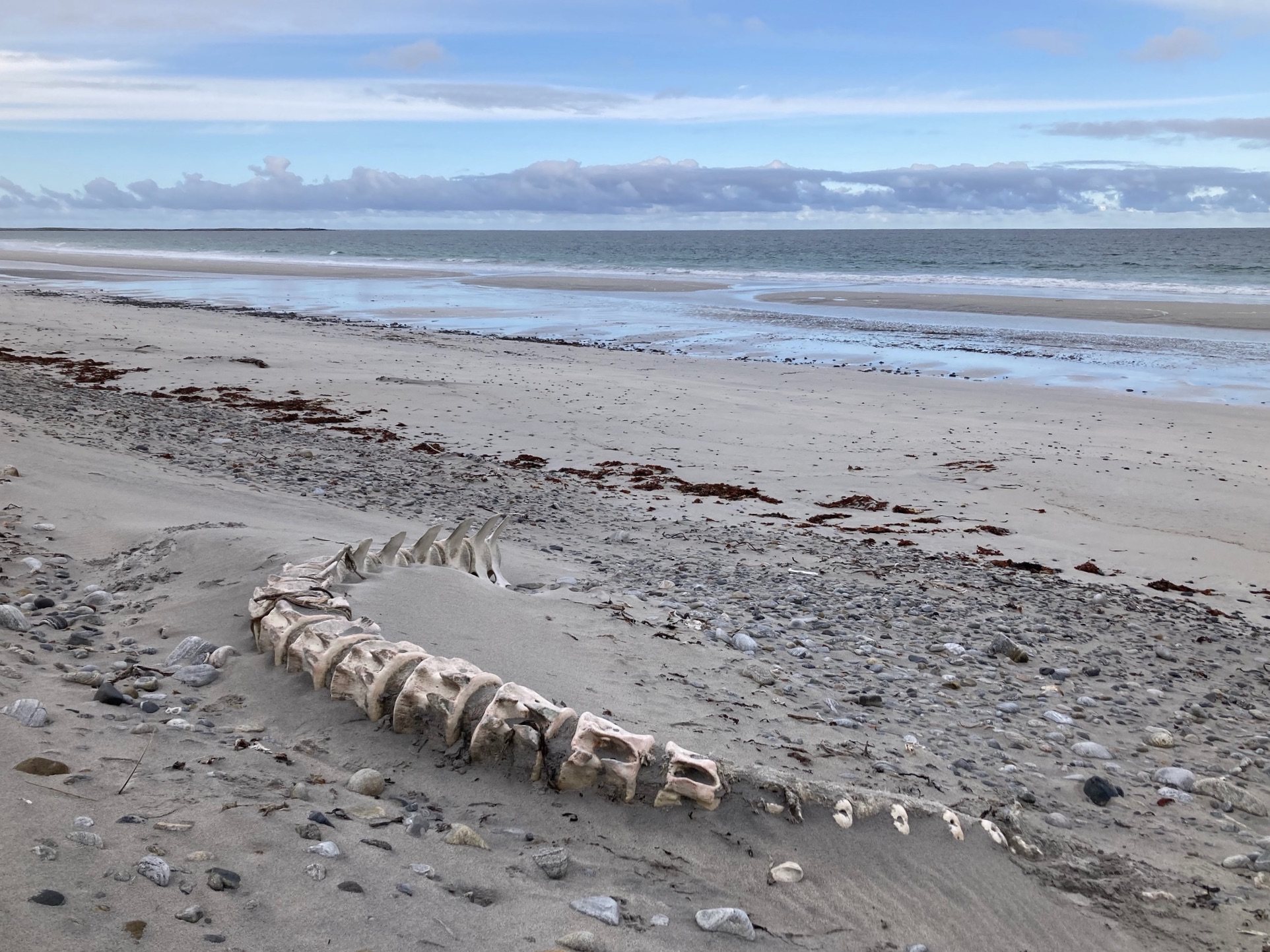
Bornais
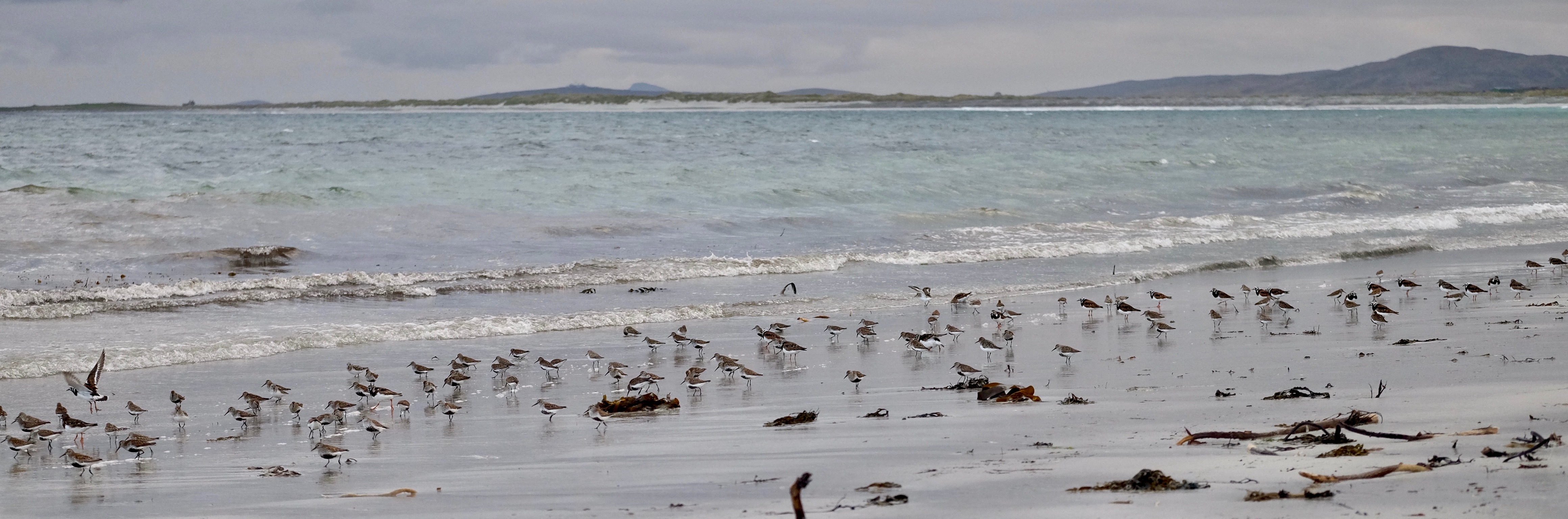
Our local beach, at the Bornais end, was teeming with waders: sanderling; turnstones; and dunlin. Along with the rusting cars, old fridges and abandoned farm equipment, there were other equally powerful remnants of the island’s habitants, including the washed up remains of a whale. A fine resting place if ever there was one!
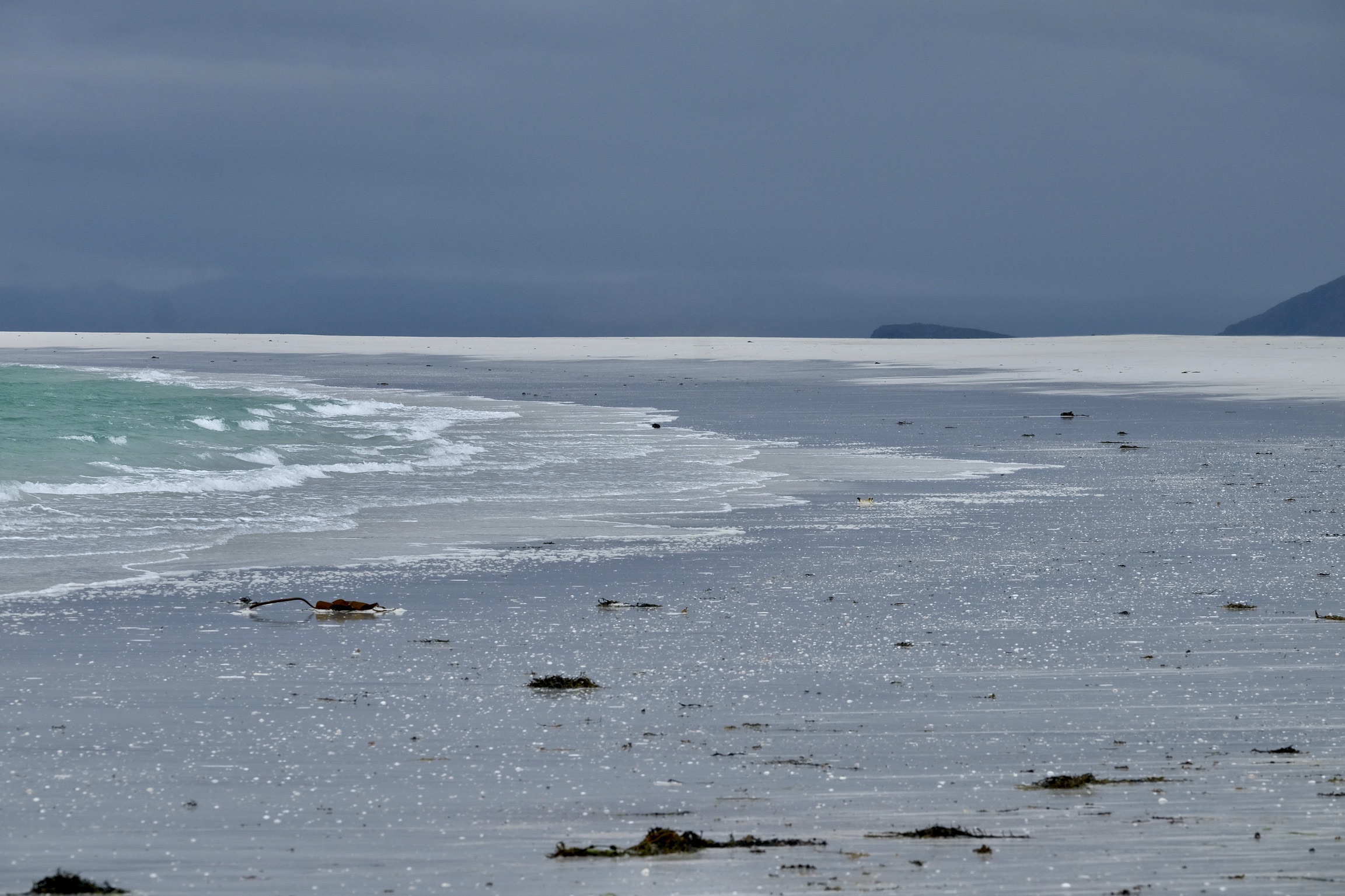
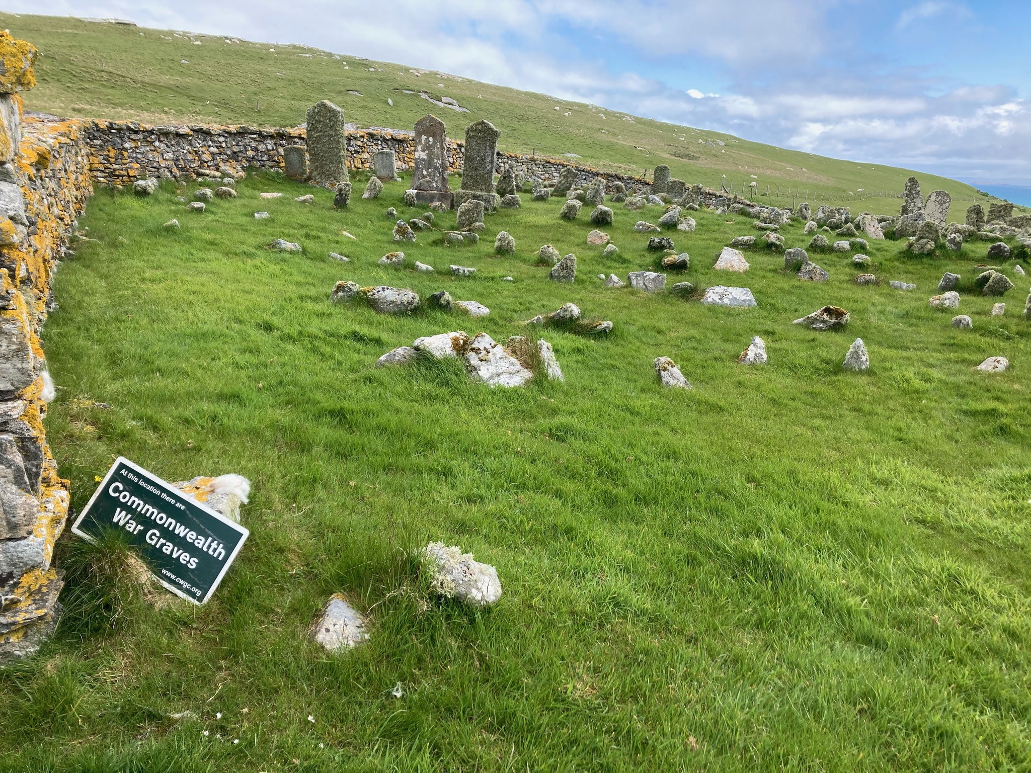
Berneray
We did a wonderful walk around the island of Berneray, black skies in sharp contrast with the white sand beaches. On the north eastern corner lies a cemetery. Marked only by stones, are the graves of commonwealth soldiers. I have not been able to find out why these burials happened here or who lies beneath. Would families members know, were they told? Unrecognised people in the ground of a foreign land for which, willingly or otherwise, they had given their lives. For these poor souls, while incredibly beautiful, this probably cannot be considered a fine resting place.
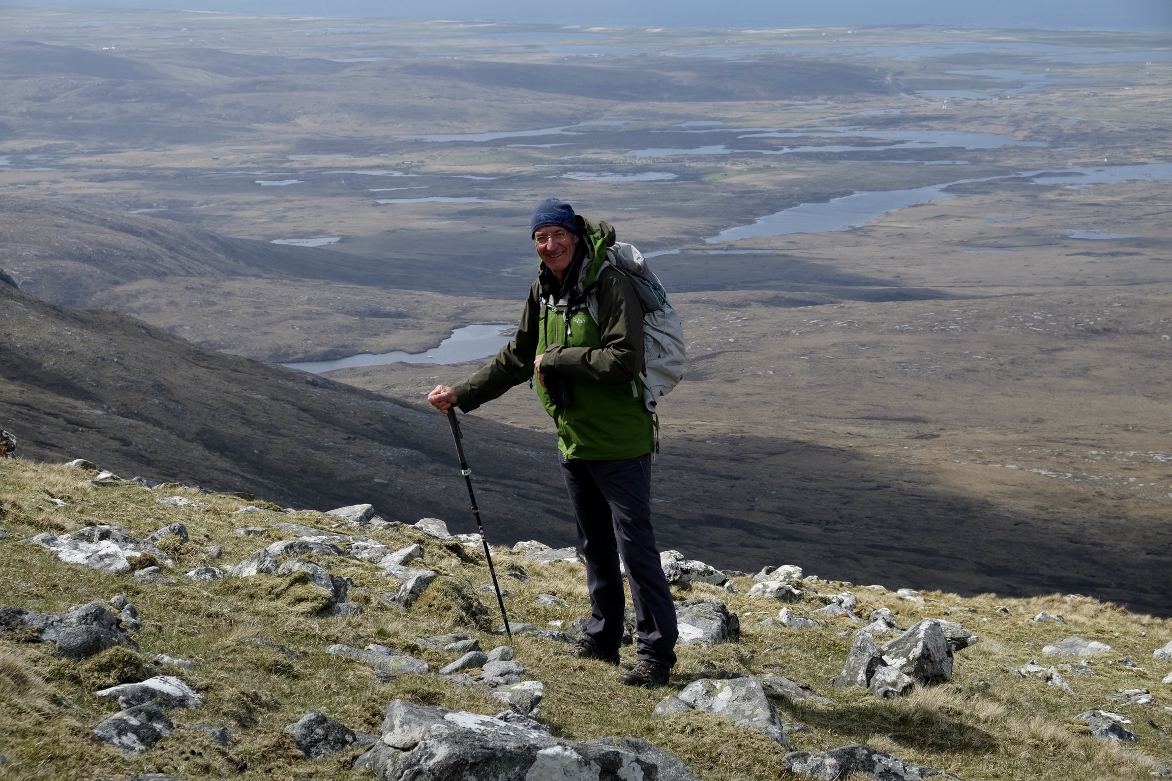
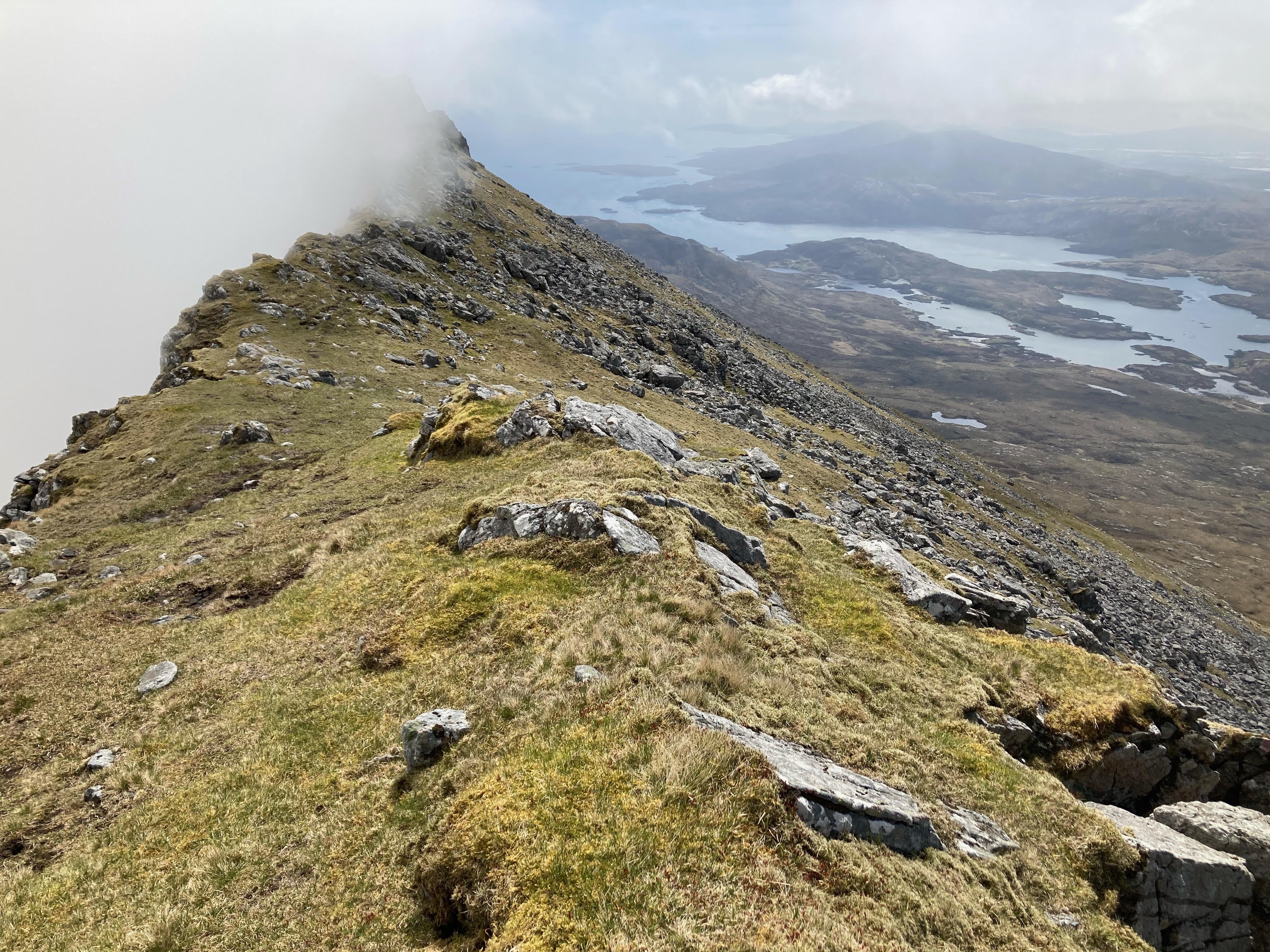
Beinn Mhòr
From our house we could see Beinn Mhòr, the highest peak on the outer Hebrides. We waited for the best weather to climb her. It was touch and go. There are no foot paths. It would be very easy to get lost in cloud, the mountainside can disappear in seconds. The route to the top follows an arrete which caused an attack of vertigo in one of us!
Looking down towards Loch Aineort from the Beinn Mhòr arrete. The clouds hiding the sheer drop on the eastern side of the mountain.
Vallay
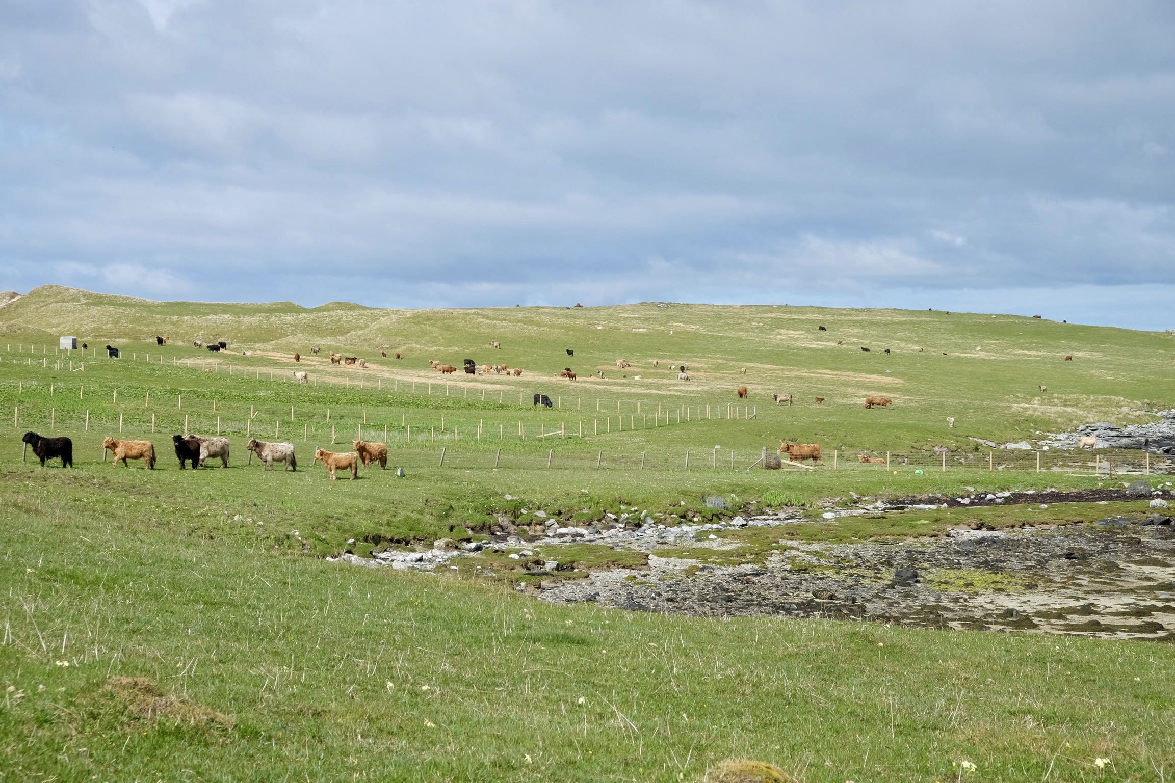
On the north west side of N. Uist lies the island of Vallay, which is accessible in fair weather at low tide. The island is awash with wild flowers. Its western side has spectacular beaches perfect for a picnic and swim! But the interior is disappointing, filled as it is with cattle and all the paraphernalia that comes with farming – barbed and electric fences, plastic silage bags and unnatural ‘improved’ grassland where Machair should be, a rare and delicate grass growing on shell sand. At least the farming is not as intensive as it could be, but no doubt it impacts on wildlife and habitat. Facing the main land on the south coast lies the ruin of a large house once lived in by textile factory owner Erskine Beveridge. We spent some time trying to see the Corncrakes we could hear rasping close by. On crossing a barbed fence at a broken down style, I got a whopping electric shock that hurled me to the ground. The wire was not marked as live. Walking in the Outer Hebrides is clearly not encouraged, live wires, broken styles, no footpaths. Perhaps this keeps the place free of too many tourists. We saw no other people on this day.
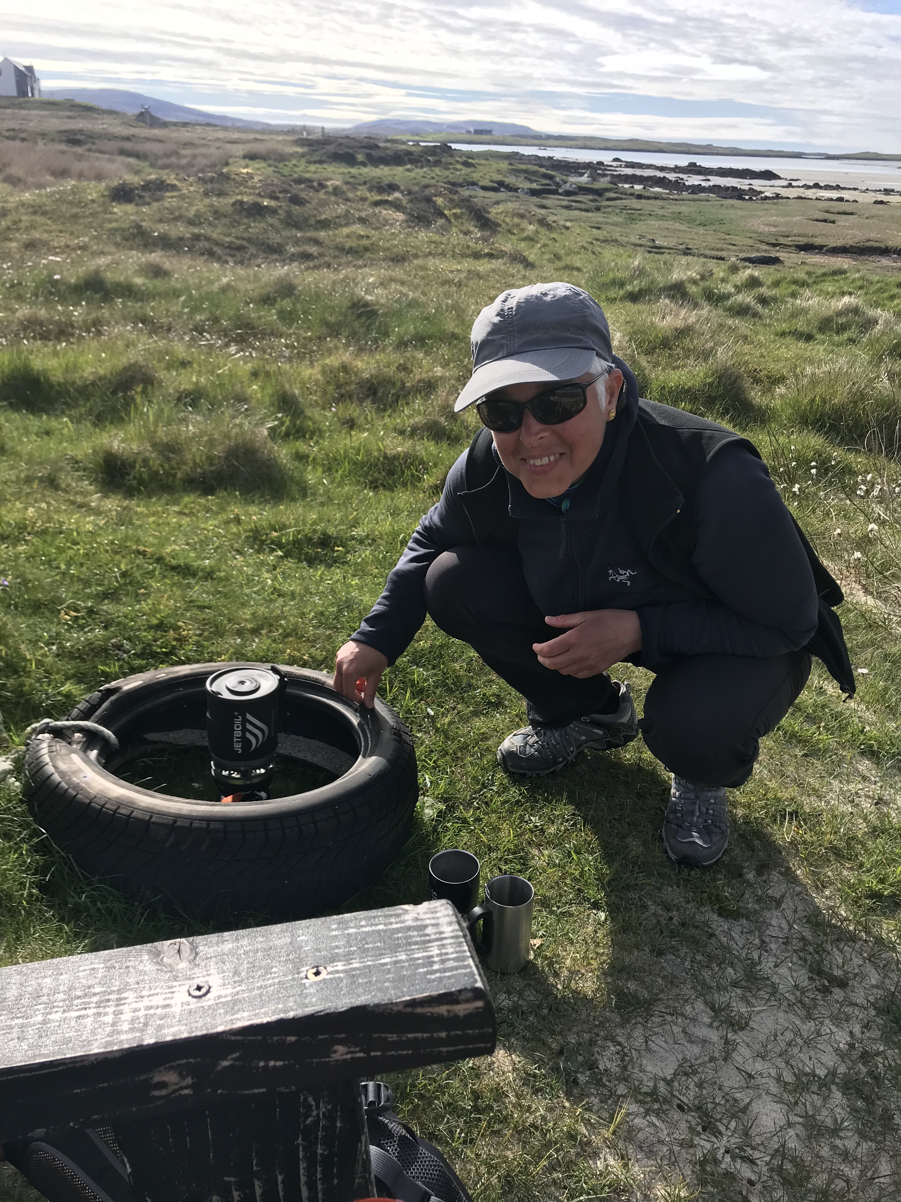
Oyster catcher nest amidst the Highland cattle dungA quick brew using a useful spare tyre as a wind shield for the camp cooker.
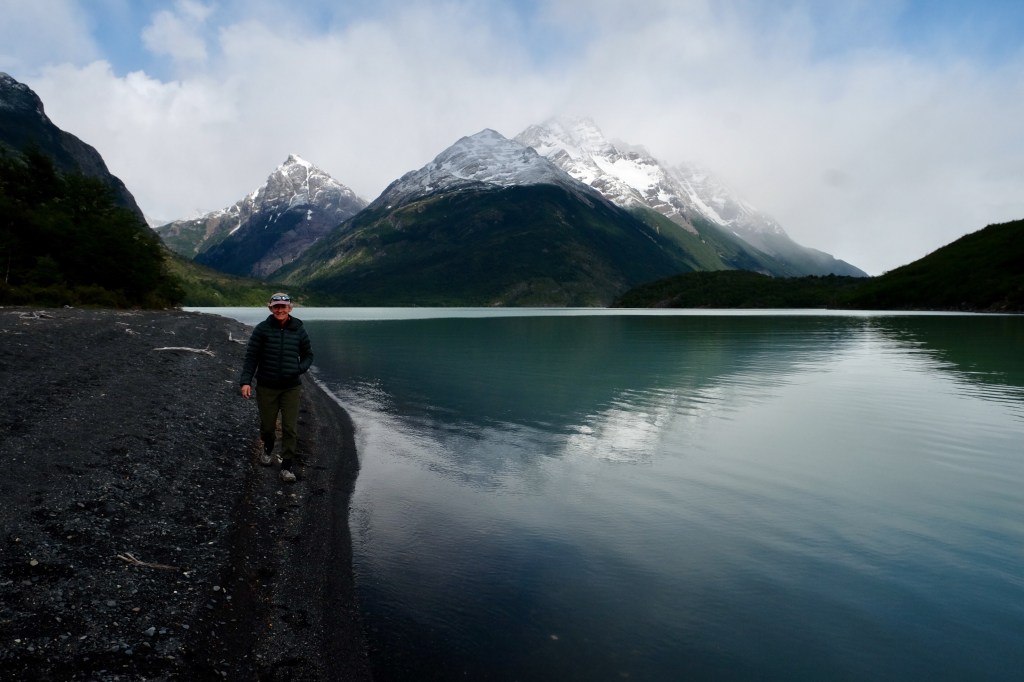
Loch Aineort
Loch Aineort lies in a spectacular valley at the foot of Beinn Mhòr, just the other side of the ‘main road’ from where we were staying. We had been alerted to it by a birder we met on the beach at Berneray. At the end of the road, the land owner has planted a garden which has matured over the years and, unusually, has an array of welcoming footpaths! We returned to this place a number of times, firstly to spot otters and subsequently to walk and to sit, brew up and enjoy the spectacular scenery.
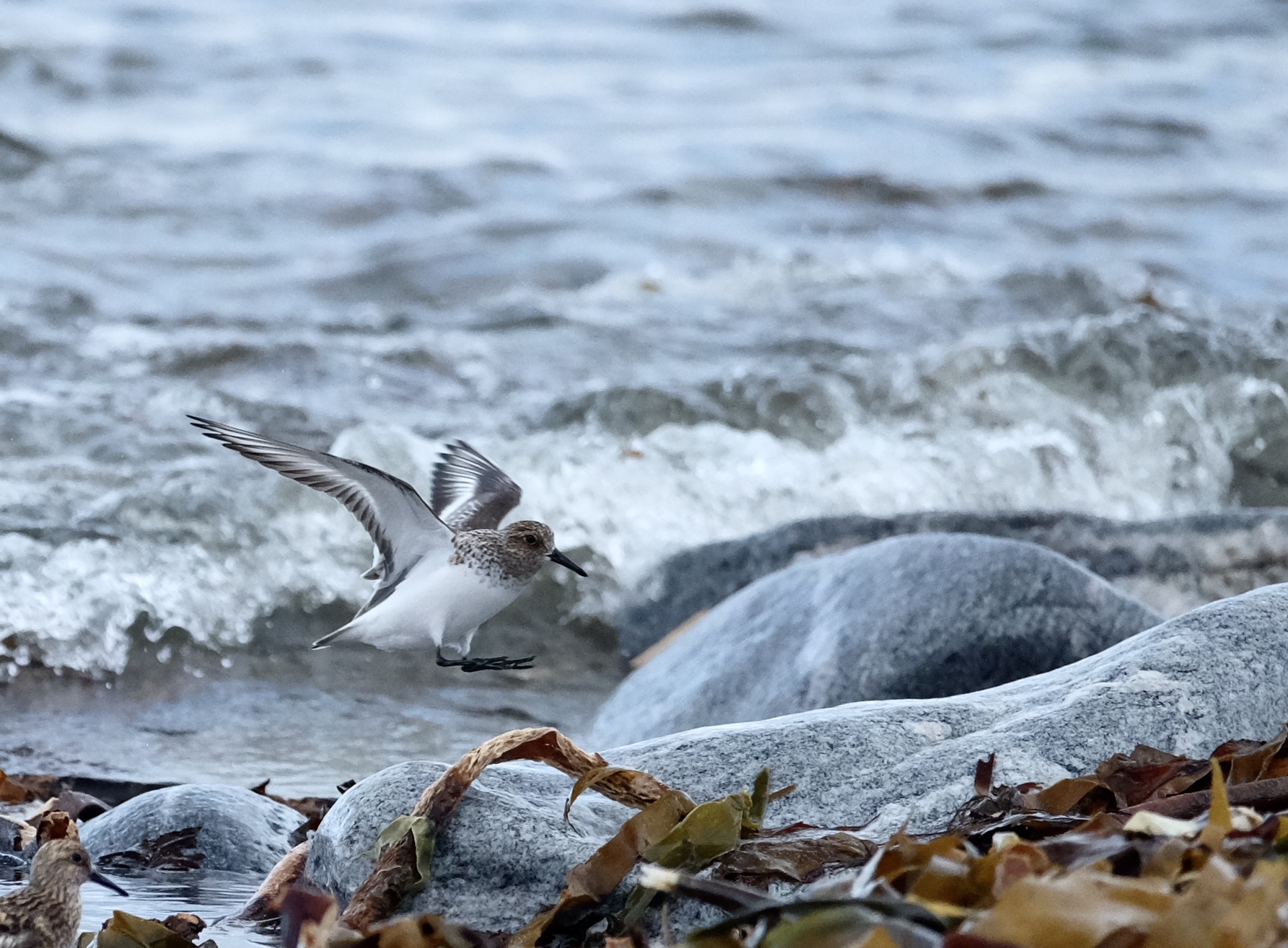
One wet afternoon we stopped on the road side, threatening clouds meant we did not wander too far from the car. We dropped down on the beach at Stinky Bay on Benbecula, and sat for some time watching waders at very close range, they appeared totally undisturbed by our presence.
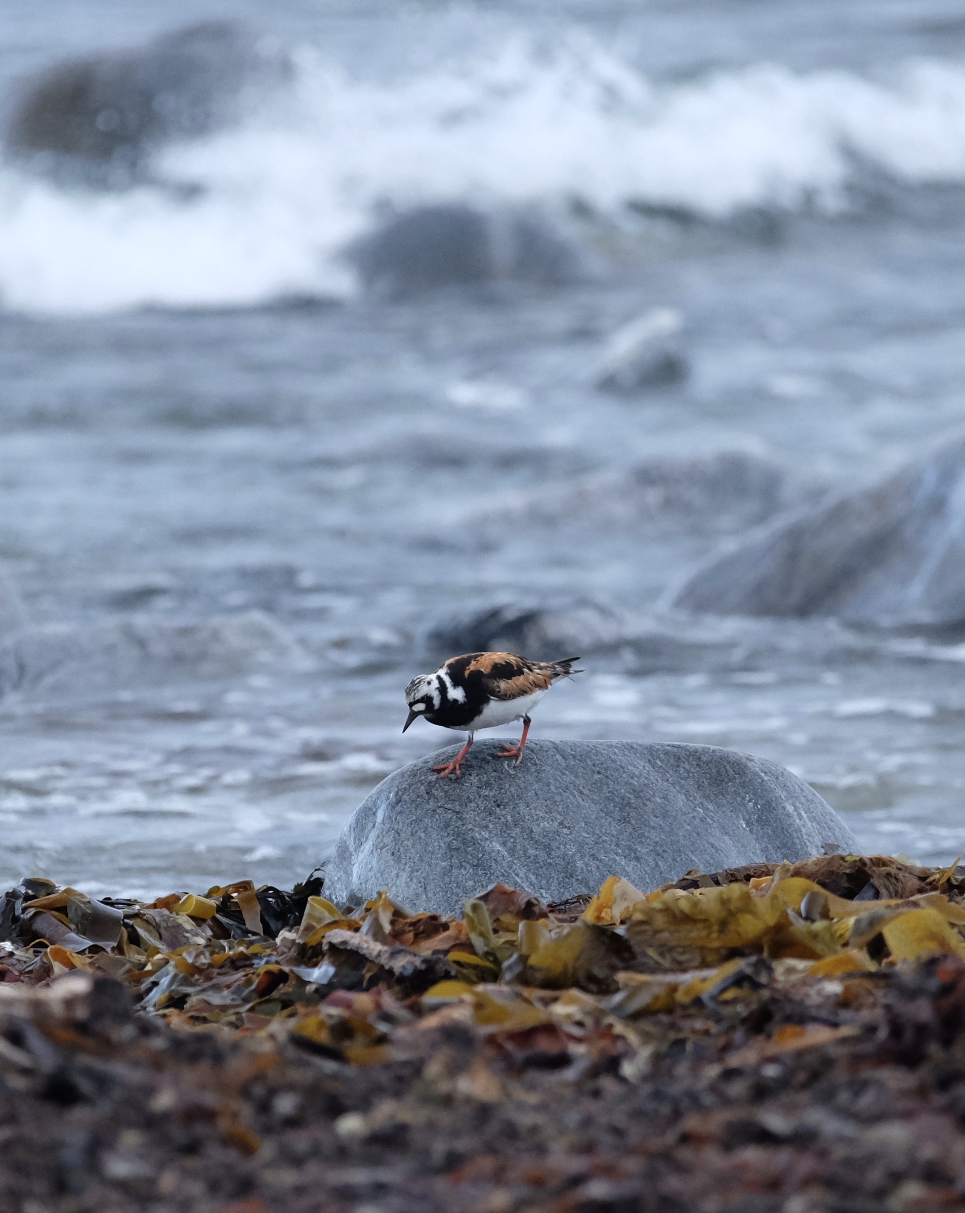
TurnstoneLanding sanderling
Eriskay
On our last day, under a blanket of thick cloud, we drove south and over the bridge to Eriskay. We stopped for lunch at Am Politician, wishing that ours could do better. After an excellent meal of hand caught scallops for one and battered monk fish for the other, we set off walking around the bay. It began to warm and clear. Eriskay has a very different feel to S. Uist. It appears almost touristy, with upmarket accommodation, some remarkable and others a disgrace!
We spotted something that looked a bit like a foot path but of course turned out not to be, and then followed our noses through bog and bush to the high point of the island. Views from the top of the shallow waters between the islands were sublime.
The village shop did not have any Magnums, so clearly Eriskay is not that touristy after-all!
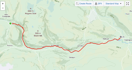
St Bees, in Cumbria to Reeth in Yorkshire over 7 days
Day 0 Oct 10 2020
We journeyed by train to St Bees. From Cambridge to London with an overnight at Highbury Quadrant, then together with my son Fabian, the 07:10 train from Euston via Carlisle. The trains were empty. Everyone masked. On the line south from Carlisle our carriage suddenly filled. A group of men sat in the seats opposite, in front and behind us even though there was lots of space on the train. The nearest asked if he we minded if he ate his toast, pulling down his mask before we had responded. Others were drinking beer. We decided to move carriage causing an uncomfortable exchange. The term ‘social distancing’ has so many connotations. It was clear to them that we were from elsewhere and on holiday, and in that moment, I felt socially distant to those men for more reasons than one. Once settled in our new seats, we enjoyed the views over the Irish sea, as we cruised along the coast passing Flimby, Workington and Whitehaven.
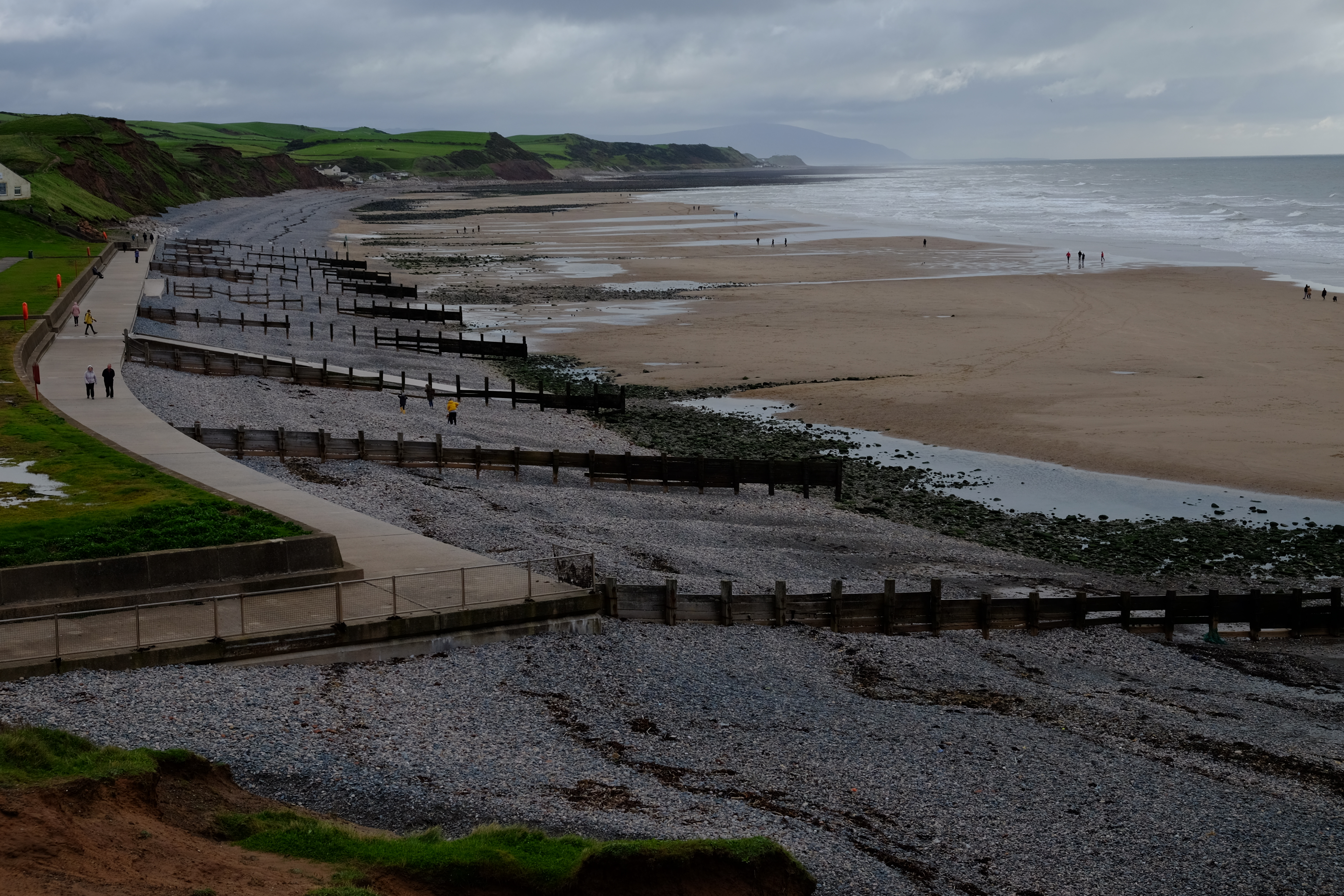
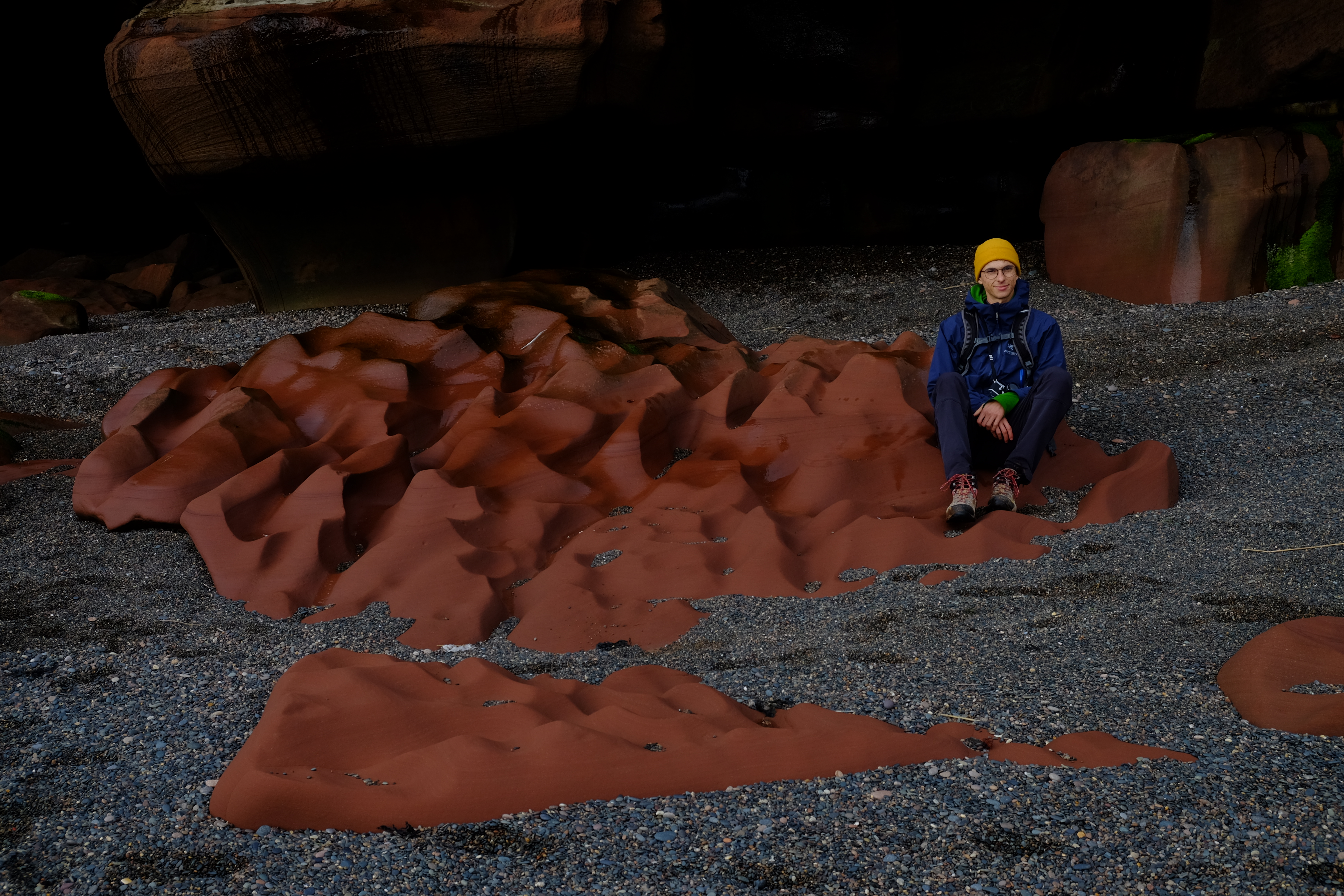
We dropped our bags at The Queen’s Hotel and walked to the beach, picked up pebbles as tradition dictates when commencing this path, then walked up and around St Bees Head visiting the inlet with red sandstone rocks, all the new RSPB cliff-top lookout points, although the nesting Guillemots, Razorbills, Fulmars, Kittiwakes and other sea birds had long since departed. Then we headed back to the hotel, via Sandwith, over the fields. We had supper in the bar – lasagne with a side order of chips. We were both totally wiped and slept soundly.
St Bees beach
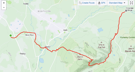
Day 1, Oct 11 2020 – destination Ennerdale Bridge, 25km (map below is incomplete as we did not switch on Strava until our breakfast stop) .
We departed early, with a packed breakfast, in order to catch the sun rise. We walked adjacent to the railway, across St Bees school grounds and eventually under the railway to pick up the official trail. We took a detour to walk along a disused railway line, now a cycle path and stopped for breakfast in a sunny spot. Fabian fired up the cooker and made coffee. Runners, cyclists and dog walkers passed by in both directions. Then it was through fields and up onto Dent, with good views back to the coast, and then gently down the other side into a lovely valley with a babbling brook. We wended our way this way and that over little bridges then through a gate, stopping for lunch on a rocky outcrop above the path. Sunday walkers and all-terrain bikers stopped to chat. Then a short walk up onto a road and down into Ennerdale Bridge. We stayed at Thorntrees. We were booked into the Fox and Hounds Inn for the evening meal. We had the special -lamb shank and mash. This sounded good in principle. Certainly, we could not complain about the size of the portions.
DentView from our lunch time picnic stop
Day 2, Oct 12 2020 – destination Seatoller (Borrowdale) 24.33km
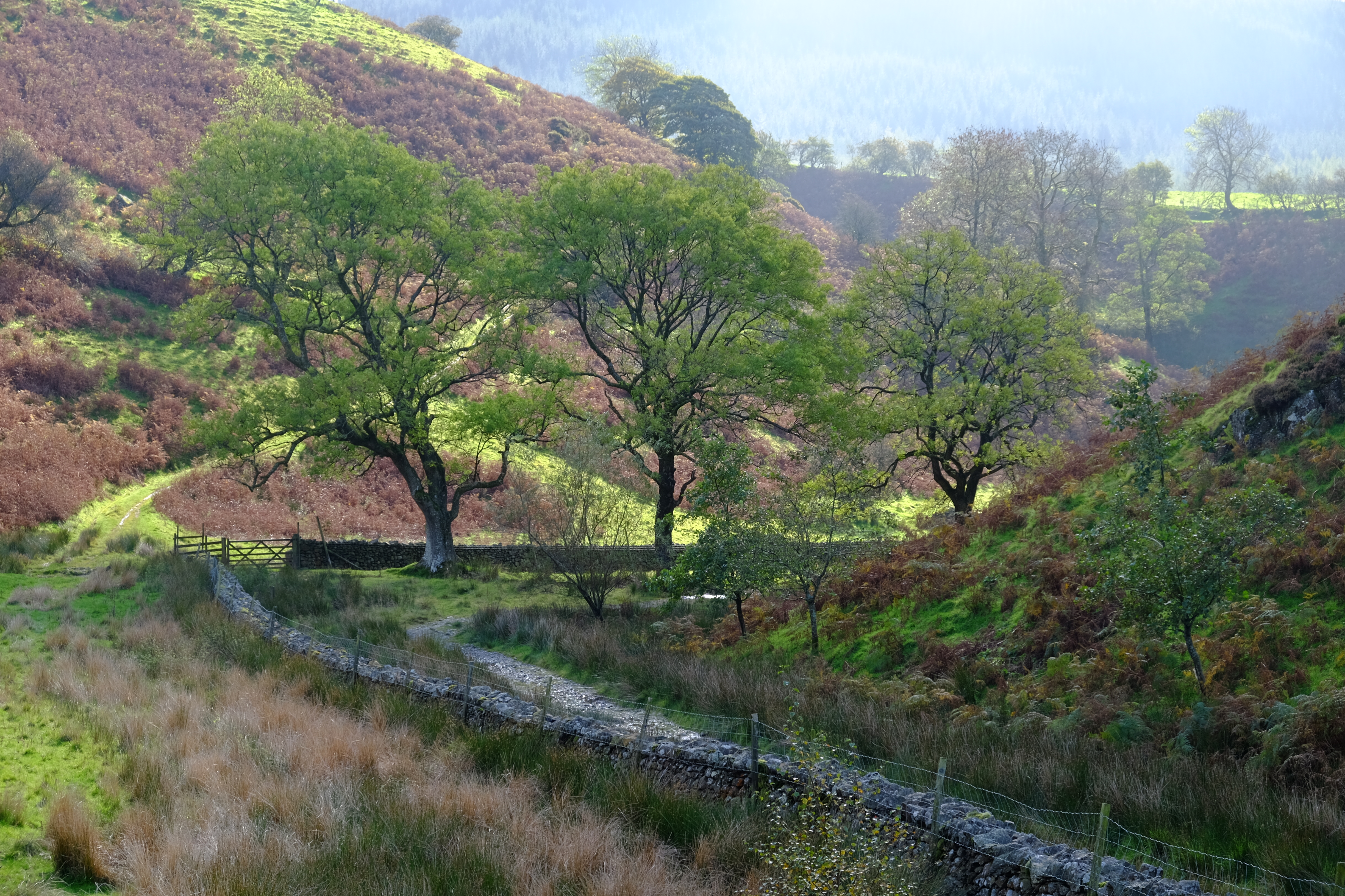
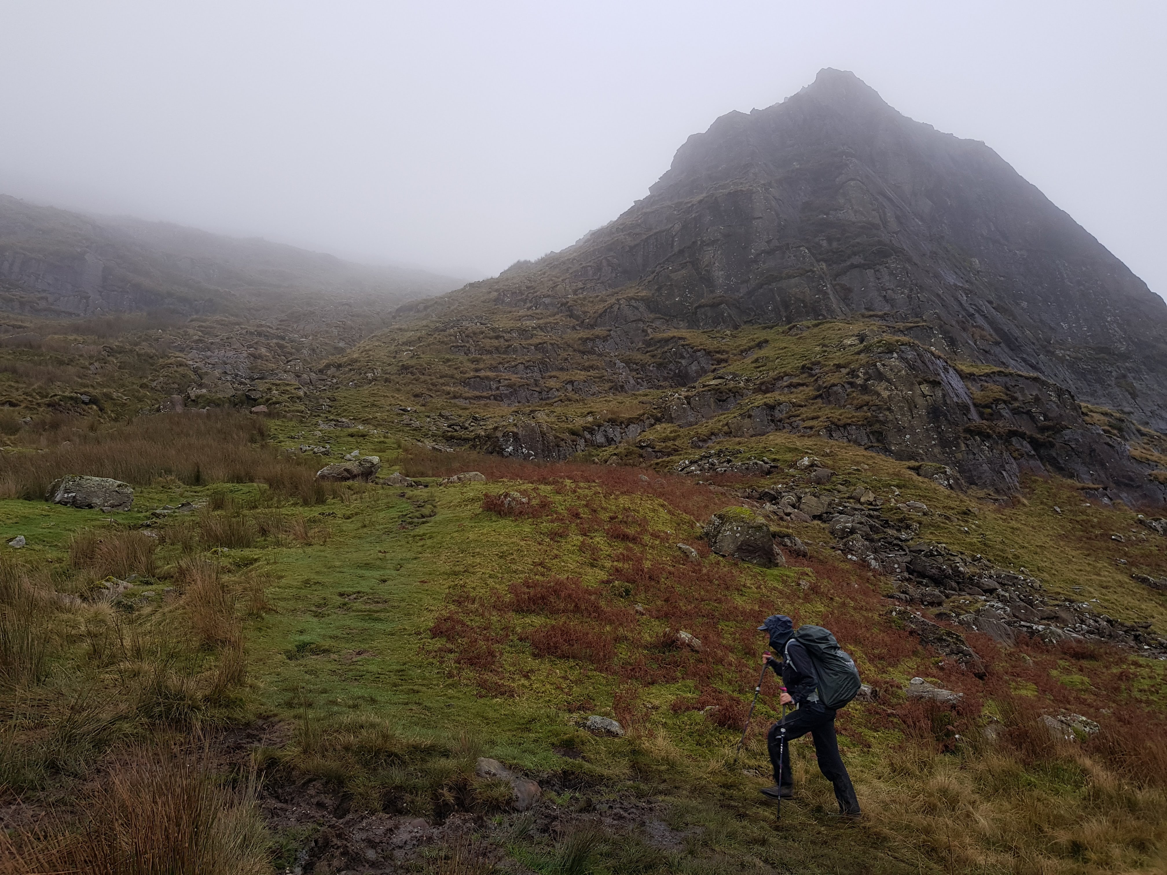
The day started dry but it was raining by the time we left. We met Dave Heath, another C2C walker, at breakfast (see his videos on youtube: https://www.youtube.com/channel/UC0Np6p9bX0GZzF-5yVrUk7w). He was walking on his own, carrying all his belongings for the full journey across. We swapped phone numbers, just in case either party needed help. By the time we arrived at Ennerdale lake the rain was lashing down which made the walking tough and the path a rocky stream. Ennerdale is a re-wilded valley but this was hard to appreciate in the conditions. We squelched our way across the valley and onto a forest road, heading for the Youth Hostel where we thought we could shelter and have lunch. It was closed. We back tracked to the ‘field centre’. A bunk house and some barns. Someone gave us access to one of the barns. We fired up our cooker for tea, munched sandwiches and hit the trail again, up the valley and out onto to the moor. We passed another really lovely youth hostel, but this too was closed, having been booked by a private group. Up into the cloud we trudged, more rain pelted down on us. We found ourselves on the wrong side of a stream bush whacking. We realised our error and crossed the stream and found ourselves on a much better path with steps all the way. At the top, we were greeted by the local (Herdwick) sheep, and a vast emptiness, a distant open cast mine to the left. Haystack Rocks were blanketed by cloud. A blast of wind sliced into the gap between my back and pack, chilling my spine. We kept moving, now downwards, eventually to a very steep and slippery path to Honister Hause and the green slate mine, in torrential rain. We stopped here for a few minutes, but my mask eluded me, hidden in one of countless pockets, so I remained dripping wet and cold outside whilst Fabian enjoyed a solitary banana in the relative comfort of the visitor centre foyer. We walked down a path alongside the road to Seatoller and Glaramara House Hotel, with a little hiccough near the end because one of us failed to read the instructions properly.
After a luxurious shower, we joined others, far smarter than we, in the dinning room and enjoyed a good meal. Back in our room, we managed to wash clothes and lay them out to dry. Unfortunately, my phone, which had been in my anorak, had got wet. I tried to dry it on a radiator overnight. In the morning it lit up, but the keyboard had a mind of its own, opening and closing apps, sending random gibberish texts to who knows whom and generally taking the piss. The screen displayed ghostly patches. I switched it off. I could do without. Even if there had been signal, Dave Heath would not have been able to contact us should an emergency have arisen.
Ennerdale The locals
Day 3, Oct 12 2020 – destination Patterdale 25.7km
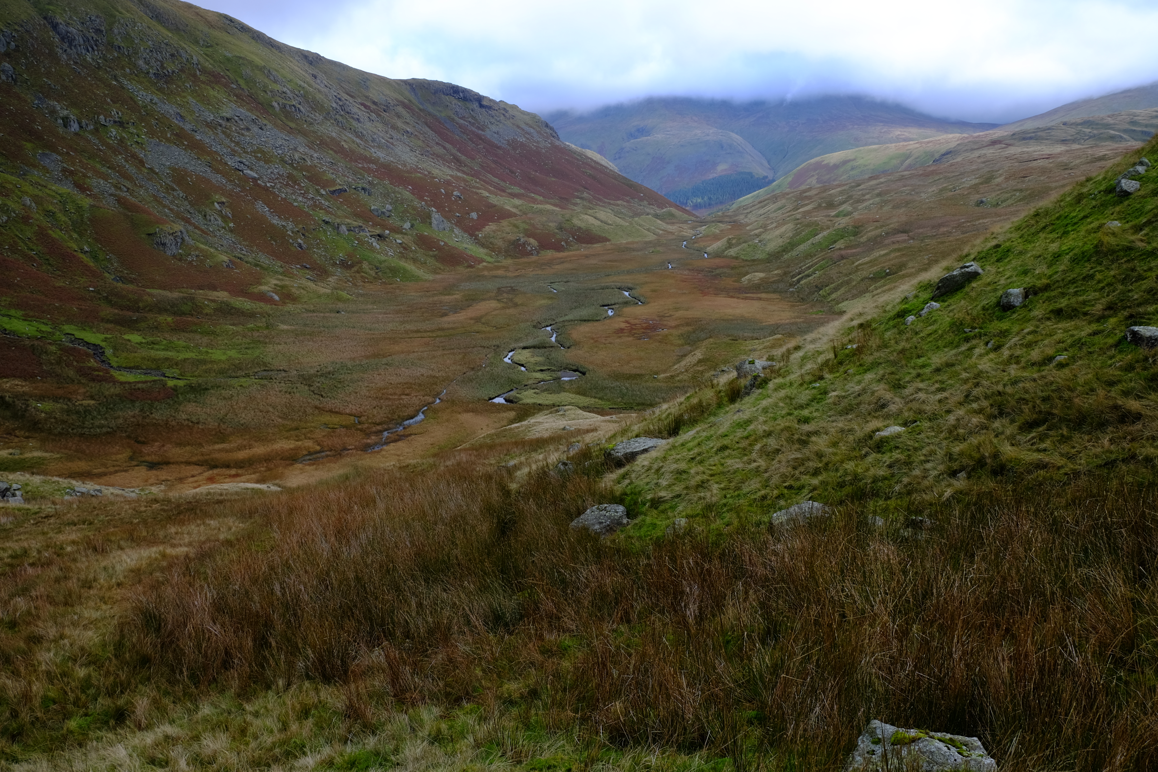
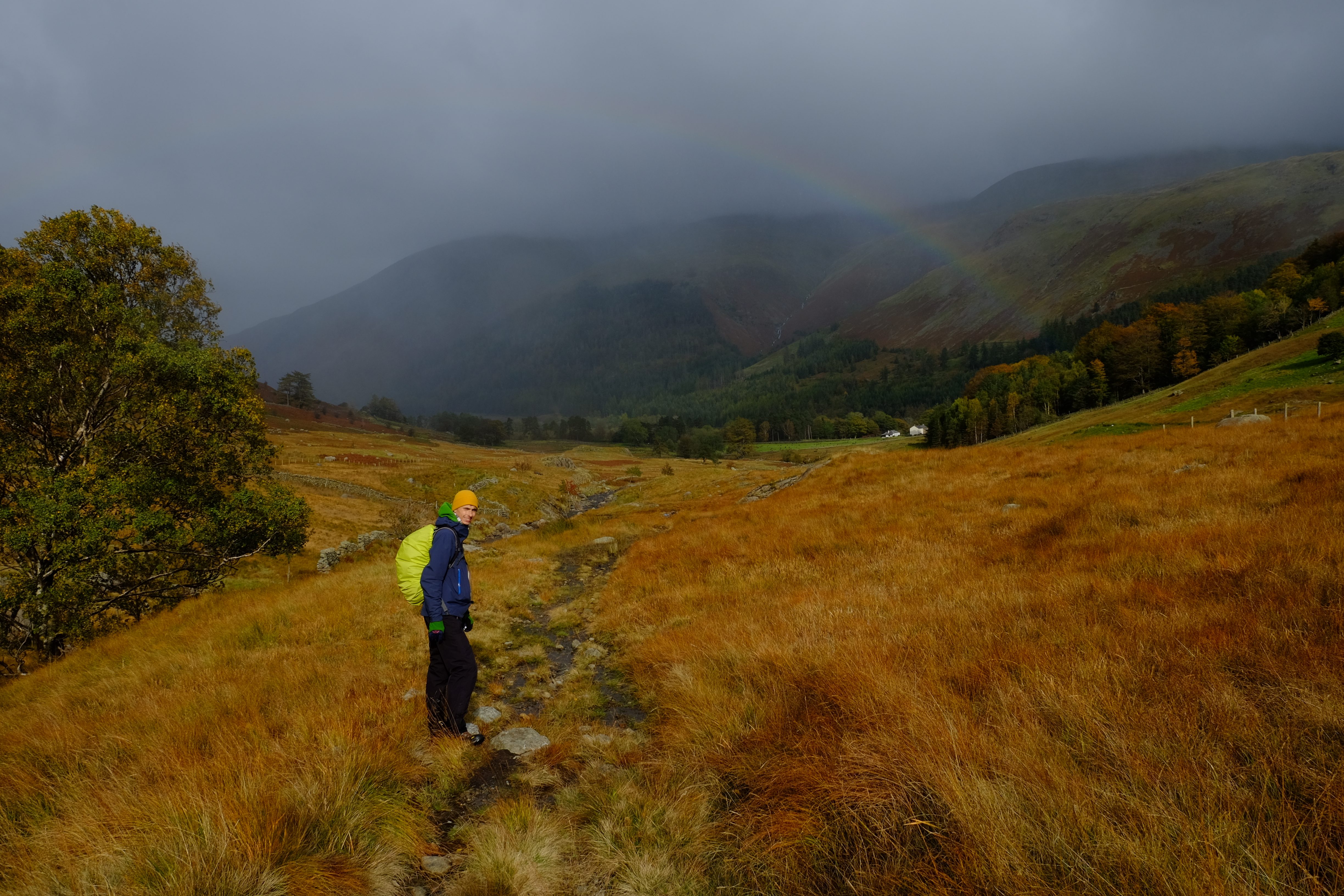
Again, we were unable to get an early breakfast, so we made a late start. The weather was fairly ok. We by passed Rosthwaite and re-joined the path at Stonethwaite Fell. We walked up into the clouds. It was quite misty as we crossed Greenup Edge. On the other side we took a detour which we hoped would buy us time, but almost certainly did not. We took a left turn walking via Middle How along the Wyth Burn. There was a clear path on the map, but it was non-existent on the ground. The centre of the valley is aptly labelled The Bog. There was a cold wind funnelling up the valley and we could not find shelter. So, it was a quick stop for lunch in the lee of a rock, and then off again, hard walking over thick tussock grass, rushes and reeds trying to keep our feet dry. Eventually we came out under the cloud and we got a bit of sun, wonderful autumn colours, a rainbow and views over Thirlmere. Then we navigated our way around the corner scrambling over a dry stone wall, up a cycle path along the Pass of Dunmail Raise, and then onto a well-marked foot path following Raise Beck to the eastern side of Grisedale tarn. As we climbed, the wind got up and there were massive gusts, full frontal. At the tarn, the water was inky black with white horses. The wind scooped up the water and it swirled like a tornado up into the air and up the valley. A small tent was pitched at the water side, right in the stream of airborne water twisters. We marched around the valley, hatches battened, and followed the rocky path down to Patterdale. On our way to Old Water View BnB we passed the pub where we planned to eat that evening only to discover that it was chef’s night off. So we took a cab (£12 for 2 miles) to Glenridding, where we had a pretty decent meal in the Patterdale Hotel.
Trudging towards Greenup EdgeThe BogThirlmereGrisdale Tarn, a green tent is just visible in the centre of the picture at the water’s edge.
Day 4, Oct 13 2020 – Patterdale to Shap 28.68km
We had given up trying to convince any of the hostelries to provide an early breakfast, so we went with the flow. It looked to be a fine day, so we were less bothered about a late departure. However, this lack of concern would come back to haunt us. As we were leaving, our host informed us that Margaret from Brookfield in Shap, our next stop, had been trying to contact us. There had been an outbreak of Covid at the pub so her advice was to pick up fish and chips and eat them in her dining room. The C2C grapevine was working like clock work!
We climbed out of Patterdale with the clouds lifting and wonderful low, golden autumn light. We stopped for a coffee break by Angletarn, dodging the bog to get to the rocks jutting out into the water. Then we followed the path up towards High Street and took a detour to High Raise, the highest point on the C2C.
Views were terrific and weather too! We knew we had a long way to go to reach Shap but the people at Patterdale had led us to believe that the path along the north side of Haweswater was good, so we reckoned we could march it out. The path was good, in that it was easy to follow, but it was definitely NOT a marching out sort of a path. At the other end of the lake, it was worse. We still had miles to go and we had a sinking feeling that we would not make it to Shap before dark. We picked up pace, but it was hard going. The path was poorly marked or not marked at all, and deep mud, sculpted by grazing cattle, slowed progress further. It was beautiful by the river but there was little time to enjoy it. Eventually we left the river behind, and climbed up a field. We were harried by some cattle so crossed a fence on a style and continued on rough ground arriving at Rossgill as the sun was dipping. We were concerned that it would be darker still if we followed the official C2C route through the valley, so we crossed the bridge into the village and took a public footpath, tucked away between the houses and then across fields hoping it would be mud free and easy to follow. With the help of google maps, we eventually hit a road and decided to walk the rest of the way on hard ground. It was now pouring with rain and dark. We found the Shap chippy, with just 20 minutes spare before they closed. We still had just over another-very-long-wet mile to Margaret’s at Brookfield. On arrival, we peeled off our wet kit, stuffed our boots with newspaper and stepped into the other world that is her house. We disappeared up the stairs to wash. When we came down, Margaret had laid us a lovely table with hot plates, condiments, napkins, a steaming tea pot, cups and saucers. Magic! She also provided me with a bag full of rice to help rescue my phone. We slept very well that night. She had beautiful bed linen and very comfortable beds.
AngletarnHigh RaiseHeading down to Haweswater
Day 5 Oct 14 2020 – Shap to Kirkby Steven 33km
After the best breakfast so far, (lovely fresh fruit salad, creamy porridge, toast, coffee) with no single use plastics, we set off in reasonable weather, a little misty, on the long haul to Kirkby Stevens. Should we have taken a day off to rest before this next marathon? We had not considered days off when we booked the holiday, and it never occurred to us to take a cab. We gritted our teeth and set off. The prospect of another mad dash in the dark at the other end of the day did not appeal, so we decided to keep close eye on the time and our pace. Margaret had packed a superb lunch. Fresh salmon sandwiches, cherry tomatoes and lettuce leaves on the side, buttered tea bread and a thick piece of cheese, also fruit cake. We kept the last treat for the final few kilometres of the day, a lovely almond tart. This was surely the day when we would need the extra calories and luckily, we had them.
It was a spectacular walking day. Massive open spaces, limestone walls, much, much drier under foot. We got into Kirkby Stevens just as dark was falling. On a bench in the high street we took off our muddy over trousers and spruced ourselves up before heading to The Mango Tree for a typical Yorkshire Indian. Great choice, fantastic meal and a nice change from pub fare. We then staggered back up the road to Lockholme where we were hosted by the wonderful Chrissie, a runner with many medals. Home bakes and tea rounded off a terrific day.
Crossing the M6 outside ShapLime stone pavementDowning a beer at The Mango Tree in Kirkby Steven
Day 6, Oct 15 2020 – Kirkby Steven to Keld 19km – via bog knows where
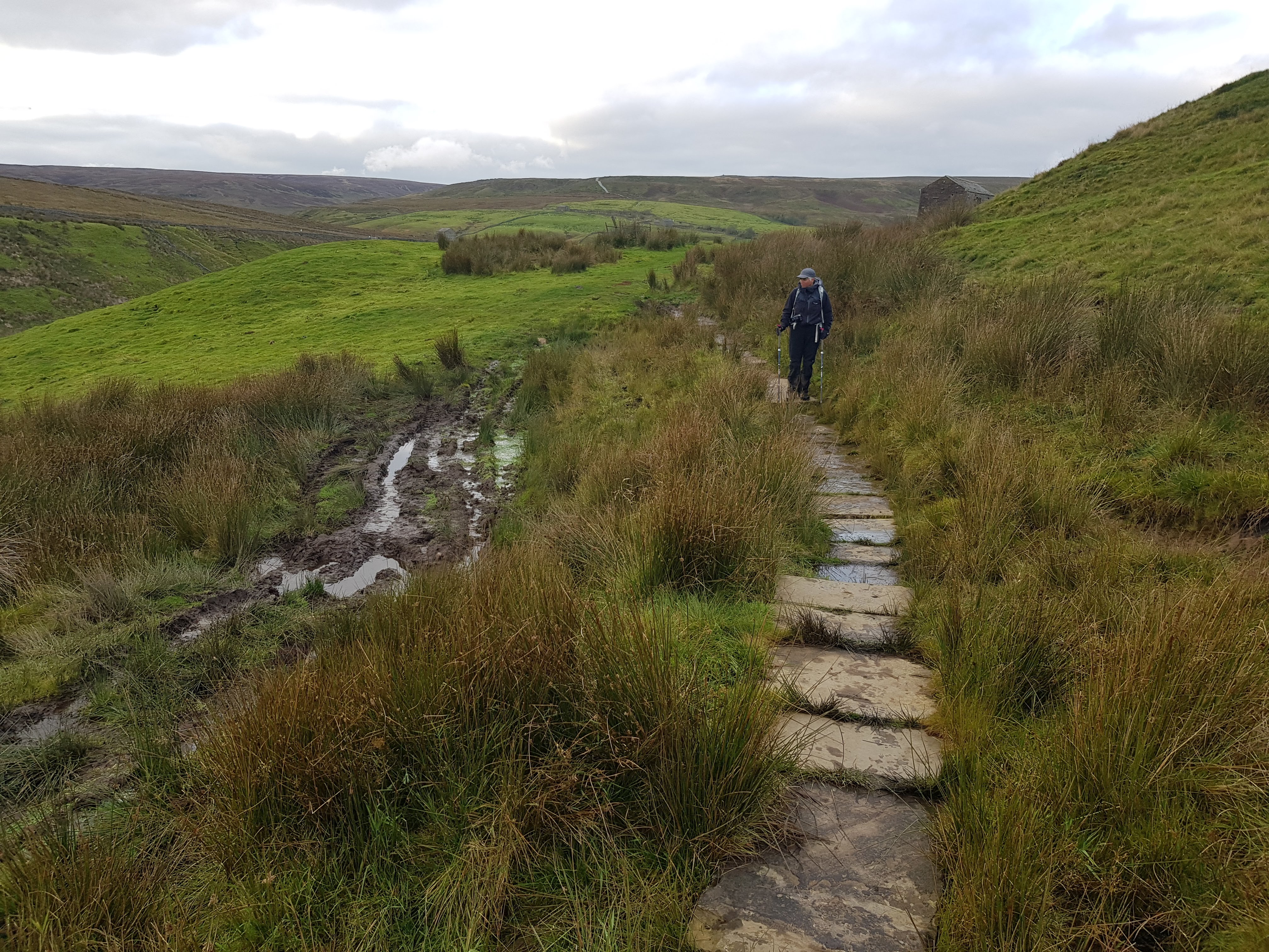
Over another lovely breakfast, with home made marmalade, Chrissie informed us that on a good day, the 9 Standards Rigg could be seen from her dining room window. We peered out imagining the view through the thick, low cloud. The days walk started with a stroll back down the high street. We stopped at the camping shop. My feet were not in good shape. New socks for us both and a blister kit were purchased. We put them on in the shop and took off again, through back streets then out along a stream and eventually up a small road passed a quarry, towards the grim, cloud-cloaked moor. The path became steeper, blacker and boggier. The erosion was stark. It is no surprise that there are now three routes across this stretch of ground, an attempt to preserve the precious peat bog. We passed the Standards in the rain. Off to our left was a line of beaters, driving petrified grouse towards blokes in tweeds with guns. Everywhere on the ground were little piles of grouse poo, a good indicator of the millions of birds that are reared here for the shooting industry. The path became hard to navigate let alone traverse. Large chasms in the surface peat, tens of metres wide and deep, cut down to the thick gluey mud, broken up with streams. Further along was a flag-stone floating pavement, which made the going much easier, however it was not long before we were back at the mercy of the bog. Small posts marked the trail but, in many instances, these had sunk into the ground. Had the cloud been lower still, we would not have spotted them and would have been quite lost. Our lunch was a standing stop, it was too wet to sit down. Eventually we came down to a winding stream. Along this next bit of path, were snare traps, and sign posts about protecting ground nesting birds – the super abundant red grouse. One day this ‘sport’ will come to an end, the balance of the ecosystem will recover, sphagnum moss will rejuvenate, more carbon will be sequestered than released, the water holding capacity will rise, native wild birds and mammals will flourish and the driven grouse shooters will switch their focus to nurturing native wildlife and with any luck, the health and well being of all!
On the road down to Keld, we met a young lad getting off a bus. He was in school uniform and was walking up the rough track in his school shoes with laces flapping. He travelled 1.5 hours in each direction for school, then had to climb the steep path to his moorland home, be it in sunshine, wind, rain, snow and darkness. I told him that he did not know how lucky he was. He gave a rye smile but probably thought I was barking mad! We arrived at Keld shortly after 5pm. A short day in comparison to the previous few, but for me, one of the toughest, bleeding blisters, and water logged boots did not help. We had a very warm welcome at Butt House by Jacqui and Chris. They impressed us with their super high tech boot driers. Supper was served in their front room and shared with two other sets of visitors, one of which was was a pin hole camera enthusiast. We were the last Coast to Coasters of the season.
A short but most welcome stretch of floating flag stones. Thank you to all the volunteers and donors who made this happen!Whitsundale Beck, where the upper valley is full of snare trapsAnother floating flag stone path, making the going so much easier!
Day 7, Oct 16 2020 – Keld to Reeth
We decided at the very last minute to take the valley route through Swaledale rather than spend yet another day on the tops in cloud. While our boots were dry and warm, having been dried to a crisp over night, they had shrunk and it took best part of an hour before I was able to walk properly and forget the pain of the soft broken tissue on my heels! Fortunately, the valley was lovely, lush green with beautiful golden autumn colours, sheep fields, dry stone walls, Cowuss’s and yes, loads of styles! Some were very narrow, forcing us to take off our packs to get through. Clearly this route would be prohibitive to anyone a bit broader than I!
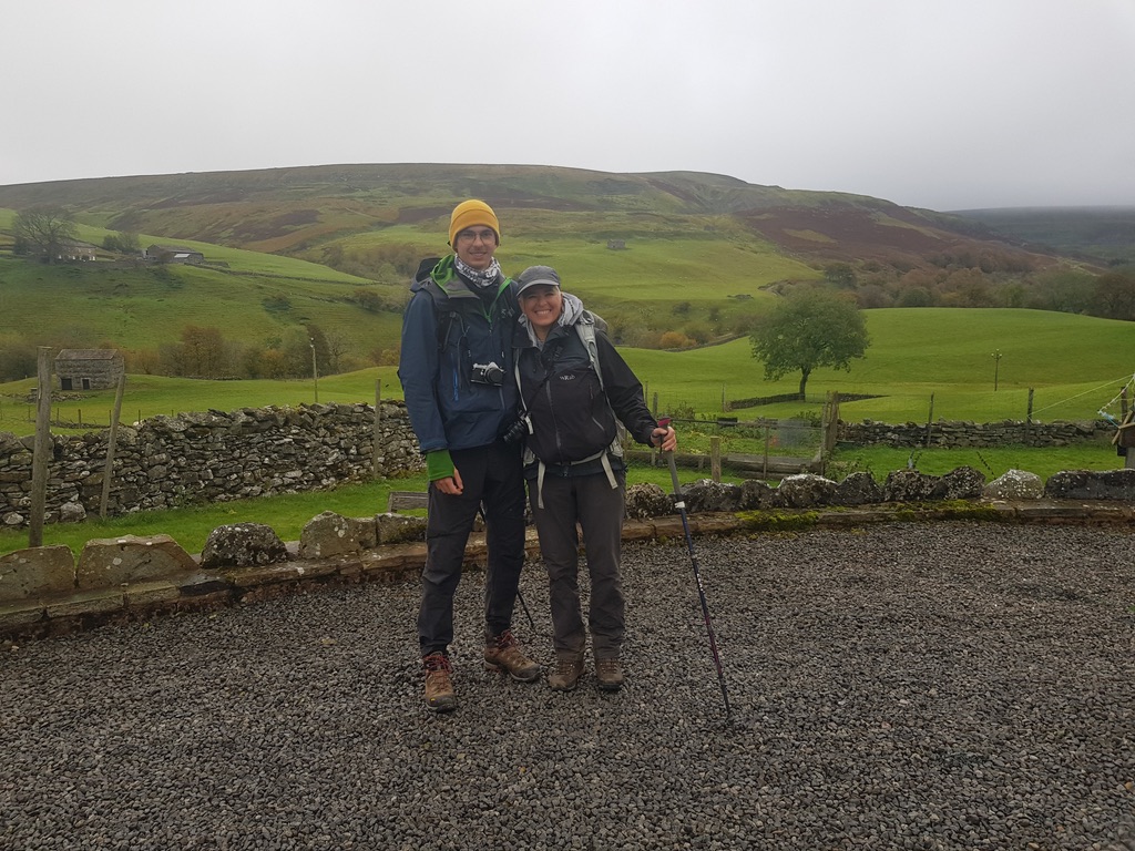
We were met at Reeth by my partner, Andy, and celebrated the the completion of half the Coast to Coast walk, with a wonderful meal at The Burgoyne. The following morning after a quick tour of the village and purchasing of beautiful woollen socks at Dragon Ridge Hills, we folded our bodies into the car for the long drive south. We dropped Fabian at Kings Lynne for his onward journey to London (and tier two) and we headed to the north Norfolk coast to catch a momentary glimpse of a Rufus Bush Chat, at Stiffkey. A great end to a great holiday.
Ivelet BridgeSuspension bridge just before entering ReethSheep, Swaledale
In September 2015 I joined a bunch of top birders on a trip to Fair Isle. There were eight of them and me.
‘I cannot think of anything worse’ is what my daughter said.
Needless to say, I had a fabulous time and so, I believe, did they!
Below is a selection of photos from the trip.
Torness, on the road up.
Aberdeen
Overnight ferry to Shetland
My flight onto Fair Isle was a day later than the rest of the team. I spent a very comfortable night with Rebecca Nason at her B&B in down town Lerwick. Rebecca is an extraordinary photographer and naturalist. I loved her house, brimming with fine things including a delightful collection of bird bones and bills!
Sumburgh, Shetland
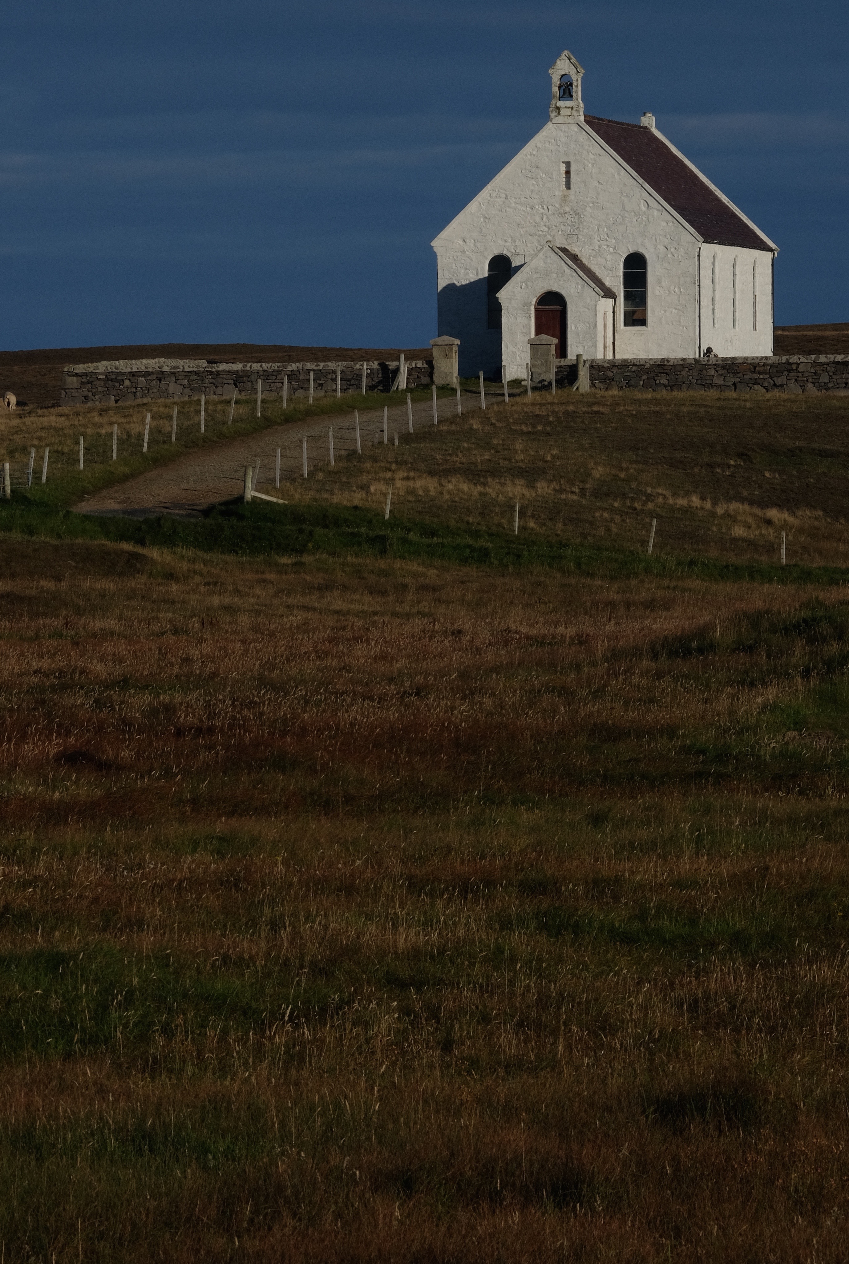
Fair Isle, Church of Scotland
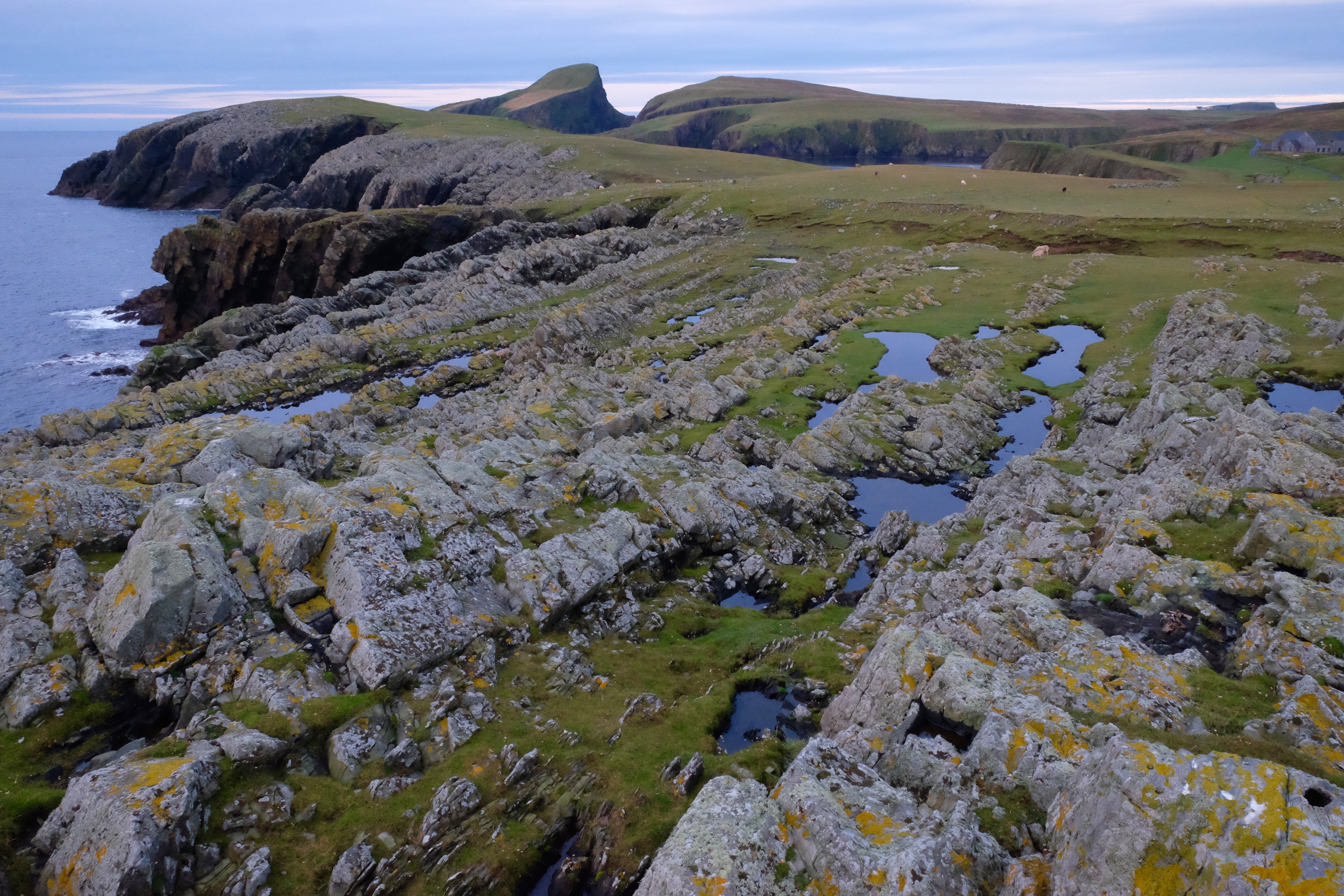
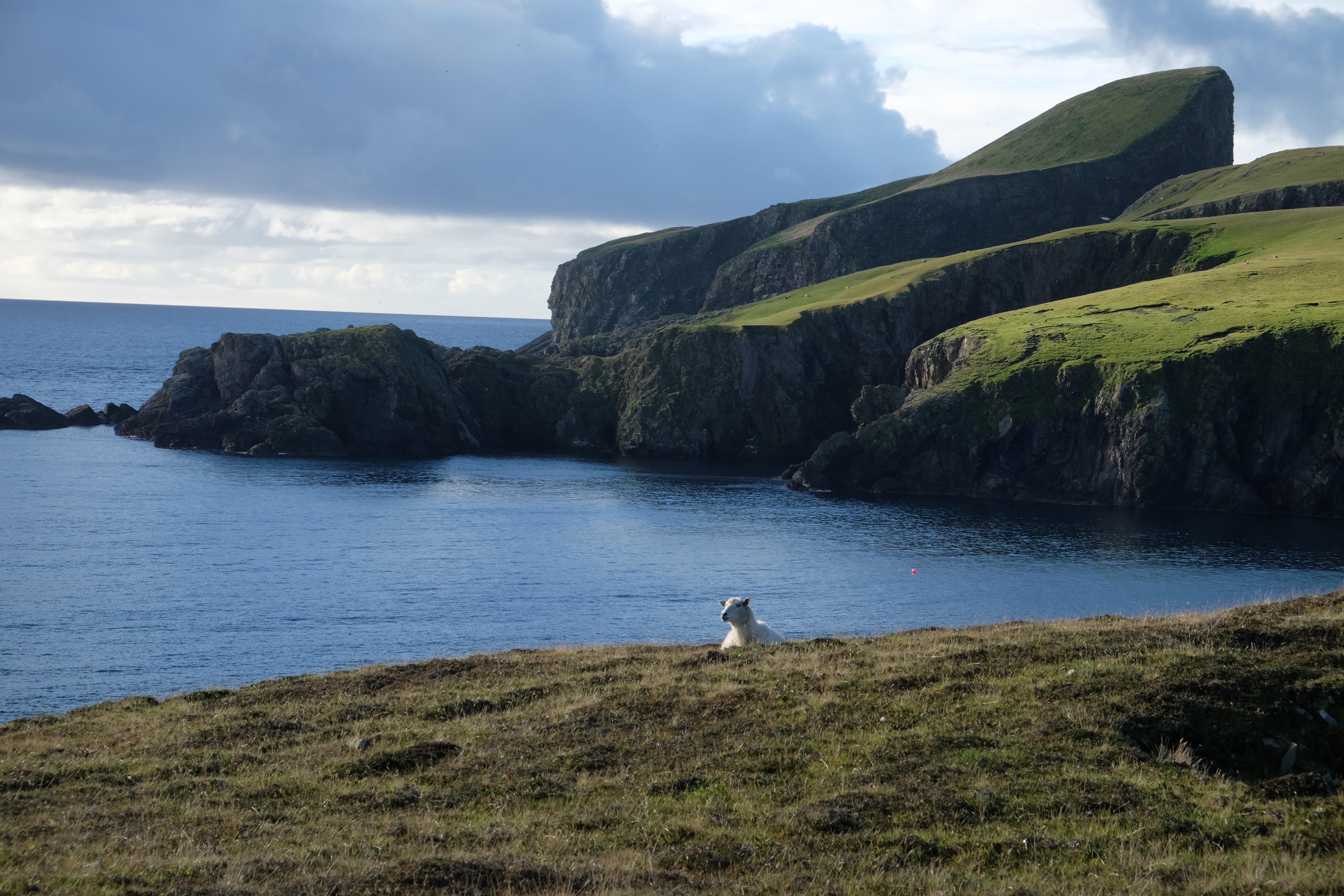
View of Sheep Rock from Bu Ness
Heligoland trap
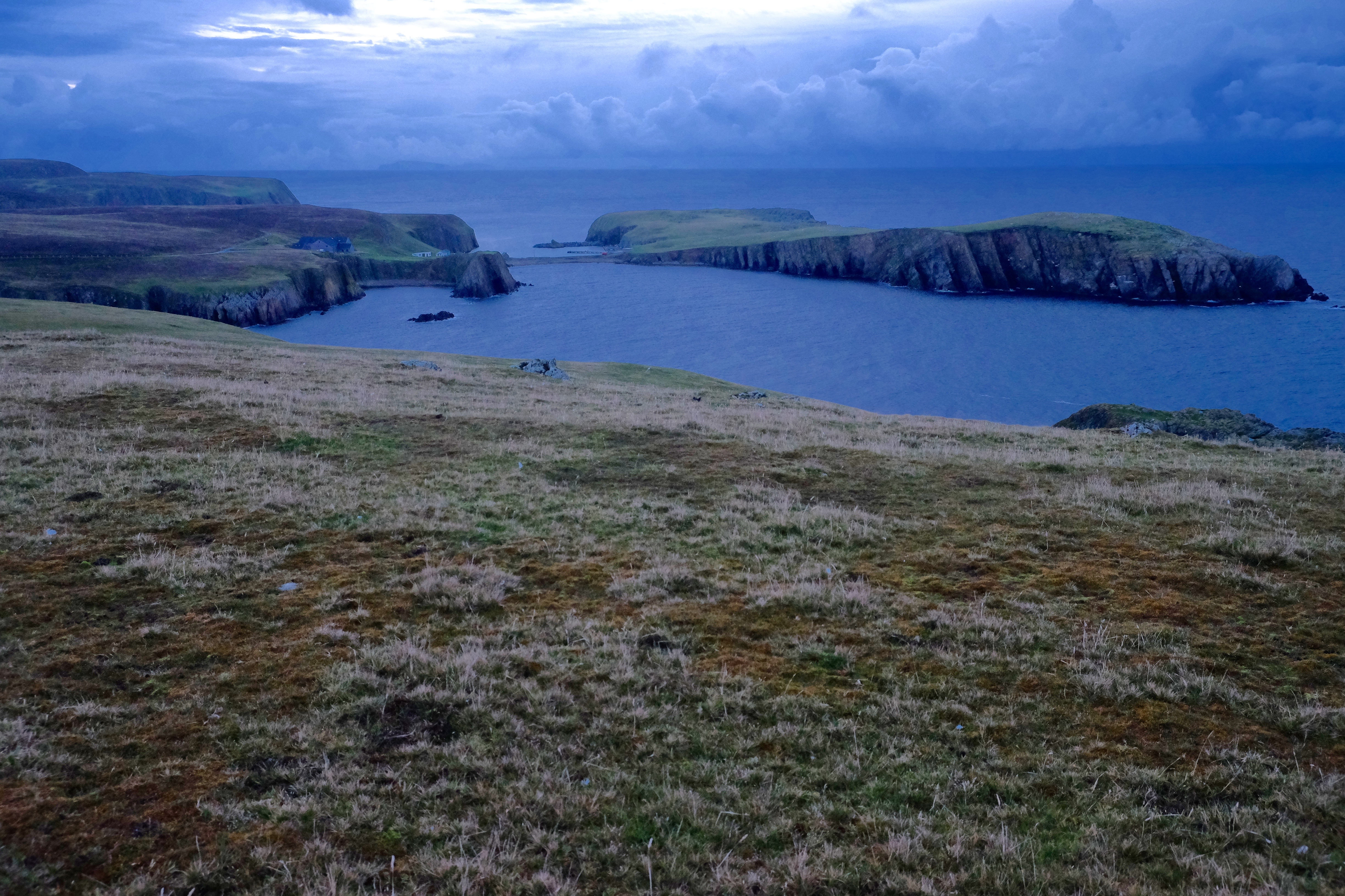
Bu Ness, whale tale.
Hunting for petrified fish having dipped on the Thick Billed Warbler found at Quendale the evening before. This rarity pulled all the local birders and left an audience of may be 4, plus the 8 of us for the Shetland bird club talk that 2 of our team were due give.
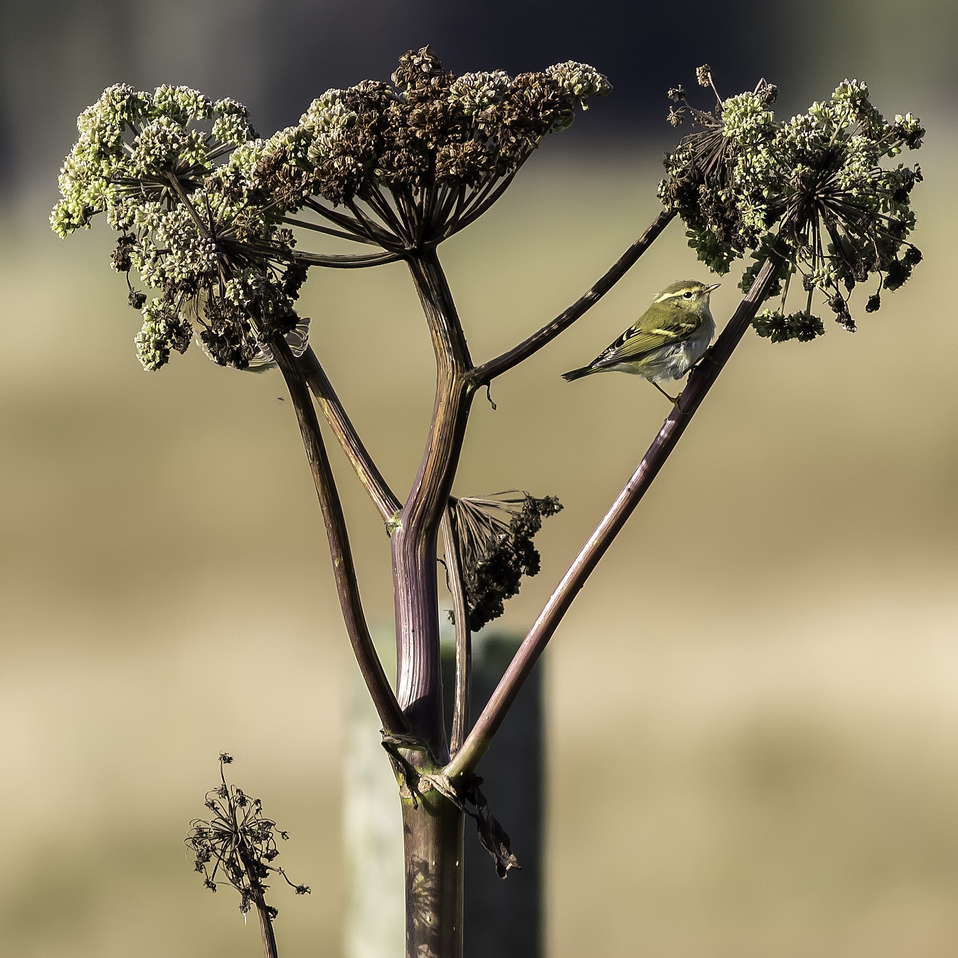
The bird of the trip was Yellow-browed Warbler. On 21 September 53 birds were seen and 12 were ringed. These birds, weighing just 5g, are likely to have travelled from the Urals, 3-3.5,000 miles away, to winter in Britain.
Fair Isle’s roads are lined with Angelica, a kind of wild celery. Their flowers are host to numerous insects that Yellow-browed warbler’s find utterly irresistible after their long flight. The photo below was taken by Andy Mason.